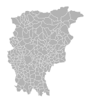
File:Mappa provincia Bergamo.png
From Wikimedia Commons, the free media repository
Jump to navigation
Jump to search

Size of this preview: 489 × 600 pixels. Other resolutions: 196 × 240 pixels | 615 × 754 pixels.
Original file (615 × 754 pixels, file size: 22 KB, MIME type: image/png)
File information
Structured data
Captions
Captions
Add a one-line explanation of what this file represents
| DescriptionMappa provincia Bergamo.png |
|
|||
| Date | ||||
| Source | mappa numerica dal sito della provincia di Bergamo in formato DXF | |||
| Author | Convertita e colorata da Luigi Chiesa | |||
| Permission (Reusing this file) |
|

|
File:Map - IT - Bergamo blank1.svg is a vector version of this file. It should be used in place of this PNG file when not inferior.
File:Mappa provincia Bergamo.png → File:Map - IT - Bergamo blank1.svg
For more information, see Help:SVG.
|
File history
Click on a date/time to view the file as it appeared at that time.
| Date/Time | Thumbnail | Dimensions | User | Comment | |
|---|---|---|---|---|---|
| current | 16:43, 17 July 2006 |  | 615 × 754 (22 KB) | Luigi Chiesa (talk | contribs) | {{Information| |Description = <br/> *{{en|Map of provincia di Bergamo}} *{{it|Mappa della provincia di Bergamo}} |Source = [http://siter.provincia.bergamo.it/sitera2/archivi_db/documenti/download/confini.zip mappa numerica] dal sito della provincia di Ber |
You cannot overwrite this file.
File usage on Commons
The following 3 pages use this file:
