File:Map position kisarazu city.png
From Wikimedia Commons, the free media repository
Jump to navigation
Jump to search
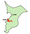
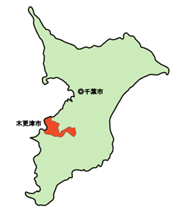
Map_position_kisarazu_city.png (263 × 300 pixels, file size: 22 KB, MIME type: image/png)
File information
Structured data
Captions
Captions
Add a one-line explanation of what this file represents
Summary
[edit]Map_position_kisarazu_city.png (263×300pix)
著作権
[edit]| Public domainPublic domainfalsefalse |
| I, the copyright holder of this work, release this work into the public domain. This applies worldwide. In some countries this may not be legally possible; if so: I grant anyone the right to use this work for any purpose, without any conditions, unless such conditions are required by law. |
ja:2006年ja:1月14日 ja:Adobe Illustratorにより自主製作--Kentagon 2006年1月14日 (土) 03:32 (UTC)
File history
Click on a date/time to view the file as it appeared at that time.
| Date/Time | Thumbnail | Dimensions | User | Comment | |
|---|---|---|---|---|---|
| current | 09:06, 14 January 2006 |  | 263 × 300 (22 KB) | Kentagon (talk | contribs) | 以前のバージョンへの差し戻し (Reverted to earlier revision) |
| 08:51, 14 January 2006 |  | 300 × 300 (17 KB) | Kentagon (talk | contribs) | 以前のバージョンへの差し戻し (Reverted to earlier revision) | |
| 08:42, 14 January 2006 |  | 263 × 300 (22 KB) | Kentagon (talk | contribs) | 初版の元画像について、パブリックドメインかどうか確認が難しいので、改めてウィキメディアコモンズの画像を元に自作する | |
| 15:14, 13 January 2006 |  | 300 × 300 (17 KB) | Kentagon (talk | contribs) | {{PD}} Map_position_kisaradu_city.png。 2006年1月14日 木更津地図画像を参考に自作。 | |
| 15:07, 13 January 2006 |  | 300 × 300 (17 KB) | Kentagon (talk | contribs) | {{PD}} ノート、リスト 2 パブリックドメイン |
You cannot overwrite this file.
File usage on Commons
There are no pages that use this file.
