File:Map of USA WA.svg
Jump to navigation
Jump to search

Size of this PNG preview of this SVG file: 286 × 186 pixels. Other resolutions: 320 × 208 pixels | 640 × 416 pixels | 1,024 × 666 pixels | 1,280 × 832 pixels | 2,560 × 1,665 pixels.
Original file (SVG file, nominally 286 × 186 pixels, file size: 167 KB)
Captions
Captions
Add a one-line explanation of what this file represents
Clickable version
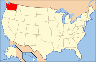
| Description | Map of USA with Washington highlighted | ||||||||
| Date | see file history below. | ||||||||
| Source | own work by uploader, based on Image:Map of USA without state names.svg | ||||||||
| Author |
This version: uploader Base versions this one is derived from: originally created by en:User:Wapcaplet |
||||||||
| Permission (Reusing this file) |
This file is licensed under the Creative Commons Attribution 2.0 Generic license.
|
||||||||
| Other versions | image:Map of USA with state names.svg | ||||||||
| SVG development |

File history
Click on a date/time to view the file as it appeared at that time.
| Date/Time | Thumbnail | Dimensions | User | Comment | |
|---|---|---|---|---|---|
| current | 10:42, 9 June 2006 | | 286 × 186 (167 KB) | Huebi~commonswiki (talk | contribs) | {{Information| |Description=Map of USA with Washington highlighted |other_versions=image:Map of USA with state names.svg }} Category:Maps of the United States Category:Maps of Washington Category:SVG maps {{GFDL-en}}{{cc-by-2.0}}{{cc-by |
You cannot overwrite this file.
File usage on Commons
The following 12 pages use this file:
- Locator maps for U.S. states
- File:Map of USA WA.svg
- File:Map of USA highlighting Washington.png
- Category:Churches in Columbia County, Washington
- Category:Cities in Washington (state)
- Category:Columbia County, Washington
- Category:Locator maps of cities in Washington (state)
- Category:Locator maps of counties of Washington (state)
- Category:Maps of Catholic dioceses of Washington (state)
- Category:Maps of Columbia County, Washington
- Category:Maps of Washington (state)
- Category:Videos from Washington (state)
File usage on other wikis
The following other wikis use this file:
- Usage on af.wikipedia.org
- Usage on ang.wikipedia.org
- Usage on an.wikipedia.org
- Usage on ar.wikipedia.org
- Usage on az.wikipedia.org
- Usage on bat-smg.wikipedia.org
- Usage on ba.wikipedia.org
- Usage on bcl.wikipedia.org
- Usage on be-tarask.wikipedia.org
- Usage on bg.wikipedia.org
- Адамс (окръг, Вашингтон)
- Айлънд
- Асотин (окръг)
- Гарфийлд (окръг, Вашингтон)
- Грант (окръг, Вашингтон)
- Грейс Харбър (окръг)
- Джеферсън (окръг, Вашингтон)
- Дъглас (окръг, Вашингтон)
- Каулиц (окръг)
- Кинг (окръг)
- Кититас (окръг)
- Китсап (окръг)
- Клалам (окръг)
- Кларк (окръг, Вашингтон)
- Кликитат (окръг)
- Колумбия (окръг, Вашингтон)
- Линкълн (окръг, Вашингтон)
- Луис (окръг, Вашингтон)
- Мейсън (окръг, Вашингтон)
- Оканоган (окръг)
- Панд Орей (окръг)
- Пасифик (окръг)
- Пиърс (окръг, Вашингтон)
- Сан Хуан (окръг, Вашингтон)
- Скаджит (окръг)
- Скамания
- Спокан (окръг)
- Стивънс (окръг, Вашингтон)
- Търстън (окръг, Вашингтон)
- Уакаякъм
- Уаткъм
- Уитман (окръг)
- Уола Уола (окръг)
- Фери
- Франклин (окръг, Вашингтон)
- Челан (окръг)
- Якима (окръг)
- Usage on bi.wikipedia.org
- Usage on bo.wikipedia.org
View more global usage of this file.