File:Map of Russia - Karelia.svg
Jump to navigation
Jump to search

Size of this PNG preview of this SVG file: 800 × 440 pixels. Other resolutions: 320 × 176 pixels | 640 × 352 pixels | 1,024 × 563 pixels | 1,280 × 704 pixels | 2,560 × 1,407 pixels | 1,541 × 847 pixels.
Original file (SVG file, nominally 1,541 × 847 pixels, file size: 6.56 MB)
Captions
Captions
Add a one-line explanation of what this file represents
The map has a mistake - Crimea is Ukraine, it is temporarily occupied by russia
Summary
[edit]
| Description |
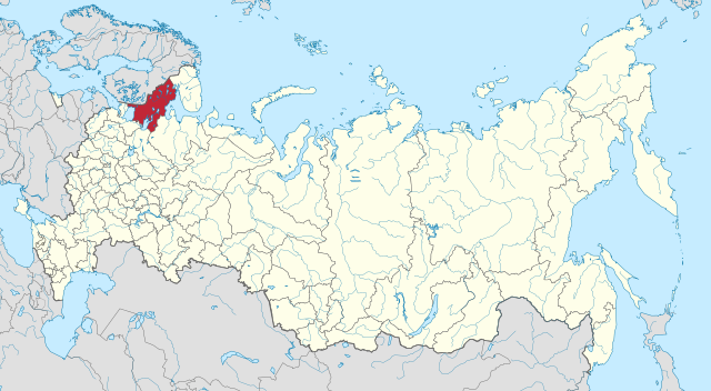
Русский: Карелия на карте России |
| Date | |
| Source | Own work |
| Author | Stasyan117 |
Licensing
[edit]
I, the copyright holder of this work, hereby publish it under the following license:
This file is licensed under the Creative Commons Attribution-Share Alike 4.0 International license.
- You are free:
- to share – to copy, distribute and transmit the work
- to remix – to adapt the work
- Under the following conditions:
- attribution – You must give appropriate credit, provide a link to the license, and indicate if changes were made. You may do so in any reasonable manner, but not in any way that suggests the licensor endorses you or your use.
- share alike – If you remix, transform, or build upon the material, you must distribute your contributions under the same or compatible license as the original.
File history
Click on a date/time to view the file as it appeared at that time.
| Date/Time | Thumbnail | Dimensions | User | Comment | |
|---|---|---|---|---|---|
| current | 03:10, 21 April 2015 | | 1,541 × 847 (6.56 MB) | Stasyan117 (talk | contribs) | User created page with UploadWizard |
You cannot overwrite this file.
File usage on Commons
The following 16 pages use this file:
- File:Map of Russia (2014–2022) - Karelia (Crimea disputed).svg
- Category:Abandoned villages in the Republic of Karelia
- Category:Airports in the Republic of Karelia
- Category:Births in the Republic of Karelia
- Category:Coats of arms of the Republic of Karelia
- Category:Deaths in the Republic of Karelia
- Category:Economy of the Republic of Karelia
- Category:Monasteries in the Republic of Karelia
- Category:People of the Republic of Karelia
- Category:Republic of Karelia
- Category:Settlements in the Republic of Karelia
- Category:Sports in the Republic of Karelia
- Category:Templates related to the Republic of Karelia
- Category:Views of the Republic of Karelia
- Category:Waterfalls in the Republic of Karelia
- Category:Wooden churches in the Republic of Karelia
_-_Karelia_(Crimea_disputed).svg)
File usage on other wikis
The following other wikis use this file:
- Usage on ar.wikipedia.org
- Usage on arz.wikipedia.org
- Usage on ast.wikipedia.org
- Usage on az.wikipedia.org
- Usage on ba.wikipedia.org
- Usage on be.wikipedia.org
- Usage on bg.wikipedia.org
- Usage on bxr.wikipedia.org
- Usage on ca.wikipedia.org
- Usage on ceb.wikipedia.org
- Usage on ce.wikipedia.org
- Usage on crh.wikipedia.org
- Usage on cs.wikipedia.org
- Usage on cv.wikipedia.org
- Usage on da.wikipedia.org
- Usage on diq.wikipedia.org
- Usage on el.wikipedia.org
- Usage on en.wikipedia.org
- Usage on es.wikipedia.org
- Usage on eu.wikipedia.org
- Usage on ga.wikipedia.org
- Usage on gl.wikipedia.org
- Usage on hy.wikipedia.org
- Usage on ie.wikipedia.org
- Usage on io.wikipedia.org
- Usage on ja.wikipedia.org
- Usage on kaa.wikipedia.org
- Usage on koi.wikipedia.org
- Usage on ky.wikipedia.org
- Usage on la.wikipedia.org
- Usage on lmo.wikipedia.org
- Usage on lt.wikipedia.org
- Usage on mhr.wikipedia.org
- Usage on mrj.wikipedia.org
- Usage on myv.wikipedia.org
- Usage on mzn.wikipedia.org
- Usage on olo.wikipedia.org
View more global usage of this file.