File:Map of Bielitz 1855 (2).jpg
Jump to navigation
Jump to search

Size of this preview: 800 × 450 pixels. Other resolutions: 320 × 180 pixels | 640 × 360 pixels | 1,024 × 576 pixels | 1,366 × 768 pixels.
Original file (1,366 × 768 pixels, file size: 641 KB, MIME type: image/jpeg)
Captions
Captions
Add a one-line explanation of what this file represents
| Description |
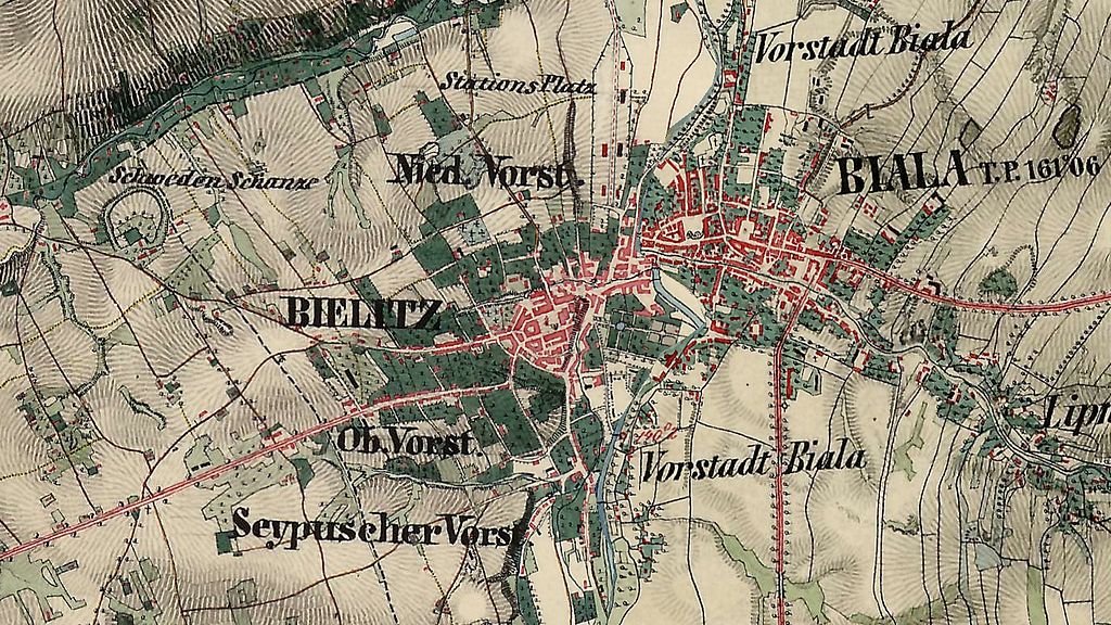
English: Austrian topographic map of Bielsko and Biała (Bielitz and Biala).
Polski: Austriacka mapa topograficzna Bielska i Białej.
Deutsch: Eine österreichische topographische Karte von Bielitz und Biala.
Čeština: Rakouska topografická mapa Bílska a Bělé.
Ślůnski: Austryjackŏ topograficznŏ mapa Biylska a Biŏłyj. |
||||
| Date | between 1855 and 1869 | ||||
| Source | Unknown source | ||||
| Author | Franziszeische Landesaufnahme (online) | ||||
| Permission (Reusing this file) |
|
||||
| Other versions |
 |
||||
File history
Click on a date/time to view the file as it appeared at that time.
| Date/Time | Thumbnail | Dimensions | User | Comment | |
|---|---|---|---|---|---|
| current | 10:09, 21 August 2016 | | 1,366 × 768 (641 KB) | Gaj777 (talk | contribs) | lepsza wersja |
| 12:44, 26 August 2008 |  | 808 × 406 (132 KB) | Gaj777 (talk | contribs) | {{Information |Description={{en|Map of Bielitz (Bielsko) in 1855. </br>}} {{pl|Mapa Bielitz (Bielsko) z 1855 r.}} |Source= |Date=1855-1860 |Author= |Permission={{pd-old}} |other_versions=200px }} Category:Bielsko-Biała |
You cannot overwrite this file.
File usage on Commons
The following page uses this file:
File usage on other wikis
The following other wikis use this file:
- Usage on cs.wikipedia.org
- Usage on de.wikipedia.org
- Usage on en.wikipedia.org
- Usage on pl.wikipedia.org
.jpg&oldid=906791182)