File:Map Iberian Peninsula 1037-bg.svg
Jump to navigation
Jump to search

Size of this PNG preview of this SVG file: 800 × 555 pixels. Other resolutions: 320 × 222 pixels | 640 × 444 pixels | 1,024 × 711 pixels | 1,280 × 888 pixels | 2,560 × 1,777 pixels | 827 × 574 pixels.
Original file (SVG file, nominally 827 × 574 pixels, file size: 253 KB)
Captions
Captions
Add a one-line explanation of what this file represents
Summary
[edit]| Description |
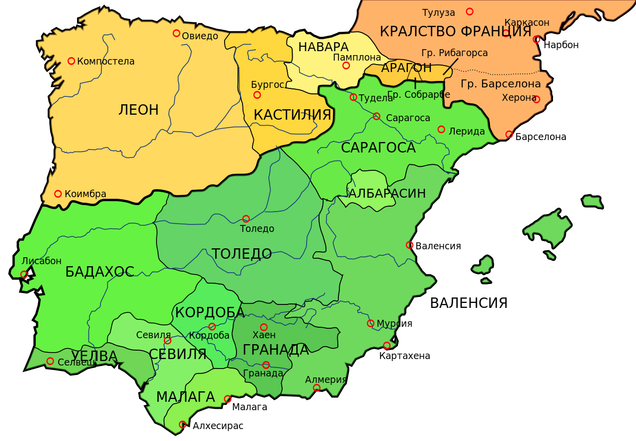
Български: Иберийският полуостров през 1037 г. |
||
| Date | |||
| Source |
|
||
| Author | derivative work: Nauka | ||
| Other versions |
[]
See also[edit] |


|
This SVG file contains embedded text that can be translated into your language, using any capable SVG editor, text editor or the SVG Translate tool. For more information see: About translating SVG files. |
Licensing
[edit]
This file is licensed under the Creative Commons Attribution-Share Alike 3.0 Unported license.
- You are free:
- to share – to copy, distribute and transmit the work
- to remix – to adapt the work
- Under the following conditions:
- attribution – You must give appropriate credit, provide a link to the license, and indicate if changes were made. You may do so in any reasonable manner, but not in any way that suggests the licensor endorses you or your use.
- share alike – If you remix, transform, or build upon the material, you must distribute your contributions under the same or compatible license as the original.
This file is licensed under the Creative Commons Attribution-Share Alike 2.5 Generic license.
- You are free:
- to share – to copy, distribute and transmit the work
- to remix – to adapt the work
- Under the following conditions:
- attribution – You must give appropriate credit, provide a link to the license, and indicate if changes were made. You may do so in any reasonable manner, but not in any way that suggests the licensor endorses you or your use.
- share alike – If you remix, transform, or build upon the material, you must distribute your contributions under the same or compatible license as the original.
File history
Click on a date/time to view the file as it appeared at that time.
| Date/Time | Thumbnail | Dimensions | User | Comment | |
|---|---|---|---|---|---|
| current | 16:28, 14 July 2011 | | 827 × 574 (253 KB) | Nauka (talk | contribs) | Some mistakes were removed. |
| 16:18, 13 July 2011 |  | 827 × 574 (253 KB) | Nauka (talk | contribs) |
You cannot overwrite this file.
File usage on Commons
The following 7 pages use this file:
File usage on other wikis
The following other wikis use this file:
- Usage on ru.wikipedia.org
Categories:
- Maps showing 1037
- History of Catalonia
- Iberian kingdoms
- Maps of the Iberian Peninsula in the 11th century
- Maps of the Frankish territory
- Maps of the Kingdom of Aragon
- Maps of the Kingdom of León
- Maps showing 11th-century history
- Bulgarian-language SVG maps showing history
- Maps of the taifa kingdoms
- 1037 in Spain