File:Mansarovar map.jpg
From Wikimedia Commons, the free media repository
Jump to navigation
Jump to search

Size of this preview: 384 × 599 pixels. Other resolutions: 154 × 240 pixels | 307 × 480 pixels | 492 × 768 pixels | 1,048 × 1,635 pixels.
Original file (1,048 × 1,635 pixels, file size: 1.34 MB, MIME type: image/jpeg)
File information
Structured data
Captions
Captions
Add a one-line explanation of what this file represents
| DescriptionMansarovar map.jpg |
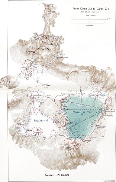
Map of the Lake Manasarovar region |
|||||||||
| Date |
between 1915 and 1922 date QS:P,+1950-00-00T00:00:00Z/7,P1319,+1915-00-00T00:00:00Z/9,P1326,+1922-00-00T00:00:00Z/9 |
|||||||||
| Source | Southern Tibet. Discoveries in former times compared with my own researches in 1906-1908. Volume 12 | |||||||||
| Creator |
Sven Hedin |
|||||||||
| Permission (Reusing this file) |
|
|||||||||
| Geotemporal data | ||||||||||
| Bounding box |
|
|||||||||
| Georeferencing | View the georeferenced map in the Wikimaps Warper | |||||||||
| Other versions |
|
|||||||||
File history
Click on a date/time to view the file as it appeared at that time.
| Date/Time | Thumbnail | Dimensions | User | Comment | |
|---|---|---|---|---|---|
| current | 16:07, 21 March 2013 |  | 1,048 × 1,635 (1.34 MB) | Shyamal (talk | contribs) | {{Information |Description=Map of the Lake Manasarovar region |Source=Southern Tibet. Discoveries in former times compared with my own researches in 1906-1908. Volume 12 |Date=1915-1922 |Author=Sven Hedin |Permission={{pd-1923}} |other_versions= }} [... |
You cannot overwrite this file.
File usage on Commons
The following 2 pages use this file:
File usage on other wikis
The following other wikis use this file:
- Usage on en.wikipedia.org
- Usage on it.wikipedia.org
- Usage on ja.wikipedia.org
- Usage on sl.wikipedia.org
- Usage on sr.wikipedia.org
- Usage on tt.wikipedia.org
- Usage on uz.wikipedia.org

