File:Lower Wachau.png
Jump to navigation
Jump to search

Size of this preview: 567 × 600 pixels. Other resolutions: 227 × 240 pixels | 454 × 480 pixels | 913 × 966 pixels.
Original file (913 × 966 pixels, file size: 397 KB, MIME type: image/png)
Captions
Captions
Add a one-line explanation of what this file represents
| Description |
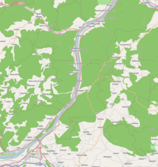
English: Map of the lower part of the Wachau valley
This file is licensed under the Creative Commons Attribution-Share Alike 2.0 Generic license.
|
| Date | |
| Source | OpenStreetMap |
| Author | Dr. Blofeld based on OpenStreetMap |
File history
Click on a date/time to view the file as it appeared at that time.
| Date/Time | Thumbnail | Dimensions | User | Comment | |
|---|---|---|---|---|---|
| current | 19:43, 6 December 2010 | | 913 × 966 (397 KB) | Blofeld Dr. (talk | contribs) | {{Information |Description={{en|1=r}} |Source=r |Author=r |Date=rr |Permission= |other_versions= }} |
You cannot overwrite this file.
File usage on Commons
There are no pages that use this file.
File usage on other wikis
The following other wikis use this file:
- Usage on en.wikipedia.org
- Usage on et.wikipedia.org
- Usage on sl.wikipedia.org