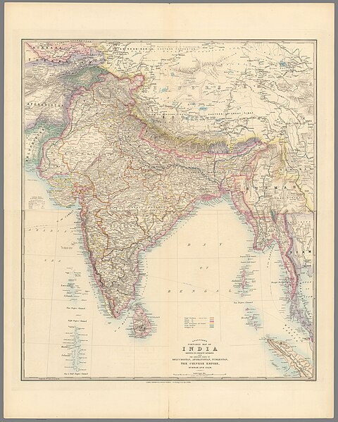
File:London atlas of universal geography, by Edward Stanford (11741041).jpg
From Wikimedia Commons, the free media repository
Jump to navigation
Jump to search

Size of this preview: 480 × 599 pixels. Other resolutions: 192 × 240 pixels | 384 × 480 pixels | 615 × 768 pixels | 820 × 1,024 pixels | 1,640 × 2,048 pixels | 18,216 × 22,745 pixels.
Original file (18,216 × 22,745 pixels, file size: 98.39 MB, MIME type: image/jpeg)
File information
Structured data
Captions
Captions
Add a one-line explanation of what this file represents
Summary
[edit]| Warning | The original file is very high-resolution. It might not load properly or could cause your browser to freeze when opened at full size. | Open in ZoomViewer |
|---|
| DescriptionLondon atlas of universal geography, by Edward Stanford (11741041).jpg |
English: London atlas of universal geography, by Edward Stanford, exhibiting the physical and political divisions of the various countries of the world. Folio edition, published by Edward Stanford. The Stanford map making company had been active in London since 1854. In 1874 they acquired the London atlas of 1834 from John Arrowsmith, with 50 maps which had increased to over 65 maps within 30 years. According to Francis Herbert, Stanford released a special limited edition in 1884 with 70 maps. This edition, published in 1887, has 90 maps—spanning Vol. I and Vol II—covering the continents, countries, kingdoms and empires. Contains important new maps, including the North Pole, Malta, Cyprus, the approaches to the Black Sea, parts of Canada and Australia. Vol. I has 39 of the maps, as listed in the Contents, which appears in Vol. I, preceding the maps. Handwritten annotations therein mark the presence of Maps 1, 4, 5, 6, 12, 13, 19, 20, 34-36, 38, 40, 41, 45, 46, 48, 50-52, 55-57, 59, 61, 64-66, 71-77, 80, 84, 86, 88 and 90, as well as the Index.
Français : London atlas of universal geography, par Edward Stanford, montrant les divisions physiques et politiques des différents pays du monde. Édition in-folio, publiée par Edward Stanford. La société de cartographie de Stanford était active à Londres depuis 1854. En 1874, elle acquit l'atlas de Londres de 1834 de John Arrowsmith, avec 50 cartes qui étaient passées à plus de 65 cartes en 30 ans. Selon Francis Herbert, Stanford a publié une édition limitée spéciale en 1884 avec 70 cartes. Cette édition, publiée en 1887, compte 90 cartes — couvrant le Vol. I et Vol II — couvrant les continents, les pays, les royaumes et les empires. Contient de nouvelles cartes importantes, y compris le pôle Nord, Malte, Chypre, les approches de la mer Noire, certaines parties du Canada et de l'Australie. Vol. J'ai 39 des cartes, comme indiqué dans le Sommaire, qui apparaît dans le Vol. I, précédant les cartes. Des annotations manuscrites y marquent la présence des Cartes 1, 4, 5, 6, 12, 13, 19, 20, 34-36, 38, 40, 41, 45, 46, 48, 50-52, 55-57, 59, 61, 64-66, 71-77, 80, 84, 86, 8 8 et 90, ainsi que l'Index. |
|||||||||||||||||||
| Date | ||||||||||||||||||||
| Source | list, main | |||||||||||||||||||
| Author |
creator QS:P170,Q3655695 |
|||||||||||||||||||
Licensing
[edit]|
This is a faithful photographic reproduction of a two-dimensional, public domain work of art. The work of art itself is in the public domain for the following reason:
The official position taken by the Wikimedia Foundation is that "faithful reproductions of two-dimensional public domain works of art are public domain".
This photographic reproduction is therefore also considered to be in the public domain in the United States. In other jurisdictions, re-use of this content may be restricted; see Reuse of PD-Art photographs for details. | |||||
File history
Click on a date/time to view the file as it appeared at that time.
| Date/Time | Thumbnail | Dimensions | User | Comment | |
|---|---|---|---|---|---|
| current | 20:02, 23 July 2023 |  | 18,216 × 22,745 (98.39 MB) | YannBot (talk | contribs) | == {{int:filedesc}} == {{Information |Description={{en|1=''London atlas of universal geography'', by Edward Stanford, exhibiting the physical and political divisions of the various countries of the world. Folio edition, published by Edward Stanford. The Stanford map making company had been active in London since 1854. In 1874 they acquired the London atlas of 1834 from John Arrowsmith, with 50 maps which had increased to over 65 maps within 30 years. According to Francis Herbert, Stanford rel... |
You cannot overwrite this file.
File usage on Commons
The following page uses this file: