File:Location map Netherlands Amsterdam Central.png
From Wikimedia Commons, the free media repository
Jump to navigation
Jump to search

Size of this preview: 638 × 600 pixels. Other resolutions: 255 × 240 pixels | 511 × 480 pixels | 785 × 738 pixels.
Original file (785 × 738 pixels, file size: 807 KB, MIME type: image/png)
File information
Structured data
Captions
Captions
Add a one-line explanation of what this file represents

|
This map image could be re-created using vector graphics as an SVG file. This has several advantages; see Commons:Media for cleanup for more information. If an SVG form of this image is available, please upload it and afterwards replace this template with
{{vector version available|new image name}}.
It is recommended to name the SVG file “Location map Netherlands Amsterdam Central.svg”—then the template Vector version available (or Vva) does not need the new image name parameter. |
| DescriptionLocation map Netherlands Amsterdam Central.png |
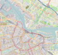
English: Map of Amsterdam
Geographic limits of the map:
Español: Mapa del área central de Ámsterdam, Países Bajos.
This file is licensed under the Creative Commons Attribution-Share Alike 2.0 Generic license.
|
| Source | OpenStreetMap |
| Author | Dr. Blofeld |
File history
Click on a date/time to view the file as it appeared at that time.
| Date/Time | Thumbnail | Dimensions | User | Comment | |
|---|---|---|---|---|---|
| current | 11:40, 14 May 2010 |  | 785 × 738 (807 KB) | Dr. Blofeld~commonswiki (talk | contribs) | {{Information |Description={{en|1=j}} |Source=j |Author=jj |Date=j |Permission= |other_versions= }} |
You cannot overwrite this file.
File usage on Commons
The following 3 pages use this file:
File usage on other wikis
The following other wikis use this file:
- Usage on ar.wikipedia.org
- Usage on ast.wikipedia.org
- Usage on az.wikipedia.org
- Usage on bg.wikipedia.org
- Usage on bn.wikipedia.org
- Usage on ceb.wikipedia.org
- Usage on en.wikipedia.org
- Concertgebouw, Amsterdam
- Het Schip
- El Tawheed Mosque
- Paradiso (Amsterdam)
- Melkweg
- Wereldmuseum Amsterdam
- Museum Willet-Holthuysen
- Museum Geelvinck-Hinlopen
- Verzetsmuseum
- Swissôtel Amsterdam
- Astoria (Amsterdam)
- EYE Film Institute Netherlands
- Museum Van Loon
- Ons' Lieve Heer op Solder
- Marie Heinekenplein
- Module:Location map/data/Netherlands Amsterdam/doc
- Lloyd Hotel
- Admiralenbuurt
- Flevopark
- Rapenburg
- Schinkelbuurt
- Westelijke Eilanden
- Westermoskee
- Press Museum
- Waldorf Astoria Amsterdam
- Module:Location map/data/Netherlands Amsterdam
- Warehouses Medan, Bindjeij and Laboean
- Nieuwe Vaart
- Prinseneilandsgracht
- Realengracht
- Bickersgracht
- Tabakspanden
- Oosterdok
- Murder of Peter R. de Vries
- Gerard Doustraat Synagogue
- Allied bombings of Amsterdam-Noord
- Westerdok
- Usage on eo.wikipedia.org
View more global usage of this file.