File:Local Authority Boundary Sign, Keresley Village - geograph.org.uk - 583424.jpg
Jump to navigation
Jump to search
No higher resolution available.
Local_Authority_Boundary_Sign,_Keresley_Village_-_geograph.org.uk_-_583424.jpg (640 × 427 pixels, file size: 115 KB, MIME type: image/jpeg)
Captions
Captions
Add a one-line explanation of what this file represents
Summary
[edit]
| Description |
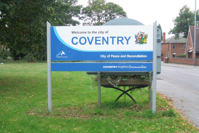
English: Local Authority Boundary Sign, Keresley Village Keresley village is part of the City of Coventry, unlike most of the surrounding area which falls under the Borough of Nuneaton and Bedworth. This sign is only a few years old, as it displays the logo and livery adopted by Coventry City Council around 2004. The strapline 'City of Peace and Reconciliation' has been in use for many years, reflecting a long-held civic mission of the city. |
| Date | |
| Source | From geograph.org.uk |
| Author | Niki Walton |
| Attribution (required by the license) | Niki Walton / Local Authority Boundary Sign, Keresley Village / |
| Camera location | | View this and other nearby images on: OpenStreetMap |
|---|
_heading:270.00&language=en)
| Object location | | View this and other nearby images on: OpenStreetMap |
|---|
_heading:270.00&language=en)
Licensing
[edit]

|
This image was taken from the Geograph project collection. See this photograph's page on the Geograph website for the photographer's contact details. The copyright on this image is owned by Niki Walton and is licensed for reuse under the Creative Commons Attribution-ShareAlike 2.0 license.
|
This file is licensed under the Creative Commons Attribution-Share Alike 2.0 Generic license.
Attribution: Niki Walton
- You are free:
- to share – to copy, distribute and transmit the work
- to remix – to adapt the work
- Under the following conditions:
- attribution – You must give appropriate credit, provide a link to the license, and indicate if changes were made. You may do so in any reasonable manner, but not in any way that suggests the licensor endorses you or your use.
- share alike – If you remix, transform, or build upon the material, you must distribute your contributions under the same or compatible license as the original.
File history
Click on a date/time to view the file as it appeared at that time.
| Date/Time | Thumbnail | Dimensions | User | Comment | |
|---|---|---|---|---|---|
| current | 14:18, 6 February 2011 | | 640 × 427 (115 KB) | GeographBot (talk | contribs) | == {{int:filedesc}} == {{Information |description={{en|1=Local Authority Boundary Sign, Keresley Village Keresley village is part of the City of Coventry, unlike most of the surrounding area which falls under the Borough of Nuneaton and Bedworth. This si |
You cannot overwrite this file.
File usage on Commons
There are no pages that use this file.