File:Las Palmas de Gran Canaria-Distritos 2004.svg
Jump to navigation
Jump to search

Size of this PNG preview of this SVG file: 600 × 600 pixels. Other resolutions: 240 × 240 pixels | 480 × 480 pixels | 768 × 768 pixels | 1,024 × 1,024 pixels | 2,048 × 2,048 pixels.
Original file (SVG file, nominally 800 × 800 pixels, file size: 765 KB)
Captions
Captions
Add a one-line explanation of what this file represents
| Description |
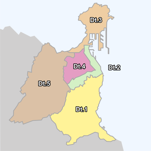
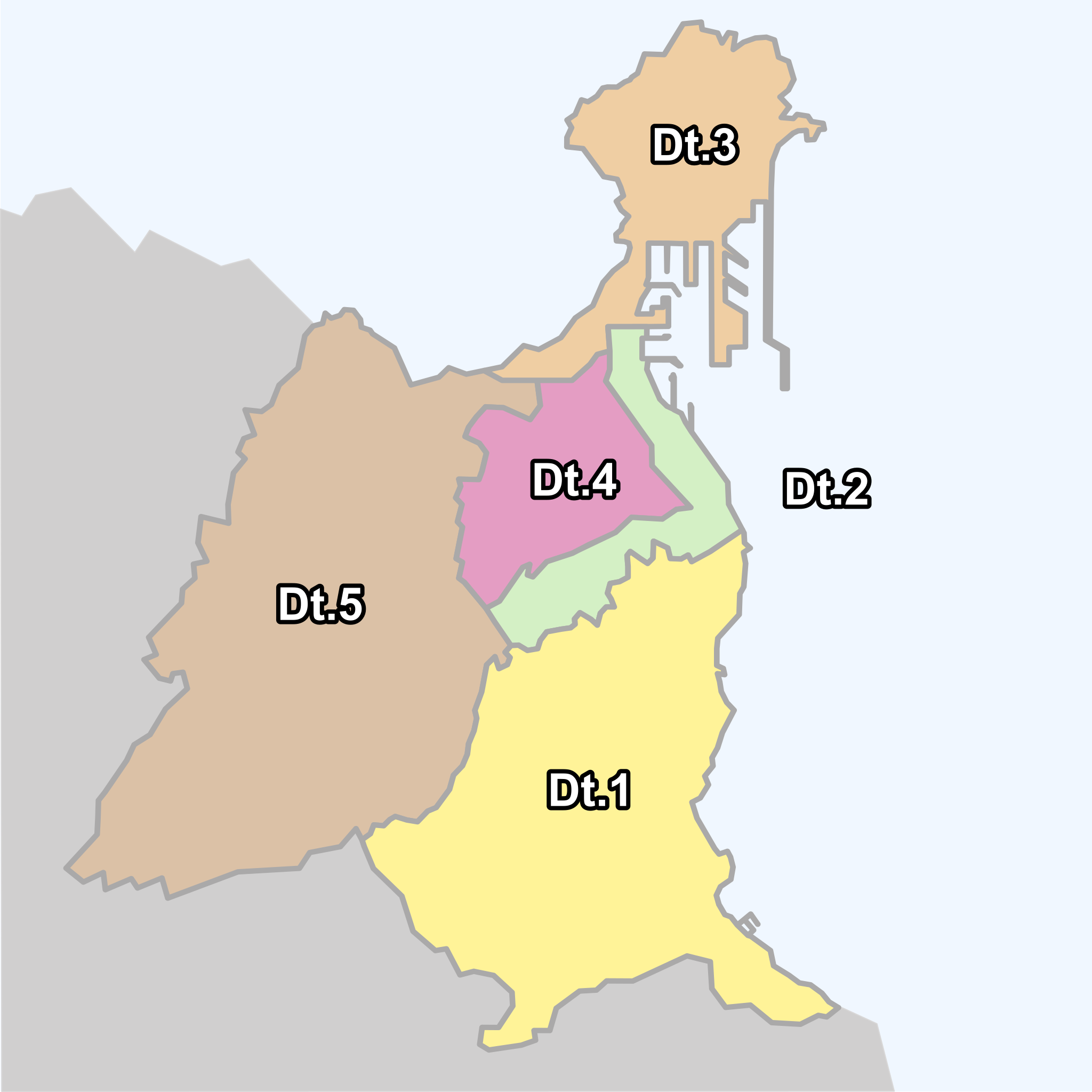
Municipality of Las Palmas de Gran Canaria (Gran Canaria), Canary Islands, Spain. All district map locator (2004) with legend: Dt.1= Vegueta, Cono Sur y Tafira; Dt.2= Centro (center district); Dt.3= Puerto-Canteras; Dt.4= Ciudad Alta; Dt.5= Tamaraceite-San Lorenzo. |
||
| Date | |||
| Source | self-made from Image:Gran Canaria municipio Las Palmas de Gran Canaria.svg by Júlio Reis | ||
| Author | Pepelopex | ||
| Permission (Reusing this file) |
I, the copyright holder of this work, hereby publish it under the following licenses:
This file is licensed under the Creative Commons Attribution-Share Alike 3.0 Unported, 2.5 Generic, 2.0 Generic and 1.0 Generic license.
You may select the license of your choice. |
||
| Other versions | Sectorized maps: District 1, District 2, District 3, District 4 and District 5. |

File history
Click on a date/time to view the file as it appeared at that time.
| Date/Time | Thumbnail | Dimensions | User | Comment | |
|---|---|---|---|---|---|
| current | 22:57, 28 October 2007 | | 800 × 800 (765 KB) | Pepelopex (talk | contribs) | adjust file size |
| 22:48, 28 October 2007 |  | 800 × 800 (1.17 MB) | Pepelopex (talk | contribs) | adjust file size | |
| 22:39, 28 October 2007 |  | 800 × 800 (1.17 MB) | Pepelopex (talk | contribs) | minor error fixes | |
| 15:32, 28 October 2007 |  | 800 × 800 (764 KB) | Pepelopex (talk | contribs) | {{Information |Description= Municipalty of Las Palmas de Gran Canaria (Gran Canaria), Canary Islands, Spain.. All district map (2004) locator with legend: Dt.1= Vegueta, Cono Sur y Tafira; Dt.2= Centro (center district); Dt.3= Puerto-Canteras; Dt.4= Ciuda |
You cannot overwrite this file.
File usage on Commons
The following page uses this file:
File usage on other wikis
The following other wikis use this file:
- Usage on azb.wikipedia.org
- Usage on en.wikipedia.org
- Usage on es.wikipedia.org
- Usage on eu.wikipedia.org
- Usage on hy.wikipedia.org
- Usage on pt.wikipedia.org
- Usage on qu.wikipedia.org
- Usage on ru.wikipedia.org
- Usage on sl.wikipedia.org
- Usage on vep.wikipedia.org