File:Kobyłka location map.svg
Jump to navigation
Jump to search

Size of this PNG preview of this SVG file: 597 × 599 pixels. Other resolutions: 239 × 240 pixels | 478 × 480 pixels | 765 × 768 pixels | 1,020 × 1,024 pixels | 2,041 × 2,048 pixels | 1,980 × 1,987 pixels.
Original file (SVG file, nominally 1,980 × 1,987 pixels, file size: 5.03 MB)
Captions
Captions
Add a one-line explanation of what this file represents
| Description |
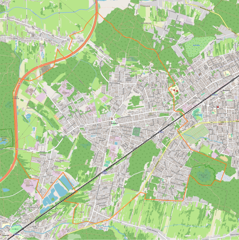
Polski: Mapa Kobyłki, Polska
English: Map of Kobylka, Poland |
|||||||||
| Date | ||||||||||
| Source | You may find a page on the OpenStreetMap wiki page for Kobyłka | |||||||||
| Creator |
OpenStreetMap contributors OpenStreetMap contributors |
|||||||||
| Permission (Reusing this file) |
OpenStreetMap data is available under the Open Database License (details). Map tiles are licensed under the Creative Commons Attribution-ShareAlike 2.0 license (CC-BY-SA 2.0).
This file is licensed under the Creative Commons Attribution-Share Alike 2.0 Generic license.
|
|||||||||
| Geotemporal data | ||||||||||
| Bounding box |
|
|||||||||
| Georeferencing | If inappropriate please set warp_status = skip to hide. | |||||||||
File history
Click on a date/time to view the file as it appeared at that time.
| Date/Time | Thumbnail | Dimensions | User | Comment | |
|---|---|---|---|---|---|
| current | 13:59, 21 June 2019 | | 1,980 × 1,987 (5.03 MB) | Smat (talk | contribs) | correct map |
| 05:00, 8 May 2014 |  | 1,020 × 1,214 (674 KB) | ArkadiuszZ (talk | contribs) | {{OpenStreetMap | name = Kobyłka | location = Kobyłka | description = {{pl|Mapa Kobyłki, Polska}} {{en|Map of Kobylka, Poland}} | top = 52.3548 | left = 21.1604 | right = 21.2218 | bot... |
You cannot overwrite this file.
File usage on Commons
There are no pages that use this file.
File usage on other wikis
The following other wikis use this file:
- Usage on pl.wikipedia.org
- Rezerwat przyrody Grabicz
- Grabicz
- Bazylika Świętej Trójcy w Kobyłce
- Kobyłka Ossów
- Kobyłka (przystanek kolejowy)
- Parafia św. Matki Teresy z Kalkuty w Kobyłce-Turowie
- Parafia Świętej Trójcy w Kobyłce
- Parafia św. Kazimierza Królewicza w Kobyłce-Stefanówce
- Głaz Edmunda
- Muzeum Oręża i Techniki Użytkowej w Kobyłce
- Moduł:Mapa/dane/Kobyłka
- Kobyła Niepodległości
- WFD Translift
- Parafia bł. księdza Jerzego Popiełuszki w Kobyłce-Maciołkach
- Antolek
- Maciołki
- Mareta
- Nadarzyn (Kobyłka)
- Piotrówek (Kobyłka)
- Jędrzejek
- Sosnówka (Kobyłka)
- Kobylak (Kobyłka)
- Zalasek (Kobyłka)
- Stefanówka (Kobyłka)
- Mareta-Kolonia Chór
- Kolonia Chór
- Turów (Kobyłka)
- Dąbrowa (Kobyłka)
- Kościół Świętego Kazimierza Królewicza w Kobyłce-Stefanówce
- Kościół św. Matki Teresy z Kalkuty w Kobyłce-Turowie
- Usage on pl.wikibooks.org
- Usage on pt.wikipedia.org