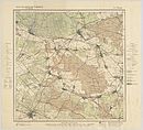
File:Karte von Berlin und Umgebung (1922) in 12 Blättern IV Freienwalde.jpg
From Wikimedia Commons, the free media repository
Jump to navigation
Jump to search

Size of this preview: 702 × 600 pixels. Other resolutions: 281 × 240 pixels | 562 × 480 pixels | 899 × 768 pixels | 1,199 × 1,024 pixels | 2,397 × 2,048 pixels | 7,599 × 6,492 pixels.
Original file (7,599 × 6,492 pixels, file size: 12.2 MB, MIME type: image/jpeg)
File information
Structured data
Captions
Captions
Add a one-line explanation of what this file represents
Description
[edit]| Warning | The original file is very high-resolution. It might not load properly or could cause your browser to freeze when opened at full size. | Open in ZoomViewer |
|---|
| Title |
Karte von Berlin und Umgebung in 12 Blättern: IV Freienwalde. |
||||||||||||
| DescriptionKarte von Berlin und Umgebung (1922) in 12 Blättern IV Freienwalde.jpg |
Deutsch: Die aus 12 Blättern bestehende Kartenserie ging 1901 aus der "Karte der Umgegend von Berlin" hervor und erschien bis 1920 mindestens fünfmal. Der Titel steht auf allen Blättern 2-zeilig links oben über dem Plan. Seit der Ausgabe von 1913 sind im Rahmen sowohl die Längen von Ferro wie auch von Greenwich angegeben. Links unter dem Plan steht: "Preußische Landesaufnahme 1901. Berichtigt 1920"; drei Maßstabsleisten über 8.000 Meter, 10.000 Schritt und 1 geographische Meile; rechts daneben ein Übersichtsschema und ein Hinweis zum Höhenbezug. Rechts und Links neben dem Plan ist auf jedem Blatt eine ausführliche Legende abgedruckt. Die "Grenze der Stadt Berlin" wurde hier gem. des Groß-Berlin-Gesetzes von 1920 mit aufgenommen. |
||||||||||||
| Date | |||||||||||||
| Source | Universiteitsbibliotheek Vrije Universiteit, Amsterdam (online) | ||||||||||||
| Creator |
Reichsamt für Landesaufnahme des Deutschen Reiches (Reich Office for Land Survey) |
||||||||||||
| Geotemporal data | |||||||||||||
| Map location | Berlin | ||||||||||||
| Scale | 1:50,000 | ||||||||||||
| Heading |
|
||||||||||||
| Georeferencing | Georeference the map in Wikimaps Warper If inappropriate please set warp_status = skip to hide. | ||||||||||||
| Bibliographic data | |||||||||||||
| Part of the series | Karte von Berlin und Umgebung in 12 Blättern | ||||||||||||
| Map sheet | IV Freienwalde | ||||||||||||
| Language | German | ||||||||||||
| Archival data | |||||||||||||
| Collection | Universiteitsbibliotheek Vrije Universiteit | ||||||||||||
| Dimensions |
height: 47 cm (18.5 in); width: 47 cm (18.5 in) dimensions QS:P2048,47U174728 dimensions QS:P2049,47U174728 |
||||||||||||
| Medium |
chromolithograph medium QS:P186,Q1121337 |
||||||||||||
| Notes |
Literatur
|
||||||||||||
| Other versions |
 |
||||||||||||
Licensing
[edit]|
This is a faithful photographic reproduction of a two-dimensional, public domain work of art. The work of art itself is in the public domain in its source country for the following reason:
It is also in the public domain in the United States for the following reason:
The official position taken by the Wikimedia Foundation is that "faithful reproductions of two-dimensional public domain works of art are public domain".
This photographic reproduction is therefore also considered to be in the public domain in the United States. In other jurisdictions, re-use of this content may be restricted; see Reuse of PD-Art photographs for details. العربية ∙ Deutsch ∙ English ∙ español ∙ français ∙ Bahasa Indonesia ∙ italiano ∙ 日本語 ∙ македонски ∙ മലയാളം ∙ polski ∙ português ∙ русский ∙ sicilianu ∙ slovenščina ∙ Türkçe ∙ 中文 ∙ 中文(中国大陆) ∙ 中文(简体) ∙ 中文(繁體) ∙ 中文(臺灣) ∙ +/− |
File history
Click on a date/time to view the file as it appeared at that time.
| Date/Time | Thumbnail | Dimensions | User | Comment | |
|---|---|---|---|---|---|
| current | 20:57, 9 December 2012 |  | 7,599 × 6,492 (12.2 MB) | Alexrk2 (talk | contribs) | new |
You cannot overwrite this file.
File usage on Commons
The following 15 pages use this file:
- File:Karte von Berlin und Umgebung (1913) in 12 Blättern IV Freienwalde.jpg
- File:Karte von Berlin und Umgebung (1922) in 12 Blättern III Bernau.jpg
- File:Karte von Berlin und Umgebung (1922) in 12 Blättern II Oranienburg.jpg
- File:Karte von Berlin und Umgebung (1922) in 12 Blättern II Oranienburg (Entenschnabel).jpg
- File:Karte von Berlin und Umgebung (1922) in 12 Blättern IV Freienwalde.jpg
- File:Karte von Berlin und Umgebung (1922) in 12 Blättern IX Werder.jpg
- File:Karte von Berlin und Umgebung (1922) in 12 Blättern I Nauen.jpg
- File:Karte von Berlin und Umgebung (1922) in 12 Blättern VIII Strausberg.jpg
- File:Karte von Berlin und Umgebung (1922) in 12 Blättern VII Cöpenick.jpg
- File:Karte von Berlin und Umgebung (1922) in 12 Blättern VI Berlin.jpg
- File:Karte von Berlin und Umgebung (1922) in 12 Blättern V Potsdam.jpg
- File:Karte von Berlin und Umgebung (1922) in 12 Blättern XII Fürstenwalde.jpg
- File:Karte von Berlin und Umgebung (1922) in 12 Blättern XI Königs-Wusterhausen.jpg
- File:Karte von Berlin und Umgebung (1922) in 12 Blättern X Zossen.jpg
- Template:Karte von Berlin und Umgebung (1922) in 12 Blättern/Index


