File:Karte Zellertalbahn.svg
Jump to navigation
Jump to search

Size of this PNG preview of this SVG file: 451 × 235 pixels. Other resolutions: 320 × 167 pixels | 640 × 333 pixels | 1,024 × 534 pixels | 1,280 × 667 pixels | 2,560 × 1,334 pixels.
Original file (SVG file, nominally 451 × 235 pixels, file size: 2.23 MB)
Captions
Captions
Add a one-line explanation of what this file represents

Summary
[edit]| Description |
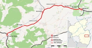
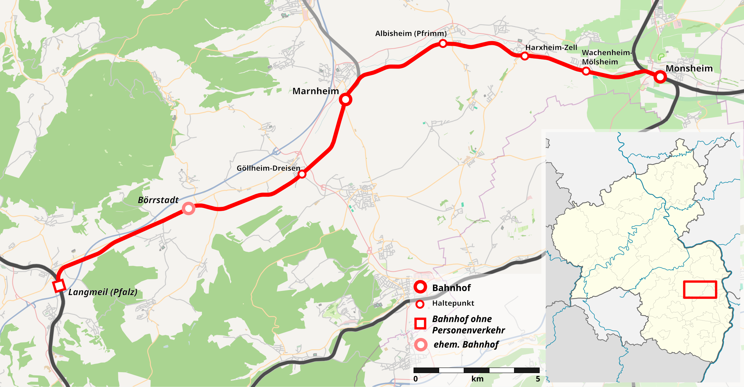
Deutsch: Verlauf der Zellertalbahn |
| Date | |
| Source |
|
| Author | Hoff1980 |
| Permission (Reusing this file) |
This map was created from OpenStreetMap project data, collected by the community. This file is licensed under the Creative Commons Attribution-Share Alike 2.0 Generic license.
|
| Other versions |
|

File history
Click on a date/time to view the file as it appeared at that time.
| Date/Time | Thumbnail | Dimensions | User | Comment | |
|---|---|---|---|---|---|
| current | 23:00, 26 January 2013 | | 451 × 235 (2.23 MB) | Hoff1980 (talk | contribs) | small changes |
| 23:03, 25 January 2013 |  | 451 × 235 (2.24 MB) | Hoff1980 (talk | contribs) | {{Information |Description={{de|1=Verlauf der Zellertalbahn}} |Source=* [http://www.openstreetmap.org OpenStreetMap] data for the background * this map by TUBS for the ... |
You cannot overwrite this file.
File usage on Commons
The following page uses this file: