File:KRTC CiaoTou Station TrainOnPlatform.jpg
Jump to navigation
Jump to search
Size of this preview: 800 × 532 pixels. Other resolutions: 320 × 213 pixels | 640 × 426 pixels | 1,024 × 681 pixels | 1,200 × 798 pixels.
Original file (1,200 × 798 pixels, file size: 398 KB, MIME type: image/jpeg)
Captions
Captions
Add a one-line explanation of what this file represents
Summary
[edit]
| Description |
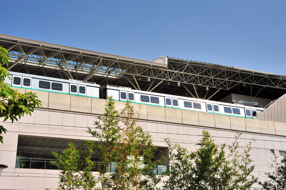
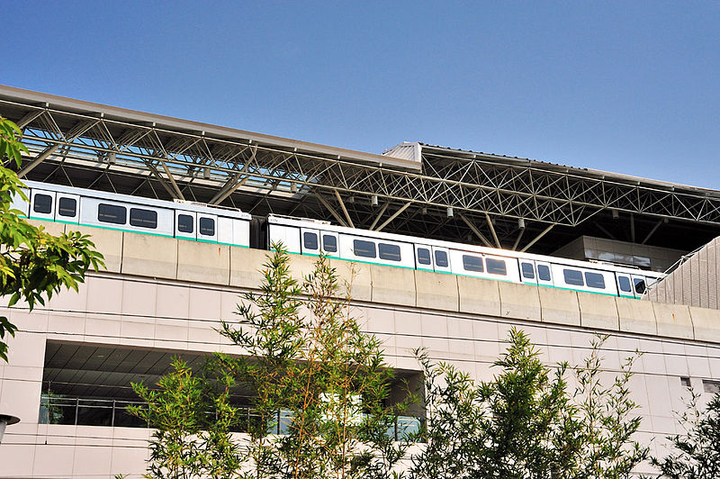
English: CiaoTou Station is a MRT station of KRTC co-sharing with TRA Western main rail line. It locates within the boundary of CiaoTou Township, KaoHsiung County. This photo shows the MRT train stopping by the elevated platform of CiaoTou Station. 中文(臺灣):橋頭火車站是高雄捷運紅線上一個與台鐵縱貫線所共用的捷運車站,位於高雄縣橋頭鄉境內。圖中所見是停靠在高架月台上的高捷列車。 |
| Date | Nov, 2008 @ CiaoTou Township, KaoHsiung County, Taiwan / 台灣高雄縣橋頭鄉 |
| Source | Own work |
| Author | SElefant |
| Camera location | | View this and other nearby images on: OpenStreetMap |
|---|
Licensing
[edit]
I, SElefant, the copyright holder of this work, hereby publishes it under the following licenses:

|
Permission is granted to copy, distribute and/or modify this document under the terms of the GNU Free Documentation License, Version 1.2 or any later version published by the Free Software Foundation; with no Invariant Sections, no Front-Cover Texts, and no Back-Cover Texts. A copy of the license is included in the section entitled GNU Free Documentation License. |
| This file is licensed under the Creative Commons Attribution-Share Alike 3.0 Unported license. | ||
| Attribution: I, SElefant | ||
| ||
| This licensing tag was added to this file as part of the GFDL licensing update. |
This file is licensed under the Creative Commons Attribution-Share Alike 2.5 Generic license.
Attribution: I, SElefant
- You are free:
- to share – to copy, distribute and transmit the work
- to remix – to adapt the work
- Under the following conditions:
- attribution – You must give appropriate credit, provide a link to the license, and indicate if changes were made. You may do so in any reasonable manner, but not in any way that suggests the licensor endorses you or your use.
- share alike – If you remix, transform, or build upon the material, you must distribute your contributions under the same or compatible license as the original.
You may select the license of your choice.
File history
Click on a date/time to view the file as it appeared at that time.
| Date/Time | Thumbnail | Dimensions | User | Comment | |
|---|---|---|---|---|---|
| current | 04:34, 7 December 2008 | | 1,200 × 798 (398 KB) | SElefant (talk | contribs) | {{Information |Description={{en|1=0}} |Source=Own work by uploader |Author=SElefant |Date= |Permission= |other_versions= }} <!--{{ImageUpload|full}}--> |
You cannot overwrite this file.
File usage on Commons
The following 2 pages use this file:
File usage on other wikis
The following other wikis use this file:
- Usage on en.wikipedia.org
- Usage on vi.wikipedia.org
- Usage on www.wikidata.org
- Usage on zh.wikipedia.org