File:Jastarnia location map.svg
Jump to navigation
Jump to search

Size of this PNG preview of this SVG file: 800 × 561 pixels. Other resolutions: 320 × 225 pixels | 640 × 449 pixels | 1,024 × 719 pixels | 1,280 × 898 pixels | 2,560 × 1,796 pixels | 1,800 × 1,263 pixels.
Original file (SVG file, nominally 1,800 × 1,263 pixels, file size: 895 KB)
Captions
Captions
Add a one-line explanation of what this file represents
| Description |
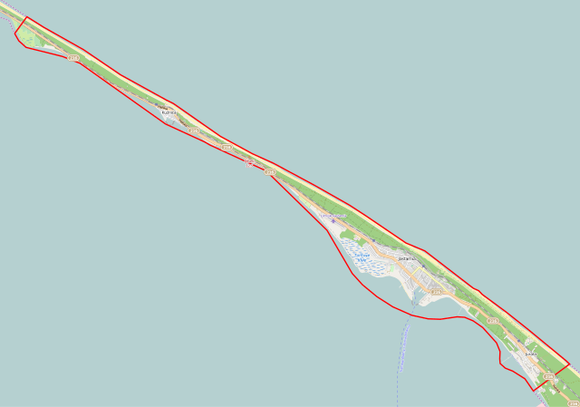
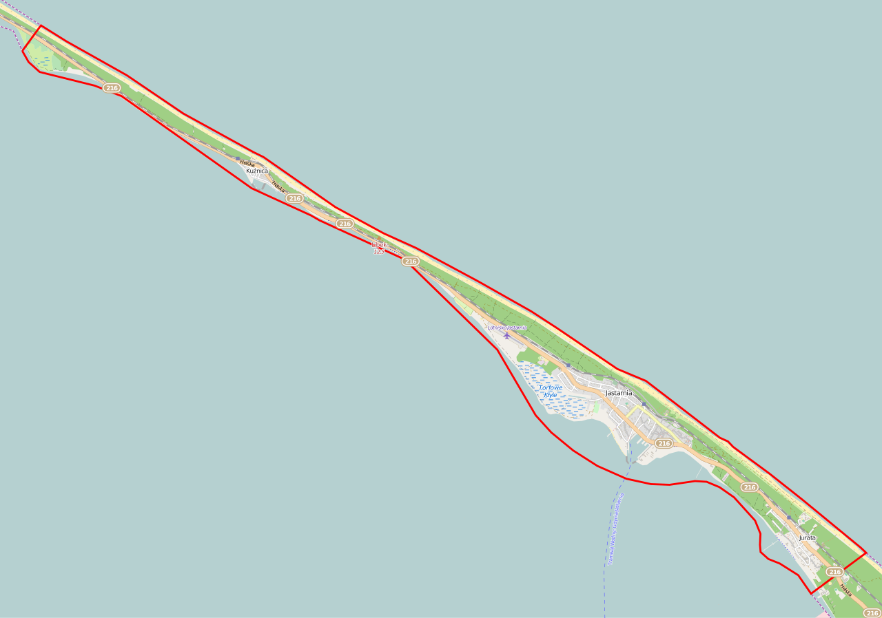
Polski: Mapa Jastarni, Polska
English: Map of Jastarnia, Poland |
|||||||||
| Date | ||||||||||
| Source | You may find a page on the OpenStreetMap wiki page for Jastarnia | |||||||||
| Creator |
OpenStreetMap contributors OpenStreetMap contributors |
|||||||||
| Permission (Reusing this file) |
OpenStreetMap data is available under the Open Database License (details). Map tiles are licensed under the Creative Commons Attribution-ShareAlike 2.0 license (CC-BY-SA 2.0).
This file is licensed under the Creative Commons Attribution-Share Alike 2.0 Generic license.
|
|||||||||
| Geotemporal data | ||||||||||
| Bounding box |
|
|||||||||
| Georeferencing | If inappropriate please set warp_status = skip to hide. | |||||||||
File history
Click on a date/time to view the file as it appeared at that time.
| Date/Time | Thumbnail | Dimensions | User | Comment | |
|---|---|---|---|---|---|
| current | 05:38, 9 January 2015 | | 1,800 × 1,263 (895 KB) | ArkadiuszZ (talk | contribs) | {{OpenStreetMap | name = Jastarnia | location = Jastarnia | description = {{pl|Mapa Jastarni, Polska}} {{en|Map of Jastarnia, Poland}} | top = 54.7595 | left = 18.5188 | right = 18.7367 |... |
You cannot overwrite this file.
File usage on Commons
The following page uses this file:
File usage on other wikis
The following other wikis use this file:
- Usage on be.wikipedia.org
- Usage on pl.wikipedia.org
- Jastarnia
- Lubek
- Jurata (osada)
- Kuźnica (województwo pomorskie)
- Lądowisko Jastarnia
- Latarnia Morska Jastarnia
- Syberia (Kuźnica)
- Jastarnia (stacja kolejowa)
- Jurata (przystanek kolejowy)
- Jastarnia Wczasy
- Kuźnica (Hel)
- Ośrodek Oporu Jastarnia
- Port morski Jastarnia
- Międzymorze (deptak)
- Parafia Nawiedzenia Najświętszej Maryi Panny w Jastarni
- Parafia Matki Boskiej Nieustającej Pomocy w Juracie
- Parafia św. Antoniego Padewskiego w Kuźnicy
- Morskie przejście graniczne Jastarnia
- Kazimierzowo (twierdza)
- Muzeum Rybackie Pod Strzechą w Jastarni
- Chata Rybacka w Jastarni
- Kościół św. Antoniego Padewskiego w Kuźnicy
- Kościół Nawiedzenia Najświętszej Maryi Panny w Jastarni
- Moduł:Mapa/dane/Jastarnia (gmina)
- Kasztanowiec biały w Jastarni
- Cmentarzowa Góra
- Jastarnia (gmina)
- Molo w Jastarni
- Moduł:Mapa/dane/Jastarnia
- Usage on pl.wikibooks.org
- Usage on www.wikidata.org