File:Island of Ireland location map Kerry.svg
Jump to navigation
Jump to search

Size of this PNG preview of this SVG file: 481 × 599 pixels. Other resolutions: 192 × 240 pixels | 385 × 480 pixels | 616 × 768 pixels | 822 × 1,024 pixels | 1,643 × 2,048 pixels | 1,450 × 1,807 pixels.
Original file (SVG file, nominally 1,450 × 1,807 pixels, file size: 642 KB)
Captions
Captions
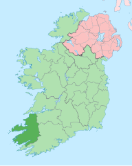
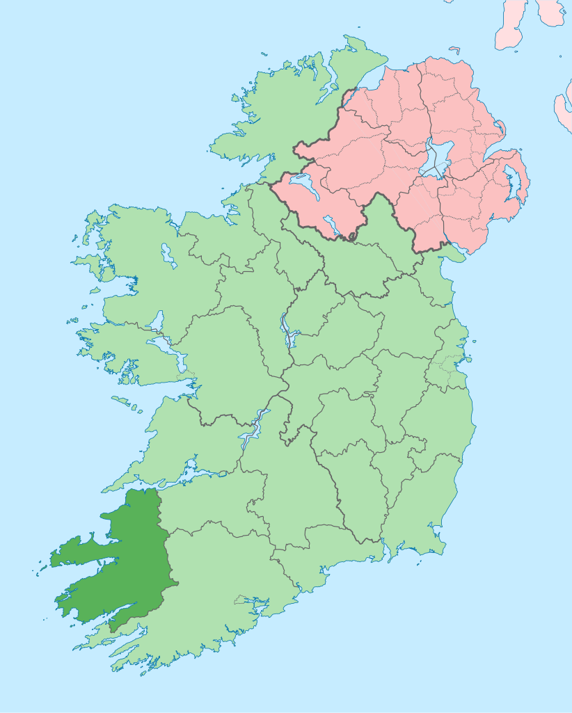
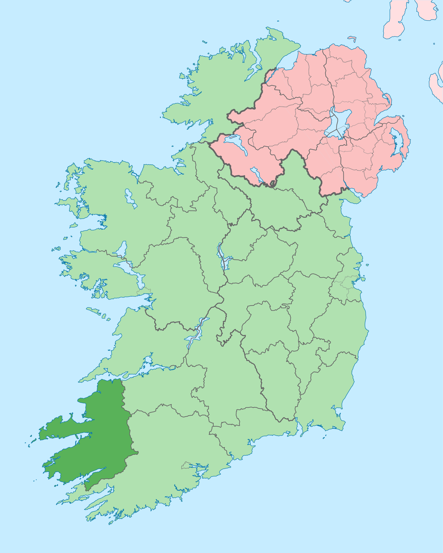
Kerry on a map
| Description |
English: The island of Ireland, showing international border between Ireland and Northern Ireland, traditional provinces, traditional counties, and local authority areas in Ireland and Northern Ireland. |
| Date | (UTC) |
| Source | |
| Author |
|
| This is a retouched picture, which means that it has been digitally altered from its original version. Modifications: Coloured in regions with county of article highlighted. The original can be viewed here: Island of Ireland location map.svg:
|
I, the copyright holder of this work, hereby publish it under the following license:
This file is licensed under the Creative Commons Attribution-Share Alike 3.0 Unported license.
- You are free:
- to share – to copy, distribute and transmit the work
- to remix – to adapt the work
- Under the following conditions:
- attribution – You must give appropriate credit, provide a link to the license, and indicate if changes were made. You may do so in any reasonable manner, but not in any way that suggests the licensor endorses you or your use.
- share alike – If you remix, transform, or build upon the material, you must distribute your contributions under the same or compatible license as the original.
Original upload log
[edit]
This image is a derivative work of the following images:
- File:Island_of_Ireland_location_map.svg licensed with Cc-by-sa-3.0
- 2010-03-06T20:43:33Z Rannpháirtí anaithnid 1450x1807 (679207 Bytes) Fix incorrectly coloured isands.
- 2010-03-03T22:19:29Z Rannpháirtí anaithnid 1450x1807 (679744 Bytes) {{Information |Description={{de|Positionskarte von [[:de:Irland|Irland]]}} Quadratische Plattkarte, N-S-Streckung 170 %. Geographische Begrenzung der Karte: * N: 55.6° N * S: 51.2° N * W: 11.0° W * O: 5.0° W {{en|Location
Uploaded with derivativeFX
File history
Click on a date/time to view the file as it appeared at that time.
| Date/Time | Thumbnail | Dimensions | User | Comment | |
|---|---|---|---|---|---|
| current | 15:58, 26 June 2020 | | 1,450 × 1,807 (642 KB) | Chipmunkdavis (talk | contribs) | Per the Local Government Reform Act 2014, joining both Tipperarys and both Waterfords (and removing Limerick City code). Colouring in islands, cleaning up and grouping code to remove stray objects and show Galway and Lough Ree. |
| 00:48, 19 July 2010 |  | 1,450 × 1,807 (821 KB) | Mabuska (talk | contribs) | {{Information |Description={{en|The island of Ireland, showing international border between Northern Ireland and Republic of Ireland, traditional provinces, traditional counties, and local authority areas in the Republic of Ireland and Northern Ireland.}} |
You cannot overwrite this file.
File usage on Commons
The following 13 pages use this file:
- Commons:Files used on the AARoads Wiki/79
- Category:Archaeological sites in County Kerry
- Category:Beaches of County Kerry
- Category:Births in County Kerry
- Category:Castles in County Kerry
- Category:County Kerry
- Category:Maps of County Kerry
- Category:Murals in County Kerry
- Category:Museums in County Kerry
- Category:People of County Kerry
- Category:Protected areas of County Kerry
- Category:Rivers of County Kerry
- Category:Roads in County Kerry
File usage on other wikis
The following other wikis use this file:
- Usage on ar.wikipedia.org
- Usage on ast.wikipedia.org
- Usage on bg.wikipedia.org
- Usage on br.wikipedia.org
- An Daingean
- Trá Lí
- Mainistir Ó dTorna
- Abhainn an Scáil
- Ard Fhearta
- Baile na nGall
- Baile an Sceilg
- Dairbhre
- An Baile Dubh
- Baile an Fheirtéaraigh
- Baile Uí Thaidhg
- Baile Mhic Eilegóid
- Cathair Uí Mhóráin
- Patrom:Kontelezh Ciarraí
- Brosnach
- Cathair Dhónaill
- Cathair Saidhbhín
- Béal Átha Longfoirt
- An Siopa Dubh
- Caisleán Ghriaire
- Usage on ca.wikipedia.org
- Comtat de Kerry
- Killarney
- Tralee
- Kenmare
- Plantilla:Comtat Kerry
- Listowel
- Baile an Fheirtéaraigh
- Baile an Sceilg
- Ceann Trá
- An Daingean
- Dún Chaoin
- Feothanach
- An Clochán
- Cé Bhréannain
- Lios Póil
- Cathair Dónall
- Baile na nGall
- Abhainn an Scáil
- Ballylongford
- Tarbert
- Ballybunion
- An Fosadh
- Baile an Mhuilinn (Kerry)
- An Com
- Usage on ceb.wikipedia.org
- Usage on cs.wikipedia.org
View more global usage of this file.