File:Interstate 80 (OH) map.png
Jump to navigation
Jump to search
Size of this preview: 800 × 474 pixels. Other resolutions: 320 × 190 pixels | 640 × 380 pixels | 1,024 × 607 pixels | 1,280 × 759 pixels | 3,425 × 2,031 pixels.
Original file (3,425 × 2,031 pixels, file size: 158 KB, MIME type: image/png)
Captions
Captions
Add a one-line explanation of what this file represents
Summary
[edit]
|
File:I-80 (OH) map.svg is a vector version of this file. It should be used in place of this PNG file when not inferior.
File:Interstate 80 (OH) map.png → File:I-80 (OH) map.svg
For more information, see Help:SVG. |
_map.svg) |
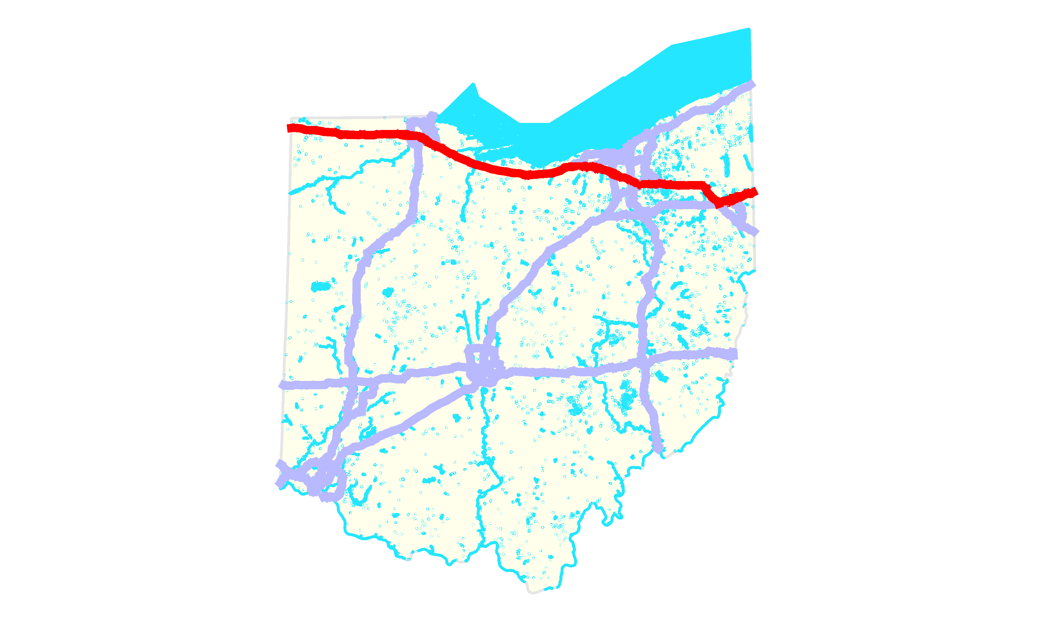
| Description | Map of Interstate 80 in Ohio |
| Date | |
| Source | Own work |
| Author | O |
Licensing
[edit]
You may select the license of your choice. |

_map.png&action=edit§ion=1)
_map.png&action=edit§ion=2)
File history
Click on a date/time to view the file as it appeared at that time.
| Date/Time | Thumbnail | Dimensions | User | Comment | |
|---|---|---|---|---|---|
| current | 01:34, 11 July 2007 | | 3,425 × 2,031 (158 KB) | O (talk | contribs) | {{Information |Description=Map of w:Interstate 80 in Ohio |Source=self-made |Date={{subst:LOCALMONTHNAME}} {{subst:LOCALDAY2}}, {{subst:LOCALYEAR}} |Author=O }} Category:Interstate 80 080 == Licensing == |
You cannot overwrite this file.
File usage on Commons
There are no pages that use this file.
_map.png&oldid=651956775)