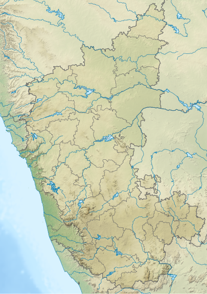
File:India Karnataka relief map.svg
From Wikimedia Commons, the free media repository
Jump to navigation
Jump to search

Size of this PNG preview of this SVG file: 423 × 600 pixels. Other resolutions: 169 × 240 pixels | 338 × 480 pixels | 542 × 768 pixels | 722 × 1,024 pixels | 1,445 × 2,048 pixels | 898 × 1,273 pixels.
Original file (SVG file, nominally 898 × 1,273 pixels, file size: 1.96 MB)
File information
Structured data
Captions
Captions
Karnataka relief map
Summary
[edit]| DescriptionIndia Karnataka relief map.svg |
English: A relief map of Karnataka |
| Date | |
| Source | Karnataka_locator_map.svg |
| Author | Planemad |
Licensing
[edit]This file is licensed under the Creative Commons Attribution-Share Alike 3.0 Unported license.
- You are free:
- to share – to copy, distribute and transmit the work
- to remix – to adapt the work
- Under the following conditions:
- attribution – You must give appropriate credit, provide a link to the license, and indicate if changes were made. You may do so in any reasonable manner, but not in any way that suggests the licensor endorses you or your use.
- share alike – If you remix, transform, or build upon the material, you must distribute your contributions under the same or compatible license as the original.
File history
Click on a date/time to view the file as it appeared at that time.
| Date/Time | Thumbnail | Dimensions | User | Comment | |
|---|---|---|---|---|---|
| current | 03:15, 16 June 2023 |  | 898 × 1,273 (1.96 MB) | C1MM (talk | contribs) | Replaced bad relief |
| 03:12, 16 June 2023 |  | 898 × 1,273 (1.67 MB) | C1MM (talk | contribs) | c Vijayanagara district | |
| 03:36, 17 July 2021 |  | 851 × 1,211 (1.72 MB) | C1MM (talk | contribs) | Corrected relief to bring in line with location map | |
| 18:01, 15 January 2021 |  | 1,634 × 2,367 (1.43 MB) | C1MM (talk | contribs) | Increased elevation contrast | |
| 02:46, 17 December 2020 |  | 1,634 × 2,367 (1.75 MB) | C1MM (talk | contribs) | Changed elevation colours | |
| 22:18, 14 December 2020 |  | 1,634 × 2,367 (1.48 MB) | C1MM (talk | contribs) | Fixed boundary | |
| 19:33, 13 December 2020 |  | 1,634 × 2,367 (1.48 MB) | C1MM (talk | contribs) | Fixed districts of Karnataka | |
| 22:48, 27 June 2020 |  | 1,634 × 2,367 (1.43 MB) | C1MM (talk | contribs) | Uploaded a work by Planemad from Karnataka_locator_map.svg with UploadWizard |
You cannot overwrite this file.
File usage on Commons
The following page uses this file:
- File:Karnataka relief map.svg (file redirect)
File usage on other wikis
The following other wikis use this file:
- Usage on de.wikipedia.org
- Usage on en.wikipedia.org
- Shravanabelagola
- Hampi
- Pattadakal
- Vijayanagara
- Vani Vilasa Sagara
- Tadiandamol
- Kukkarahalli Lake
- Kodachadri
- Brahmagiri (Karnataka)
- Kudremukha
- Aihole
- Kali Tiger Reserve
- Nagarhole National Park
- Shivanasamudra Falls
- Gokak Falls
- Godchinamalaki Falls
- Savandurga
- Basavakalyan
- Hangal
- Lakshmi Narasimha Temple, Bhadravati
- Badami cave temples
- Mekedatu
- Pushpagiri (mountain)
- Bijapur Airport
- Chandragiri hill
- Yelahanka Air Force Station
- Vibhutipura Lake
- Karanji Lake
- Supa Dam
- Bettadapura
- Hebbal Lake, Bangalore
- Lingambudhi Lake
- Pampa Sarovar
- Ulsoor Lake
- Maski
- Kanva Reservoir
- Chandramauleshwara Temple, Unkal
- Kasivisvesvara Temple, Lakkundi
- Hanumana Gundi Falls
- Hesaraghatta Lake
- Sannati
View more global usage of this file.
Metadata
This file contains additional information such as Exif metadata which may have been added by the digital camera, scanner, or software program used to create or digitize it. If the file has been modified from its original state, some details such as the timestamp may not fully reflect those of the original file. The timestamp is only as accurate as the clock in the camera, and it may be completely wrong.
| Width | 253.53891mm |
|---|---|
| Height | 359.36011mm |