File:I70WBexit1A.jpg
Jump to navigation
Jump to search

Size of this preview: 800 × 600 pixels. Other resolutions: 320 × 240 pixels | 640 × 480 pixels | 1,024 × 768 pixels | 1,280 × 960 pixels | 1,600 × 1,200 pixels.
Original file (1,600 × 1,200 pixels, file size: 683 KB, MIME type: image/jpeg)
Captions
Captions
Add a one-line explanation of what this file represents
Summary
[edit]
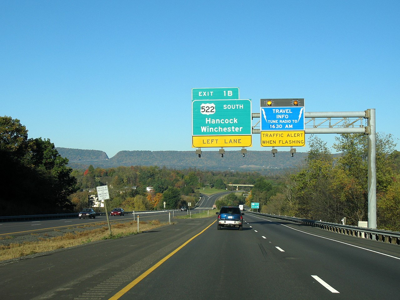
| Description | w:Interstate 70 westbound approaching the w:Pennsylvania state line, with w:Sideling Hill in the distance, where w:Interstate 68 cuts through the mountain at 1,269 feet. |
| Date | |
| Source | Own work |
| Author | MPD01605 |
Licensing
[edit]
I, the copyright holder of this work, hereby publish it under the following licenses:

|
Permission is granted to copy, distribute and/or modify this document under the terms of the GNU Free Documentation License, Version 1.2 or any later version published by the Free Software Foundation; with no Invariant Sections, no Front-Cover Texts, and no Back-Cover Texts. A copy of the license is included in the section entitled GNU Free Documentation License. |
This file is licensed under the Creative Commons Attribution 3.0 Unported license.
- You are free:
- to share – to copy, distribute and transmit the work
- to remix – to adapt the work
- Under the following conditions:
- attribution – You must give appropriate credit, provide a link to the license, and indicate if changes were made. You may do so in any reasonable manner, but not in any way that suggests the licensor endorses you or your use.
You may select the license of your choice.
File history
Click on a date/time to view the file as it appeared at that time.
| Date/Time | Thumbnail | Dimensions | User | Comment | |
|---|---|---|---|---|---|
| current | 05:35, 22 October 2007 | | 1,600 × 1,200 (683 KB) | MPD01605~commonswiki (talk | contribs) | == Summary == {{Information |Description=w:Interstate 40 westbound approaching the w:Pennsylvania state line, with w:Sideling Hill in the distance, where w:Interstate 68 cuts through the mountain at 1,269 feet. |
You cannot overwrite this file.
File usage on Commons
The following page uses this file:
File usage on other wikis
The following other wikis use this file:
- Usage on bn.wikipedia.org
- Usage on en.wikipedia.org
- Interstate 70
- Portal:U.S. roads/Selected article
- Portal:U.S. roads/Selected picture
- Interstate 70 in Maryland
- Portal:U.S. roads/Selected picture/Recommend/2011
- Portal:U.S. roads/Selected picture/September 2011
- File talk:I70WBexit1A.jpg
- Wikipedia:WikiProject U.S. Roads/Newsletter/Issues/Volume04/Issue03
- Wikipedia:WikiProject U.S. Roads/Newsletter/Newsroom/Issue4-3
- Portal:Maryland roads/Selected article
- Portal:Maryland roads/Selected article/November 2013
- Portal:U.S. roads/Selected article/July 2013
- Wikipedia:WikiProject U.S. Roads/Newsletter/Issues/Volume06/Issue04
- Usage on es.wikipedia.org
- Usage on gl.wikipedia.org
- Usage on th.wikipedia.org
- Usage on uk.wikipedia.org
Metadata
Categories:
- Sideling Hill Road Cut
- Road signs along Interstate 70 in Washington County, Maryland
- Road signs along U.S. Route 40 in Washington County, Maryland
- Road signs for U.S. Route 522 along other roads in Maryland
- Road sign gantries in Washington County, Maryland
- Roads in Hancock, Maryland
- Exits numbered 1 in Maryland
- Guardrails in Maryland
- Number 522 on highway signs
- South road signs
- Road signs for Hancock, Maryland
- Road signs for Winchester, Virginia in Maryland