File:I-440 Exit 14 Gantry.jpg
From Wikimedia Commons, the free media repository
Jump to navigation
Jump to search
Size of this preview: 800 × 534 pixels. Other resolutions: 320 × 214 pixels | 640 × 427 pixels | 1,024 × 683 pixels | 1,280 × 854 pixels | 2,560 × 1,709 pixels | 5,520 × 3,684 pixels.
Original file (5,520 × 3,684 pixels, file size: 14.81 MB, MIME type: image/jpeg)
File information
Structured data
Captions
Summary
[edit]DescriptionI-440 Exit 14 Gantry.jpg |
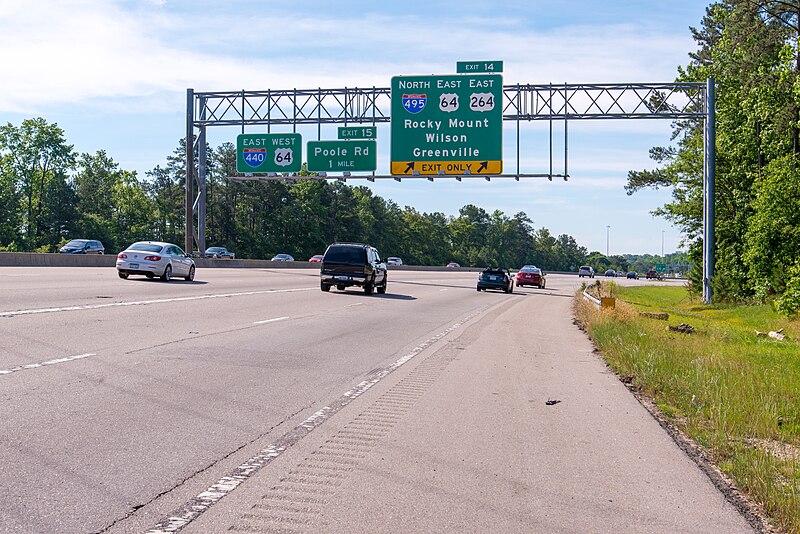
English: Exit 14 onto I-495, US 64 and US 264 from I-440 in Raleigh, North Carolina. |
Date | |
Source | Own work |
Author | Washuotaku |
Camera location | 35° 47′ 16.61″ N, 78° 34′ 28.93″ W | View this and other nearby images on: OpenStreetMap | 35.787947; -78.574703 |
---|
Licensing
[edit]I, the copyright holder of this work, hereby publish it under the following license:
This file is licensed under the Creative Commons Attribution-Share Alike 4.0 International license.
- You are free:
- to share – to copy, distribute and transmit the work
- to remix – to adapt the work
- Under the following conditions:
- attribution – You must give appropriate credit, provide a link to the license, and indicate if changes were made. You may do so in any reasonable manner, but not in any way that suggests the licensor endorses you or your use.
- share alike – If you remix, transform, or build upon the material, you must distribute your contributions under the same or compatible license as the original.
File history
Click on a date/time to view the file as it appeared at that time.
Date/Time | Thumbnail | Dimensions | User | Comment | |
---|---|---|---|---|---|
current | 02:07, 31 May 2016 | 5,520 × 3,684 (14.81 MB) | Washuotaku (talk | contribs) | User created page with UploadWizard |
You cannot overwrite this file.
File usage on Commons
The following page uses this file:
File usage on other wikis
The following other wikis use this file:
- Usage on en.wikipedia.org
Metadata
This file contains additional information such as Exif metadata which may have been added by the digital camera, scanner, or software program used to create or digitize it. If the file has been modified from its original state, some details such as the timestamp may not fully reflect those of the original file. The timestamp is only as accurate as the clock in the camera, and it may be completely wrong.
Camera manufacturer | NIKON CORPORATION |
---|---|
Camera model | NIKON D800 |
Author | Mark Clifton |
Copyright holder |
|
Exposure time | 1/400 sec (0.0025) |
F-number | f/10 |
ISO speed rating | 200 |
Date and time of data generation | 09:43, 28 May 2016 |
Lens focal length | 52 mm |
Latitude | 35° 47′ 16.61″ N |
Longitude | 78° 34′ 28.93″ W |
Altitude | 68.025 meters above sea level |
Horizontal resolution | 300 dpi |
Vertical resolution | 300 dpi |
Software used | Adobe Photoshop Lightroom 6.5.1 (Windows) |
File change date and time | 20:17, 30 May 2016 |
Exposure Program | Normal program |
Exif version | 2.3 |
Date and time of digitizing | 09:43, 28 May 2016 |
APEX shutter speed | 8.643856 |
APEX aperture | 6.643856 |
APEX exposure bias | 0 |
Maximum land aperture | 4.2 APEX (f/4.29) |
Metering mode | Pattern |
Light source | Unknown |
Flash | Flash did not fire, compulsory flash suppression |
DateTimeOriginal subseconds | 00 |
DateTimeDigitized subseconds | 00 |
Color space | sRGB |
Focal plane X resolution | 2,048.4022216797 |
Focal plane Y resolution | 2,048.4022216797 |
Focal plane resolution unit | 3 |
Sensing method | One-chip color area sensor |
File source | Digital still camera |
Scene type | A directly photographed image |
Custom image processing | Normal process |
Exposure mode | Auto exposure |
White balance | Auto white balance |
Digital zoom ratio | 1 |
Focal length in 35 mm film | 52 mm |
Scene capture type | Standard |
Scene control | None |
Contrast | Normal |
Saturation | Normal |
Sharpness | Hard |
Subject distance range | Unknown |
GPS tag version | 0.0.2.2 |
Serial number of camera | 3013898 |
Lens used | 24.0-85.0 mm f/3.5-4.5 |
Date metadata was last modified | 16:17, 30 May 2016 |
Unique ID of original document | 7802BFFF5293FC8DDE325E7BD3188078 |
IIM version | 4 |
Structured data
Items portrayed in this file
depicts
35°47'16.60801"N, 78°34'28.93199"W
28 May 2016
0.0025 second
10
52 millimetre
200
image/jpeg
15,528,003 byte
3,684 pixel
5,520 pixel
ae55ec4f3c6e3d66a6371f36fe5e767bcc30b207
Categories:
- Transport in Wake County, North Carolina
- Interstate 440 (North Carolina)
- U.S. Route 64 in North Carolina
- U.S. Route 264
- Interstate 495 (North Carolina)
- Road sign gantries in North Carolina
- May 2016 in North Carolina
- Pull-Through signs in the United States
- Interchange Exit Direction signs in North Carolina
- Shoulder rumble strips
- Exits numbered 14
- Exits numbered 15