File:House Tm-B-7 site.jpg
Jump to navigation
Jump to search

Size of this preview: 800 × 450 pixels. Other resolutions: 320 × 180 pixels | 640 × 360 pixels | 1,024 × 576 pixels | 1,280 × 720 pixels | 2,816 × 1,584 pixels.
Original file (2,816 × 1,584 pixels, file size: 1.18 MB, MIME type: image/jpeg)
Captions
Captions
Add a one-line explanation of what this file represents
|
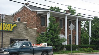
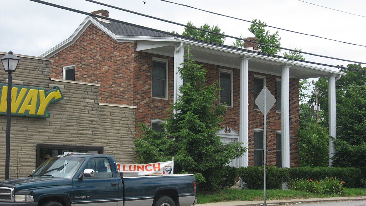
This is an image of a place or building that is listed on the National Register of Historic Places in the United States of America. Its reference number is 84002033. |
| Camera location | | View this and other nearby images on: OpenStreetMap |
|---|
| Description |
English: Buildings on the western side of Main Street (U.S. Routes 42/421) in Bedford, Kentucky, United States. The brick house occupies the site of House Tm-B-7, which was built in 1850 and listed on the National Register of Historic Places in 1984; it has not yet been removed, despite its destruction. |
||
| Date | Taken on 5 July 2013 | ||
| Source | Own work | ||
| Author | Nyttend | ||
| Permission (Reusing this file) |
|
File history
Click on a date/time to view the file as it appeared at that time.
| Date/Time | Thumbnail | Dimensions | User | Comment | |
|---|---|---|---|---|---|
| current | 00:39, 1 August 2013 | | 2,816 × 1,584 (1.18 MB) | Nyttend (talk | contribs) | {{NRHP|84002033}} {{Location|38|35|41.5|N|85|19|1|W}} {{Information |Description={{en|Buildings on the western side of Main Street (U.S. Routes {{w|U.S. Route 42|42}}/{{w|U.S. Route 421|421}}) in {{w|Bedford, Kentucky|Bedford}}, {{w|Kentucky}}, {{w|Uni... |
You cannot overwrite this file.
File usage on Commons
The following page uses this file:
File usage on other wikis
The following other wikis use this file:
- Usage on en.wikipedia.org