File:Helsinki districts6.png
From Wikimedia Commons, the free media repository
Jump to navigation
Jump to search
Helsinki_districts6.png (587 × 496 pixels, file size: 34 KB, MIME type: image/png)
File information
Structured data
Captions
Captions
Add a one-line explanation of what this file represents

|
File:Helsinki districts.svg is a vector version of this file. It should be used in place of this PNG file when not inferior.
File:Helsinki districts6.png → File:Helsinki districts.svg
For more information, see Help:SVG.
|
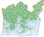
| DescriptionHelsinki districts6.png | Districts of Helsinki. Map is still not final, for example many bridges and southern islands missing (however: enhanced update; also effects of construction of Vuosaari harbour under consideration - coastal line is changing there) | |||
| Date | ||||
| Source | developed gradually from PD map Helsinki-districts2.png | |||
| Author | Paju | |||
| Permission (Reusing this file) |
|
|||
| Other versions | next release coming within 1 week or so :) |
File history
Click on a date/time to view the file as it appeared at that time.
| Date/Time | Thumbnail | Dimensions | User | Comment | |
|---|---|---|---|---|---|
| current | 15:46, 23 July 2006 |  | 587 × 496 (34 KB) | Paju~commonswiki (talk | contribs) | |Description= Districts of Helsinki. Map is still not final, for example many bridges and southern islands missing (however: enhanced update; also effects of construction of Vuosaari harbour under consideration - coastal line is changing there) |Source= d |
You cannot overwrite this file.
File usage on Commons
There are no pages that use this file.

