File:Hüttensee Panorama - 11.08.2001.jpg
Jump to navigation
Jump to search

Size of this preview: 800 × 183 pixels. Other resolutions: 320 × 73 pixels | 640 × 146 pixels | 1,024 × 234 pixels | 1,280 × 293 pixels | 5,503 × 1,259 pixels.
Original file (5,503 × 1,259 pixels, file size: 2.05 MB, MIME type: image/jpeg)
Captions
Captions
Add a one-line explanation of what this file represents
| Description |
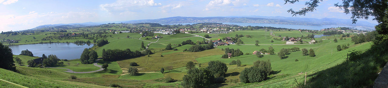
Deutsch: Hütten (ZH) : Blick über das Plateau auf den Zürichsee, links der Hüttenersee, in der Bildmitte Samstagern, im Hintergrund links die Albiskette, rechts der Pfannenstiel und ganz rechts der Seedamm etc. |
| Date | |
| Source | Own work |
| Author | Roland zh, upload on 2. März 2009 |
| Camera location | | View this and other nearby images on: OpenStreetMap |
|---|
Licensing
[edit]
I, the copyright holder of this work, hereby publish it under the following license:
This file is licensed under the Creative Commons Attribution-Share Alike 3.0 Unported license.
- You are free:
- to share – to copy, distribute and transmit the work
- to remix – to adapt the work
- Under the following conditions:
- attribution – You must give appropriate credit, provide a link to the license, and indicate if changes were made. You may do so in any reasonable manner, but not in any way that suggests the licensor endorses you or your use.
- share alike – If you remix, transform, or build upon the material, you must distribute your contributions under the same or compatible license as the original.
| Annotations | This image is annotated: View the annotations at Commons |
File history
Click on a date/time to view the file as it appeared at that time.
| Date/Time | Thumbnail | Dimensions | User | Comment | |
|---|---|---|---|---|---|
| current | 02:58, 2 March 2009 | 5,503 × 1,259 (2.05 MB) | Roland zh (talk | contribs) | {{Information |Description={{de|Hütten (ZH) : Blick über das Plateau auf den Zürichsee, links der Hüttenersee, in der Bildmitte Samstagern, im Hintergrund links die Albiskette, rec |
You cannot overwrite this file.
File usage on Commons
There are no pages that use this file.
File usage on other wikis
The following other wikis use this file:
- Usage on de.wikipedia.org
- Usage on pnb.wikipedia.org