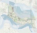
File:Gem-Reimerswaal-OpenTopo.jpg

Original file (8,143 × 7,359 pixels, file size: 4.67 MB, MIME type: image/jpeg)
Captions
Captions
 | This image was uploaded in the JPEG format even though it consists of non-photographic data. This information could be stored more efficiently or accurately in the PNG or SVG format. If possible, please upload a PNG or SVG version of this image without compression artifacts, derived from a non-JPEG source (or with existing artifacts removed). After doing so, please tag the JPEG version with {{Superseded|NewImage.ext}} and remove this tag. This tag should not be applied to photographs or scans. If this image is a diagram or other image suitable for vectorisation, please tag this image with {{Convert to SVG}} instead of {{BadJPEG}}. If not suitable for vectorisation, use {{Convert to PNG}}. For more information, see {{BadJPEG}}. |
Summary
[edit]| Warning | The original file is very high-resolution. It might not load properly or could cause your browser to freeze when opened at full size. | Open in ZoomViewer |
|---|
| DescriptionGem-Reimerswaal-OpenTopo.jpg |
Nederlands: Topografische gemeentekaart. Resolutie: 400 pixels/km.
Kaartbeeld samengesteld uit de open geodata van de Top10NL en Top25namen (Kadaster), Creative Commons-BY licentie. Gebouwvlakken uit open geodata BAG extract. Wegen uit de OpenStreetMap, OpenStreetMap community. Reliëfschaduw uit de Actuele Hoogtekaart AHN2. Samenstelling en kleurenschema: Jan-Willem van Aalst, met QGIS. Zie ook de Legenda. |
| Date | |
| Source | Own work |
| Author | Janwillemvanaalst |
Licensing
[edit]- You are free:
- to share – to copy, distribute and transmit the work
- to remix – to adapt the work
- Under the following conditions:
- attribution – You must give appropriate credit, provide a link to the license, and indicate if changes were made. You may do so in any reasonable manner, but not in any way that suggests the licensor endorses you or your use.
- share alike – If you remix, transform, or build upon the material, you must distribute your contributions under the same or compatible license as the original.
File history
Click on a date/time to view the file as it appeared at that time.
| Date/Time | Thumbnail | Dimensions | User | Comment | |
|---|---|---|---|---|---|
| current | 20:59, 1 March 2024 |  | 8,143 × 7,359 (4.67 MB) | Janwillemvanaalst (talk | contribs) | Map layers update, Feb. 2024 |
| 13:18, 9 July 2023 |  | 8,438 × 7,626 (5.13 MB) | Janwillemvanaalst (talk | contribs) | Map layers update, July 2023 | |
| 13:30, 17 September 2022 |  | 10,045 × 9,078 (9.15 MB) | Janwillemvanaalst (talk | contribs) | map layers update, September 2022 | |
| 22:15, 8 March 2021 |  | 10,045 × 9,078 (9.18 MB) | Janwillemvanaalst (talk | contribs) | Map layers update, Feb. 2021 | |
| 22:09, 6 March 2020 |  | 10,053 × 9,085 (9.06 MB) | Janwillemvanaalst (talk | contribs) | Map layers update, February 2020 | |
| 10:33, 24 July 2019 |  | 10,053 × 9,085 (9.05 MB) | Janwillemvanaalst (talk | contribs) | Map layers update, July 2019 | |
| 15:59, 25 March 2018 |  | 10,053 × 9,085 (8.91 MB) | Janwillemvanaalst (talk | contribs) | Map layers update, February 2018 | |
| 14:27, 19 March 2017 |  | 10,044 × 8,784 (14.31 MB) | Janwillemvanaalst (talk | contribs) | Map layers update, March 2017 | |
| 16:42, 15 May 2016 |  | 10,044 × 8,784 (29.32 MB) | Janwillemvanaalst (talk | contribs) | Map layers update, May 2016 | |
| 20:17, 31 December 2015 |  | 10,044 × 8,784 (20.57 MB) | Janwillemvanaalst (talk | contribs) | Map layers update, Dec. 2015 |
You cannot overwrite this file.
File usage on Commons
There are no pages that use this file.
File usage on other wikis
The following other wikis use this file:
- Usage on ar.wikipedia.org
- Usage on da.wikipedia.org
- Usage on en.wikipedia.org
- Usage on nl.wikipedia.org
- Usage on vls.wikipedia.org
- Usage on zea.wikipedia.org
Metadata
This file contains additional information such as Exif metadata which may have been added by the digital camera, scanner, or software program used to create or digitize it. If the file has been modified from its original state, some details such as the timestamp may not fully reflect those of the original file. The timestamp is only as accurate as the clock in the camera, and it may be completely wrong.
| Width | 15,080 px |
|---|---|
| Height | 13,628 px |
| Bits per component |
|
| Pixel composition | RGB |
| Orientation | Normal |
| Number of components | 3 |
| Horizontal resolution | 96 dpi |
| Vertical resolution | 96 dpi |
| Software used | Adobe Photoshop Elements 15.0 (Windows) |
| File change date and time | 08:43, 24 February 2024 |
| Exif version | 2.21 |
| Color space | sRGB |
| Unique ID of original document | E9FDFD8F9B740496B257263694F4C3B1 |
| Date and time of digitizing | 19:20, 18 February 2024 |
| Date metadata was last modified | 09:43, 24 February 2024 |
