File:Geitelder Berg von Westen.jpg
Jump to navigation
Jump to search

Size of this preview: 800 × 450 pixels. Other resolutions: 320 × 180 pixels | 640 × 360 pixels | 1,024 × 576 pixels | 1,280 × 720 pixels | 2,560 × 1,440 pixels | 3,840 × 2,160 pixels.
Original file (3,840 × 2,160 pixels, file size: 1.96 MB, MIME type: image/jpeg)
Captions
Captions
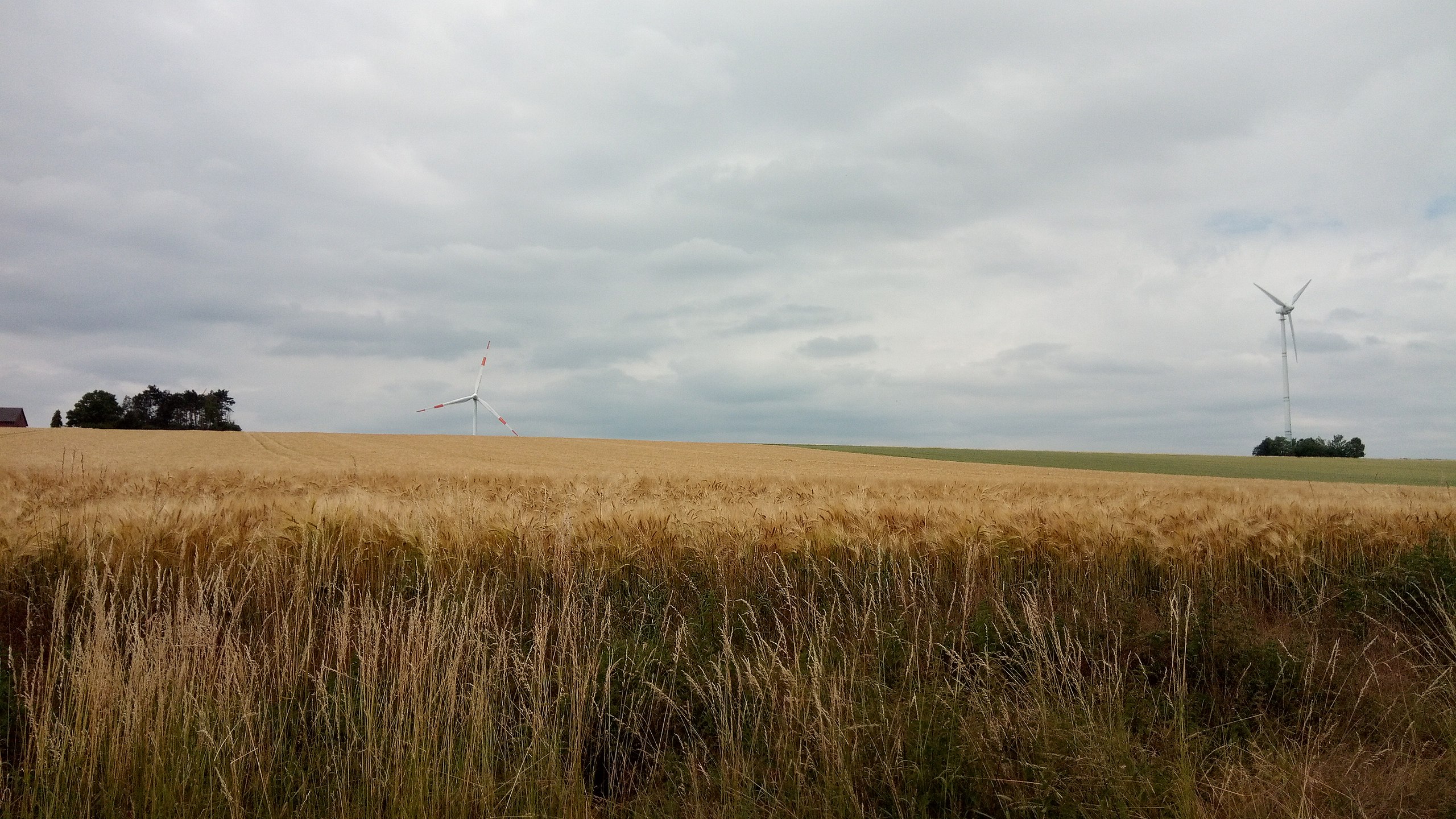
View of the Geitelder Berg, highest natural elevation in Braunschweig, Germany, from the west
Summary
[edit]
| Description |
Deutsch: Sicht auf den Geitelder Berg, höchste natürliche Erhebung in Braunschweig, von Westen.
Links im Bild die letzten Häuser in Geitelde an der Straße "Am Sender", rechts die Windkraftanlage in der Baumgruppe auf der Bergkuppe. Hinter dem Berg ragt ein weiteres Windkraftwerk hervor.
English: View of the Geitelder Berg, highest natural elevation in Braunschweig, Germany, from the west
On the left side of the picture the last few houses of Geitelde on the street "Am Sender" can be seen. On the right is the wind power station in the small forest on the hilltop. Behind the mountain, another wind mill rises over the hill. |
| Date | |
| Source | Own work |
| Author | Roland Hieber |
| Camera location | | View this and other nearby images on: OpenStreetMap |
|---|
Licensing
[edit]
I, the copyright holder of this work, hereby publish it under the following license:
| This file is made available under the Creative Commons CC0 1.0 Universal Public Domain Dedication. | |
| The person who associated a work with this deed has dedicated the work to the public domain by waiving all of their rights to the work worldwide under copyright law, including all related and neighboring rights, to the extent allowed by law. You can copy, modify, distribute and perform the work, even for commercial purposes, all without asking permission.
|
File history
Click on a date/time to view the file as it appeared at that time.
| Date/Time | Thumbnail | Dimensions | User | Comment | |
|---|---|---|---|---|---|
| current | 13:04, 30 June 2020 | | 3,840 × 2,160 (1.96 MB) | Rohieb (talk | contribs) | Uploaded own work with UploadWizard |
You cannot overwrite this file.
File usage on Commons
There are no pages that use this file.