File:GS Kungsbacka.svg

From Wikimedia Commons, the free media repository
Jump to navigation Jump to search

Original file (SVG file, nominally 5,952 × 4,436 pixels, file size: 658 KB)

Captions

Captions

Add a one-line explanation of what this file represents
Description
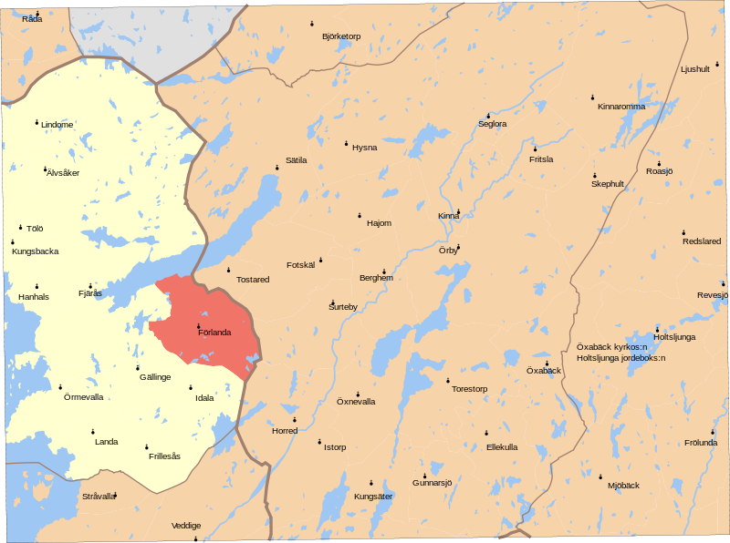
English: Map showing borders of parishes and hundreds in the vicinity of Kungsbacka, based on information from map by Topografiska Corpsen.

Kongsbacka

Geogr. längden är räknad från Stockholms Observatorium, beläget 35(grader)43'195 ost fr. Ferrô.

Grav. af Wennersten och Backhoff

Topografiska Corpsens karta öfver Sverige 1871

Uppmätt 1839-1842, öfversedd 1865.
Date (1871)
Source Lantmäteriet
Author Own work, and Topografiska Corpsen
Permission
(Reusing this file)
w:en:Creative Commons
attribution
This file is licensed under the Creative Commons Attribution 3.0 Unported license.
Attribution: Edaen
You are free:
  • to share – to copy, distribute and transmit the work
  • to remix – to adapt the work
Under the following conditions:
  • attribution – You must give appropriate credit, provide a link to the license, and indicate if changes were made. You may do so in any reasonable manner, but not in any way that suggests the licensor endorses you or your use.
Other versions

Derivative works of this file:

File history

Click on a date/time to view the file as it appeared at that time.

Date/TimeThumbnailDimensionsUserComment
current11:27, 8 September 2010Thumbnail for version as of 11:27, 8 September 20105,952 × 4,436 (658 KB)Edaen (talk | contribs)Colours
18:53, 4 September 2010Thumbnail for version as of 18:53, 4 September 20105,950 × 4,438 (703 KB)Edaen (talk | contribs){{Information |Description={{en|1=Map showing borders of parishes and hundreds in the vicinity of Kungsbacka, based on information from map by Topografiska Corpsen. <small>'''Kongsbacka''' Geogr. längden är räknad från Stockholms Observatorium, belä

There are no pages that use this file.