File:Forum-Romanum-Platner.jpg
Jump to navigation
Jump to search
Size of this preview: 800 × 593 pixels. Other resolutions: 320 × 237 pixels | 640 × 474 pixels | 1,024 × 758 pixels | 1,280 × 948 pixels | 1,400 × 1,037 pixels.
Original file (1,400 × 1,037 pixels, file size: 657 KB, MIME type: image/jpeg)
Captions
Captions
Add a one-line explanation of what this file represents
Summary
[edit]
| Description |
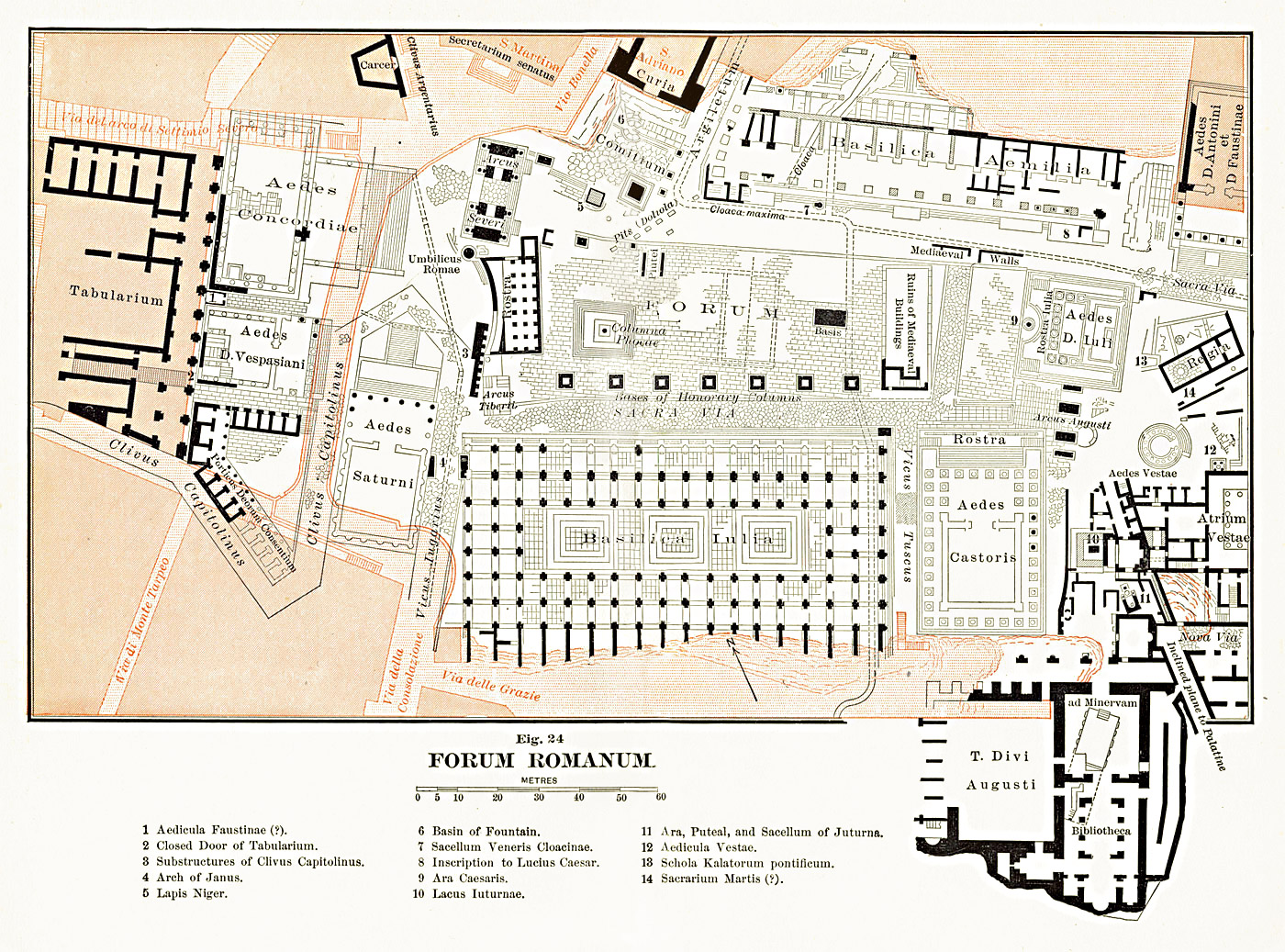
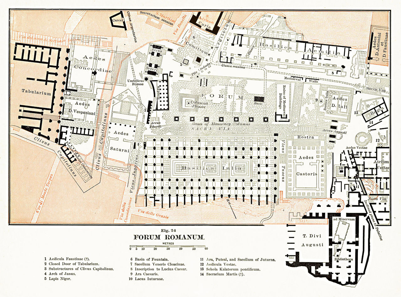
English: Map of the Roman Forum area. The scan from the original book was edited and corrected.
Français : Carte de la zone du Forum Romain à Rome (Latium, Italie).
Italiano: Pianta archeologica del Foro Romano, modificata da una scansione su due pagine del libro "The Topography and Monuments of Ancient Rome" di Ball Platner edito nel 1904. |
| Date | |
| Source | Samuel Ball Platner's The Topography and Monuments of Ancient Rome (1904) |
| Author | saikindi |
Licensing
[edit]
|
This work is in the public domain in its country of origin and other countries and areas where the copyright term is the author's life plus 70 years or fewer. | |
| This file has been identified as being free of known restrictions under copyright law, including all related and neighboring rights. | |
File history
Click on a date/time to view the file as it appeared at that time.
| Date/Time | Thumbnail | Dimensions | User | Comment | |
|---|---|---|---|---|---|
| current | 15:45, 17 September 2009 | | 1,400 × 1,037 (657 KB) | Saikindi (talk | contribs) | {{Information |Description={{en|1=Map of the Roman Forum area. The scan from the original book was edited and corrected.}} {{it|1=Pianta archeologica del Foro Romano, modificata da una scansione su due pagine del libro "The Topography and Monuments of Anc |
You cannot overwrite this file.
File usage on Commons
There are no pages that use this file.
File usage on other wikis
The following other wikis use this file:
- Usage on bg.wikipedia.org
- Usage on cs.wikipedia.org
- Usage on el.wikipedia.org
- Usage on fr.wikipedia.org
- Usage on it.wikipedia.org
- Usage on ja.wikipedia.org
- Usage on pt.wikipedia.org
- Usage on ru.wikipedia.org