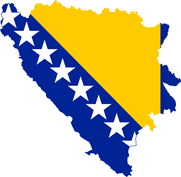
File:Flag map of Bosnia and Herzegovina.svg

Original file (SVG file, nominally 942 × 919 pixels, file size: 80 KB)
Captions
Captions
| DescriptionFlag map of Bosnia and Herzegovina.svg | Map of Bosnia and Herzegovina with flag. | |||
| Date | ||||
| Source | SVG version of Image:Ba-pahýl1.jpg, colors and dimensions are from Image:Flag of Bosnia and Herzegovina.svg | |||
| Author | PavelD | |||
| Permission (Reusing this file) |
|
|||
| Other versions |
Derivative works of this file: LGBT flag map of Bosnia and Herzegovina.svg    |
}}
File history
Click on a date/time to view the file as it appeared at that time.
| Date/Time | Thumbnail | Dimensions | User | Comment | |
|---|---|---|---|---|---|
| current | 19:04, 28 October 2011 |  | 942 × 919 (80 KB) | Fry1989 (talk | contribs) | Reverted to version as of 20:29, 11 April 2011 |
| 16:29, 28 October 2011 |  | 942 × 919 (80 KB) | Дмитрий-5-Аверин (talk | contribs) | Небольшое смещение | |
| 20:29, 11 April 2011 |  | 942 × 919 (80 KB) | Fry1989 (talk | contribs) | oh come on! | |
| 02:06, 11 April 2011 |  | 942 × 919 (80 KB) | Fry1989 (talk | contribs) | grr, that thumbnail | |
| 02:05, 11 April 2011 |  | 942 × 919 (80 KB) | Fry1989 (talk | contribs) | again | |
| 01:47, 11 April 2011 |  | 942 × 919 (80 KB) | Fry1989 (talk | contribs) | haul | |
| 18:55, 11 February 2009 |  | 800 × 787 (37 KB) | Inductiveload (talk | contribs) | made all stars visible | |
| 18:55, 11 February 2009 |  | 800 × 787 (37 KB) | Inductiveload (talk | contribs) | made all stars visible | |
| 13:41, 11 February 2009 |  | 800 × 787 (36 KB) | Inductiveload (talk | contribs) | made flag even more visible as per a Graphic Lab request. | |
| 21:36, 9 August 2007 |  | 800 × 787 (23 KB) | Nameneko~commonswiki (talk | contribs) | Made flag more visible, thinned outline |
You cannot overwrite this file.
File usage on Commons
The following 10 pages use this file:
- Atlas of Bosnia and Herzegovina
- Flag map of the world
- User:Stasyan117
- Commons:WikiProject Flag-map
- File:Ba-pahýl1.jpg
- File:BosniaHerzegovina-map-with-.png
- File:Bosnia EU.svg
- File:Bosnia and Herzegovina stub.svg (file redirect)
- File:Flag map of Bosnia and Herzegovina (1946–1992).svg
- File:Flag map of the SR Bosnia and Herzegovina (1943-1992).png
File usage on other wikis
The following other wikis use this file:
- Usage on ar.wikipedia.org
- اتحاد البوسنة والهرسك
- إنترميكو
- يدنا سي يدانا
- مجلس رئاسة البوسنة والهرسك
- قالب:بذرة البوسنة والهرسك
- شعار البوسنة والهرسك
- ميلياتسكا
- قالب:بذرة جغرافيا البوسنة والهرسك
- جبل دينارا
- جغرافيا البوسنة والهرسك
- مركز تعليم الدراما
- نهر نيريتفا
- ميديوغوريه
- سياسة التأشيرات في البوسنة والهرسك
- أيزو 3166-2:BA
- الدين في البوسنة والهرسك
- كانتون يونا-سانا
- كانتون بوسافينا
- كانتون زينيكا-دوبوي
- كانتون بودريني البوسني
- كانتون البوسنة الوسطى
- البوسنة والهرسك العثمانية
- جواز سفر بوسني
- أهرامات البوسنة المزعومة
- فربانيا (البوسنة)
- منطقة برتشكو
- كانتون سراييفو
- كانتون الهرسك-نيريتفا
- كانتون غرب الهرسك
- كانتون 10
- برنجافور
- تسليتش
- البوسنة (منطقة)
- منطقة الحكم الذاتي لشمال شرق البوسنة
- جمهورية صرب البوسنة (1992–1995)
- منطقة الحكم الذاتي رومانيا
- منطقة الحكم الذاتي الهرسك
- منطقة الحكم الذاتي بوسانسكا كرايينا
- ولاية البوسنة
- بحيرة برداشا
- بطل شعبي (يوغسلافيا)
- تريبينيي
- باريمو
- رافني
- ساسينا (قرية)
- شيبوفي (قرية)
- سوكولين (قرية)
- مودريكشا
- بالي (البوسنة والهرسك)
- غوتي (بالي)
View more global usage of this file.
Metadata
This file contains additional information such as Exif metadata which may have been added by the digital camera, scanner, or software program used to create or digitize it. If the file has been modified from its original state, some details such as the timestamp may not fully reflect those of the original file. The timestamp is only as accurate as the clock in the camera, and it may be completely wrong.
| Width | 941.65875 |
|---|---|
| Height | 919.25623 |