File:Fires in California (MODIS 2016-08-16).jpg

Original file (2,800 × 3,600 pixels, file size: 1.82 MB, MIME type: image/jpeg)
Captions
Captions
Summary
[edit].jpg&action=edit§ion=1)
| Description |
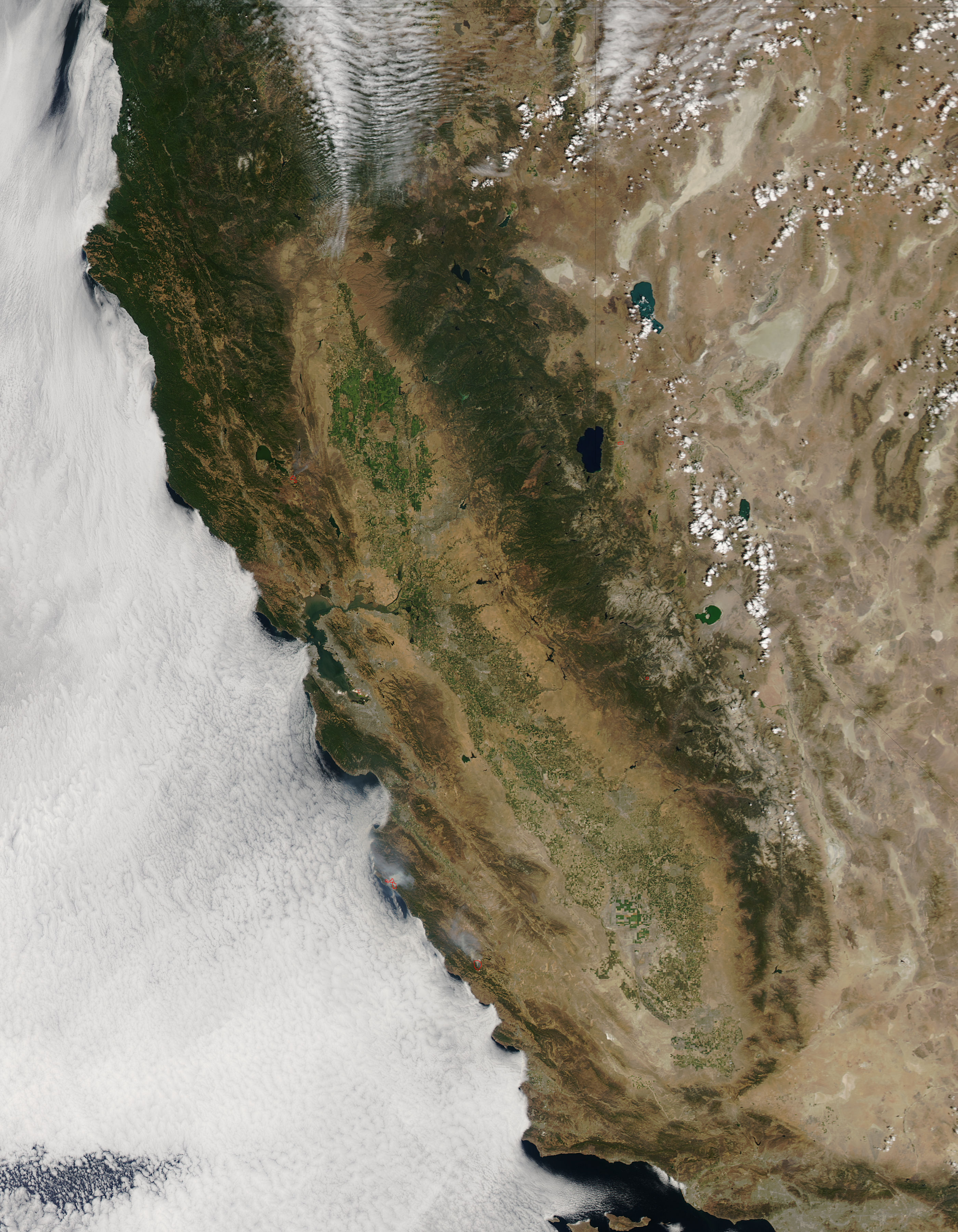
English: Fires continued to ravage the dry California landscape through July and mid-August 2016. The Moderate Resolution Imaging Spectroradiometer (MODIS) aboard NASA’s Aqua satellite captured this true-color image on August 14.
Although moisture-laden clouds hang over the Pacific Ocean, the only hints of moisture over California are the low clouds (fog) creeping over the coastline and a thin bank of clouds over the mountains in the north of the image. Three large hotspots, marked in red, can be seen in California and one in Nevada. Each red hotspot is an area where the thermal sensors on the MODIS instrument detected heat signatures that, in this case, mark actively burning fire. Fire billows from two fires in southern California and then blows to the northwest. The southernmost fire appears to be the Mineral Fire, which ignited on August 9 and had consumed 7,050 acres in Fresno by August 15. Cal Fire reports that the fire is 95% contained and has destroyed one residence and one outbuilding. Northwest of the Mineral Fire, the Soberanes Fire continues to burn in chaparral, tall grass and timber in steep and inaccessible terrain in the Big Sur area. Ignited on July 22 by an illegal campfire, the fire has scorched 72,556 acres as of August 14, according to the Inciweb Incident Information System. The fire has been 60% contained and has destroyed at least 57 residences and 11 outbuildings. High temperatures combined with low humidity is expected to continue high-fire risk conditions, which will hinder control efforts. The red hotspot that sits the farthest north marks the Clayton Fire. This fire was first reported on the evening of August 13 near the community of Lower Lake, about 100 miles north of San Francisco, and the cause is under investigation. Gusting winds and tinder-dry vegetation combined with high temperatures and low humidity set the scene for rapid growth. On August 14 the fire more than doubled in size, and by August 15 Cal Fire reported that over 4,000 acres had been burnt and the blaze was only 5% contained. Over 175 buildings have been destroyed with about an additional 1500 structures threatened. |
||
| Date | Taken on 14 August 2016 | ||
| Source |
Fires in California (direct link)
|
||
| Author | Jeff Schmaltz, MODIS Land Rapid Response Team, NASA GSFC |
| This media is a product of the Aqua mission Credit and attribution belongs to the mission team, if not already specified in the "author" row |
Licensing
[edit].jpg&action=edit§ion=2)
| This file is in the public domain in the United States because it was solely created by NASA. NASA copyright policy states that "NASA material is not protected by copyright unless noted". (See Template:PD-USGov, NASA copyright policy page or JPL Image Use Policy.) | ||
 |
Warnings:
|
File history
Click on a date/time to view the file as it appeared at that time.
| Date/Time | Thumbnail | Dimensions | User | Comment | |
|---|---|---|---|---|---|
| current | 19:23, 15 February 2024 | | 2,800 × 3,600 (1.82 MB) | OptimusPrimeBot (talk | contribs) | #Spacemedia - Upload of http://modis.gsfc.nasa.gov/gallery/images/image08162016_250m.jpg via Commons:Spacemedia |
You cannot overwrite this file.
File usage on Commons
There are no pages that use this file.
.jpg&oldid=909382976)