File:Facsimile of the Ciéla Map.jpg
Jump to navigation
Jump to search
Size of this preview: 800 × 413 pixels. Other resolutions: 320 × 165 pixels | 640 × 331 pixels | 1,024 × 529 pixels | 1,280 × 661 pixels | 2,560 × 1,322 pixels | 4,527 × 2,338 pixels.
Original file (4,527 × 2,338 pixels, file size: 1.58 MB, MIME type: image/jpeg)
Captions
Captions
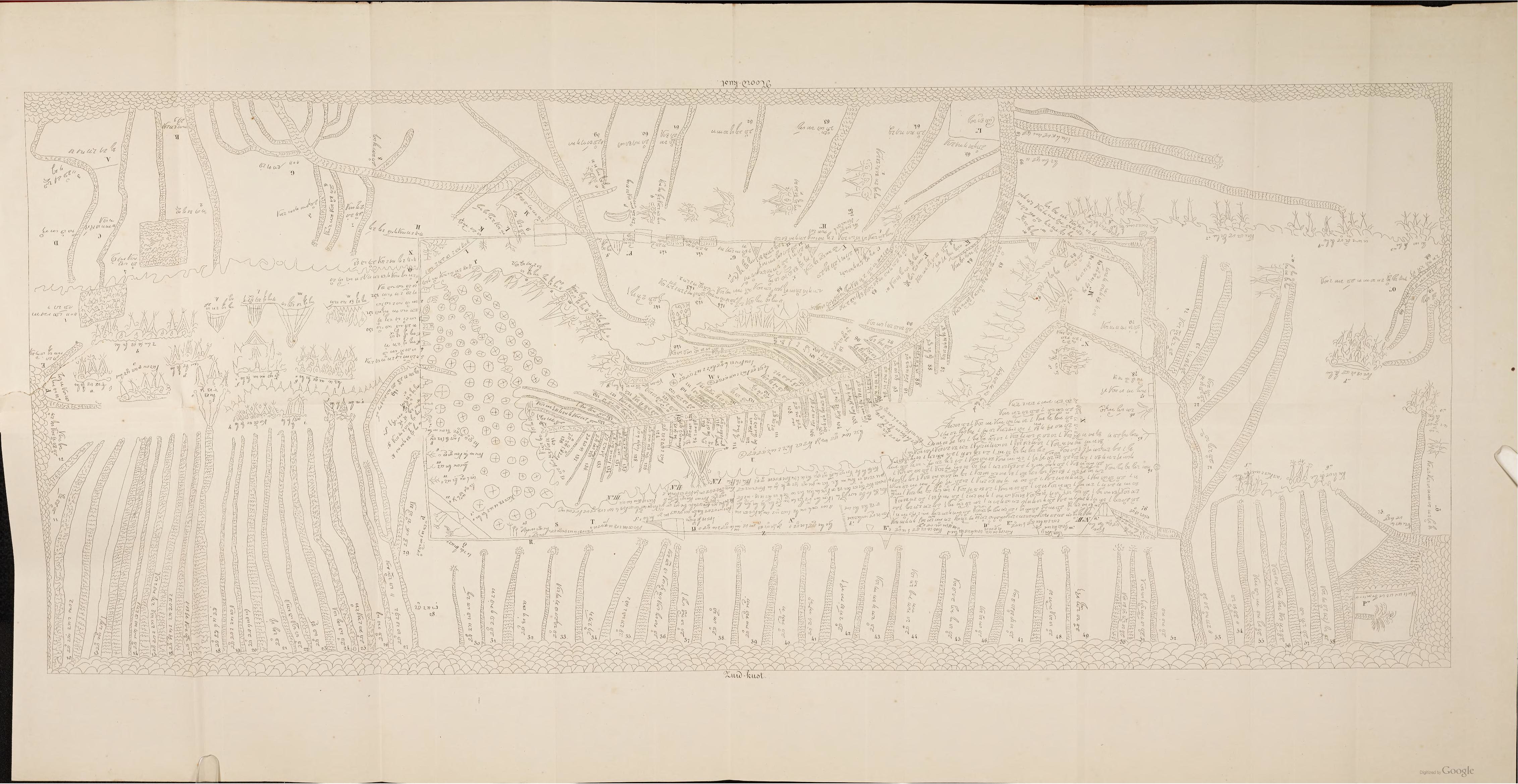
Facsimile of a map known as Ciela Map in a report paper by K. F. Holle
Summary
[edit]
| Description |
Sunda: Faksimili Peta Ciéla dina makalah laporan K. F. Holle.
English: Facsimile of a map known as Ciela Map in a report paper by K. F. Holle in Tijdschrift voor Indische Taal- Land- en Volkenkunde, vol. XXIV
Bahasa Indonesia: Faksimili Peta Ciéla dalam makalah laporan K. F. Holle. |
| Date | |
| Source | Tijdschrift voor Indische Taal- Land- en Volkenkunde, deel XXIV (https://books.google.co.id/books?id=8buzGJNqQq8C&dq) |
| Author | Facsimile by K. F. Holle |
Licensing
[edit]
|
This work is in the public domain in its country of origin and other countries and areas where the copyright term is the author's life plus 70 years or fewer. | |
| This file has been identified as being free of known restrictions under copyright law, including all related and neighboring rights. | |
File history
Click on a date/time to view the file as it appeared at that time.
| Date/Time | Thumbnail | Dimensions | User | Comment | |
|---|---|---|---|---|---|
| current | 06:10, 4 October 2021 | | 4,527 × 2,338 (1.58 MB) | Kumincir (talk | contribs) | Uploaded a work by Facsimile by K. F. Holle from Tijdschrift voor Indische Taal- Land- en Volkenkunde, deel XXIV (https://books.google.co.id/books?id=8buzGJNqQq8C&dq) with UploadWizard |
You cannot overwrite this file.
File usage on Commons
The following 2 pages use this file:
File usage on other wikis
The following other wikis use this file:
- Usage on id.wikipedia.org
- Usage on jv.wikisource.org
- Usage on su.wikipedia.org