File:EB9 Corea.png
Jump to navigation
Jump to search

Size of this preview: 432 × 599 pixels. Other resolutions: 173 × 240 pixels | 346 × 480 pixels | 554 × 768 pixels | 738 × 1,024 pixels | 2,548 × 3,534 pixels.
Original file (2,548 × 3,534 pixels, file size: 4.75 MB, MIME type: image/png)
Captions
Captions
Add a one-line explanation of what this file represents
Summary
[edit]
| Description |
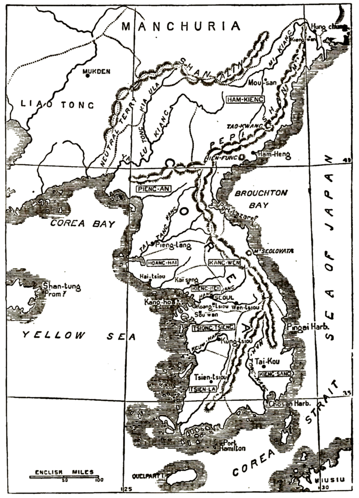
English: "Sketch Map of Corea": a map of Korea from the 9th edition of the Encyclopaedia Britannica.
The map misplaces Hamhung on Iwon Bay and includes two mountains given by their Chinese names—equivalent to Xianfeng and Daoguang—which do not exist in any way, shape, or form and are apparently the result of mistaken measurements undertaken by the Russian frigate Pallada and the French frigate Virginie in the 1850s. |
| Date | |
| Source | "Corea" in the Encyclopaedia Britannica, 9th ed., Vol. VI, p. 390. |
| Author | Anonymous but presumably the firm of William & Alexander Keith Johnston or of John Bartholomew & Son. |
Licensing
[edit]
This work is in the public domain in the United States because it was published (or registered with the U.S. Copyright Office) before January 1, 1929.
Public domain works must be out of copyright in both the United States and in the source country of the work in order to be hosted on the Commons. If the work is not a U.S. work, the file must have an additional copyright tag indicating the copyright status in the source country.
Note: This tag should not be used for sound recordings. |
| Annotations | This image is annotated: View the annotations at Commons |
File history
Click on a date/time to view the file as it appeared at that time.
| Date/Time | Thumbnail | Dimensions | User | Comment | |
|---|---|---|---|---|---|
| current | 15:57, 6 May 2017 | | 2,548 × 3,534 (4.75 MB) | LlywelynII (talk | contribs) | User created page with UploadWizard |
You cannot overwrite this file.
File usage on Commons
There are no pages that use this file.
File usage on other wikis
The following other wikis use this file:
- Usage on en.wikipedia.org
- Usage on en.wikisource.org
- Usage on it.wikipedia.org
- Usage on zh.wikipedia.org