File:Drommberg Luftbild.jpg
Original file (5,280 × 2,970 pixels, file size: 13.52 MB, MIME type: image/jpeg)
Captions
Summary
[edit]DescriptionDrommberg Luftbild.jpg |
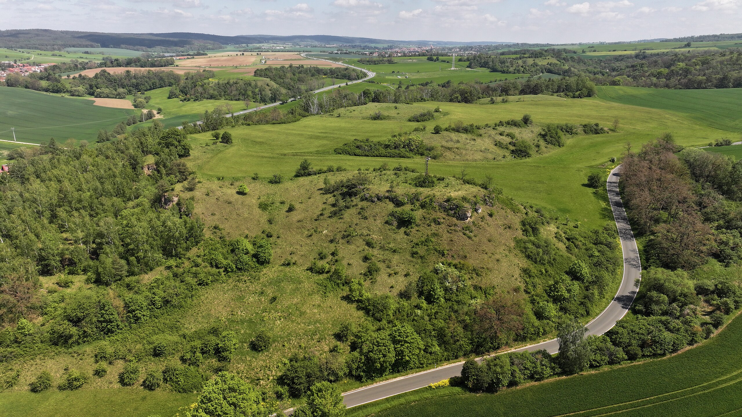
Deutsch: Luftaufnahme des Drommbergs im gleichnamigen Landschaftsschutzgebiet aus etwa 100m Höhe. Blick in Richtung Neustadt an der Orla - links die B281 bei Lausnitz, rechts die Straße von Kolba nach Krobitz. |
Date | |
Source | Own work |
Author | Db8fs |
Camera location | 50° 42′ 56.65″ N, 11° 40′ 45.48″ E | View this and other nearby images on: OpenStreetMap | 50.715737; 11.679299 |
---|
Licensing
[edit]- You are free:
- to share – to copy, distribute and transmit the work
- to remix – to adapt the work
- Under the following conditions:
- attribution – You must give appropriate credit, provide a link to the license, and indicate if changes were made. You may do so in any reasonable manner, but not in any way that suggests the licensor endorses you or your use.
- share alike – If you remix, transform, or build upon the material, you must distribute your contributions under the same or compatible license as the original.
This image was uploaded as part of Wiki Loves Earth 2024.
aragonés ∙ asturianu ∙ azərbaycanca ∙ Bahasa Indonesia ∙ Bahasa Melayu ∙ brezhoneg ∙ català ∙ čeština ∙ Cymraeg ∙ dagbanli ∙ Deutsch ∙ eesti ∙ English ∙ español ∙ euskara ∙ français ∙ galego ∙ hrvatski ∙ italiano ∙ latviešu ∙ Nederlands ∙ norsk ∙ norsk bokmål ∙ português ∙ polski ∙ português do Brasil ∙ qaraqalpaqsha ∙ română ∙ shqip ∙ sicilianu ∙ slovenščina ∙ svenska ∙ Tagalog ∙ Türkçe ∙ Ελληνικά ∙ беларуская (тарашкевіца) ∙ български ∙ кыргызча ∙ македонски ∙ русский ∙ српски / srpski ∙ українська ∙ ქართული ∙ հայերեն ∙ नेपाली ∙ मराठी ∙ বাংলা ∙ മലയാളം ∙ ไทย ∙ 한국어 ∙ 日本語 ∙ 中文 ∙ 中文(台灣) ∙ 中文(简体) ∙ 中文(繁體) ∙ עברית ∙ اردو ∙ العربية ∙ فارسی ∙ +/− |
File history
Click on a date/time to view the file as it appeared at that time.
Date/Time | Thumbnail | Dimensions | User | Comment | |
---|---|---|---|---|---|
current | 16:00, 12 May 2024 | 5,280 × 2,970 (13.52 MB) | Db8fs (talk | contribs) | Uploaded own work with UploadWizard |
You cannot overwrite this file.
File usage on Commons
There are no pages that use this file.
File usage on other wikis
The following other wikis use this file:
- Usage on de.wikipedia.org
Metadata
This file contains additional information such as Exif metadata which may have been added by the digital camera, scanner, or software program used to create or digitize it. If the file has been modified from its original state, some details such as the timestamp may not fully reflect those of the original file. The timestamp is only as accurate as the clock in the camera, and it may be completely wrong.
Image title | default |
---|---|
Camera manufacturer | Hasselblad |
Camera model | L2D-20c |
Exposure time | 1/200 sec (0.005) |
F-number | f/2.8 |
ISO speed rating | 100 |
Date and time of data generation | 12:49, 12 May 2024 |
Lens focal length | 12.29 mm |
Latitude | 50° 42′ 56.65″ N |
Longitude | 11° 40′ 45.48″ E |
Altitude | 296.43 meters above sea level |
Orientation | Normal |
Horizontal resolution | 72 dpi |
Vertical resolution | 72 dpi |
Software used | 00.04.88.53 |
File change date and time | 12:49, 12 May 2024 |
Y and C positioning | Co-sited |
Exposure Program | Normal program |
Exif version | 2.3 |
Date and time of digitizing | 12:49, 12 May 2024 |
Meaning of each component |
|
APEX shutter speed | 7.64386 |
APEX aperture | 2.97 |
APEX exposure bias | 0 |
Maximum land aperture | 2.97 APEX (f/2.8) |
Subject distance | 0 meters |
Metering mode | Average |
Light source | Cloudy weather |
Flash | Flash did not fire |
Supported Flashpix version | 1 |
Color space | sRGB |
File source | Digital still camera |
Scene type | A directly photographed image |
Custom image processing | Normal process |
Exposure mode | Auto exposure |
White balance | Auto white balance |
Digital zoom ratio | 1 |
Focal length in 35 mm film | 24 mm |
Scene capture type | Standard |
Scene control | None |
Contrast | Normal |
Saturation | Normal |
Sharpness | Normal |
Receiver status | Measurement in progress |
Geodetic survey data used | WGS-84 |
GPS tag version | 0.0.3.2 |
Structured data
Items portrayed in this file
depicts
12 May 2024
50°42'56.653"N, 11°40'45.476"E
0.005 second
2.8
12.29 millimetre
100
image/jpeg
- Images from Wiki Loves Earth 2024, DE landscape
- Files with coordinates missing SDC location of creation (50° N, 11° E)
- CC-BY-SA-4.0
- Self-published work
- Images from Wiki Loves Earth 2024
- Images from Wiki Loves Earth 2024 in Germany
- Images from Wiki Loves Earth missing SDC location of creation
- Uploaded via Campaign:wle-de