File:Dreiländerpunkt A-IT-CH.jpg
Jump to navigation
Jump to search
Size of this preview: 800 × 600 pixels. Other resolutions: 320 × 240 pixels | 640 × 480 pixels | 1,024 × 768 pixels | 1,280 × 960 pixels | 2,560 × 1,920 pixels | 4,032 × 3,024 pixels.
Original file (4,032 × 3,024 pixels, file size: 3.83 MB, MIME type: image/jpeg)
Captions
Captions
Add a one-line explanation of what this file represents
Summary
[edit]| Description |
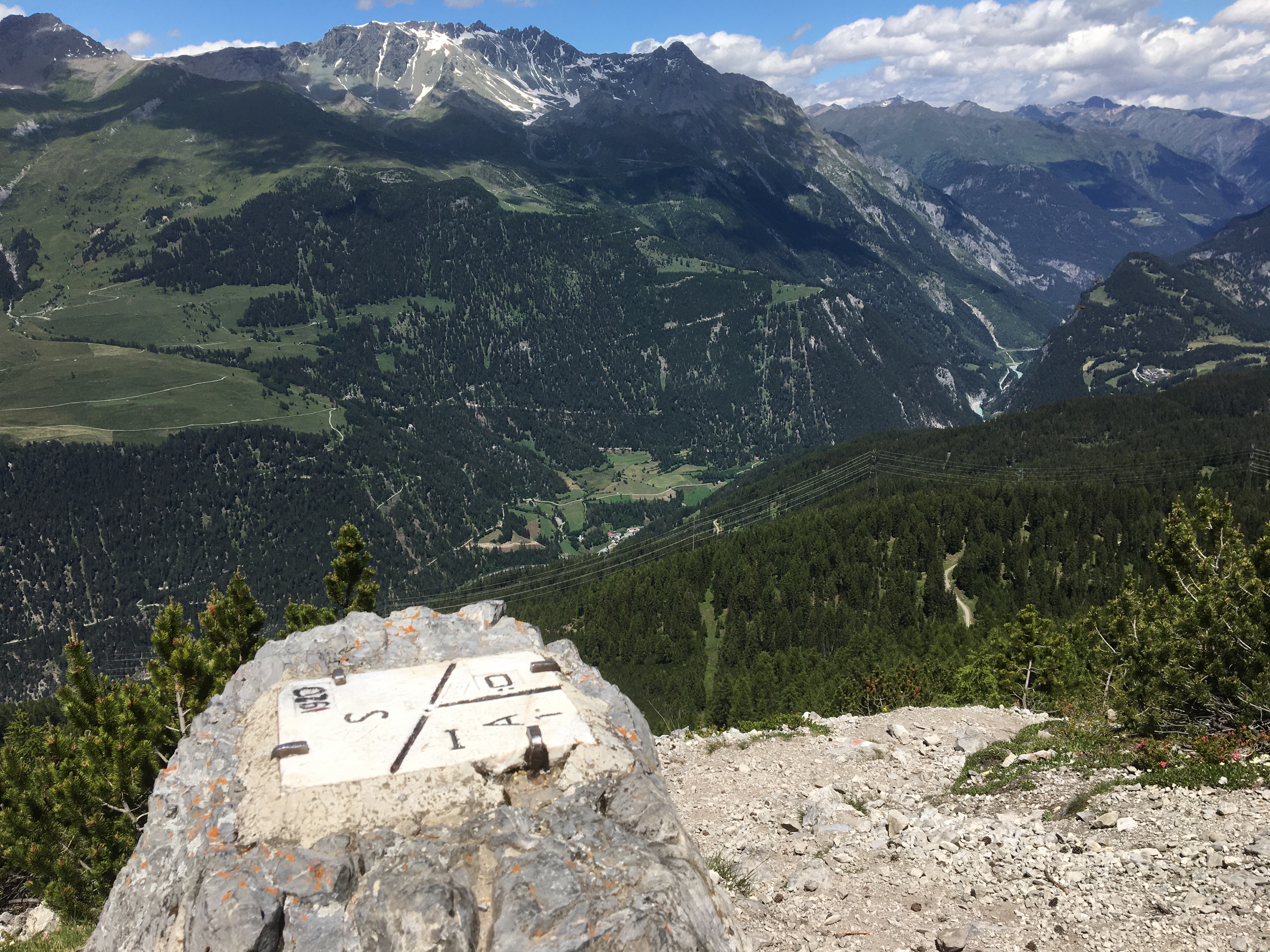
English: Top of the stone at the tripoint between Austria, Italy and Switzerland. With a view towards Martina (Valsot), Piz Mundin and Piz Alpetta. In the valley: Inn River. Deutsch: Blick vom Dreiländerpunkt A-IT-CH auf das untere Unterengadin bei Valsot, ziemlich im Osten der Schweiz. Unten der Fluss in der Schlucht bei Martina ist der En, bzw. der Inn etwas oberhalb von Finstermünz. Auf der Schweizer Seite des Tals über den Felsen sind einige Almen zu sehen, darüber die Berggipfel um den Piz Mundin, näher zum Inn hin der vorspringende Gipfel des Piz Alpetta mit dem Seitental Val da Tschera dahinter. Auf der diesseitigen Talseite sind ganz am Bildrand oberhalb der Schlucht die kleineren Höhen der Schöpfwarte ansteigend zu den Sellesköpfen und die Norbertshöhe und die Passstrasse bei → Nauders zu erahnen. |
| Date | |
| Source | Own work |
| Author | Taktaal |
| Camera location | | View this and other nearby images on: OpenStreetMap |
|---|
Licensing
[edit]I, the copyright holder of this work, hereby publish it under the following license:
This file is licensed under the Creative Commons Attribution-Share Alike 4.0 International license.
- You are free:
- to share – to copy, distribute and transmit the work
- to remix – to adapt the work
- Under the following conditions:
- attribution – You must give appropriate credit, provide a link to the license, and indicate if changes were made. You may do so in any reasonable manner, but not in any way that suggests the licensor endorses you or your use.
- share alike – If you remix, transform, or build upon the material, you must distribute your contributions under the same or compatible license as the original.
| Annotations | This image is annotated: View the annotations at Commons |

File history
Click on a date/time to view the file as it appeared at that time.
| Date/Time | Thumbnail | Dimensions | User | Comment | |
|---|---|---|---|---|---|
| current | 16:10, 10 July 2020 | | 4,032 × 3,024 (3.83 MB) | Taktaal (talk | contribs) | Uploaded own work with UploadWizard |
You cannot overwrite this file.
File usage on Commons
File usage on other wikis
The following other wikis use this file:
- Usage on de.wikipedia.org