File:Deutsches Reich (Karte) Sachsen-Altenburg.svg

From Wikimedia Commons, the free media repository
Jump to navigation Jump to search

Original file (SVG file, nominally 650 × 545 pixels, file size: 1.04 MB)

Captions

Captions

Add a one-line explanation of what this file represents
Description
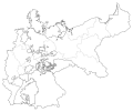
Deutsch: Karte des Deutschen Reiches zu Anbeginn des 20. Jahrhunderts. Neben den einzelnen Gliedstaaten sind auch die preußischen Provinzen auf der Karte verzeichnet. Die Lage von Sachsen-Altenburg ist hervorgehoben.
Date
Source Map based upon map data of the IEG-Maps project by Andreas Kunz, B. Johnen and Joachim Robert Moeschl of the University of Mainz. For further info visit: http://www.ieg-maps.uni-mainz.de
Author David Liuzzo
Permission
(Reusing this file)
w:en:Creative Commons
attribution share alike
This file is licensed under the Creative Commons Attribution-Share Alike 2.0 Germany license.
You are free:
  • to share – to copy, distribute and transmit the work
  • to remix – to adapt the work
Under the following conditions:
  • attribution – You must give appropriate credit, provide a link to the license, and indicate if changes were made. You may do so in any reasonable manner, but not in any way that suggests the licensor endorses you or your use.
  • share alike – If you remix, transform, or build upon the material, you must distribute your contributions under the same or compatible license as the original.

File history

Click on a date/time to view the file as it appeared at that time.

Date/TimeThumbnailDimensionsUserComment
current23:14, 9 January 2010Thumbnail for version as of 23:14, 9 January 2010650 × 545 (1.04 MB)Maproom (talk | contribs)Made Saxe-Altenburg red, so as to be seen more easily
11:43, 1 July 2007Thumbnail for version as of 11:43, 1 July 2007650 × 545 (1.04 MB)N3MO (talk | contribs)
16:49, 30 July 2006Thumbnail for version as of 16:49, 30 July 2006650 × 545 (803 KB)David Liuzzo (talk | contribs){{Information| |Description= {{de|Karte des Deutschen Reiches zu Anbeginn des 20. Jahrhunderts. Neben den einzelnen Gliedstaaten sind auch die preußischen Provinzen auf der Karte verzeichnet. Die Lage von '''Sachsen-Altenburg''' ist hervorgehoben.}} |Sou

There are no pages that use this file.

File usage on other wikis

The following other wikis use this file: