
File:Davies creek NP.jpg

Size of this preview: 308 × 599 pixels. Other resolutions: 123 × 240 pixels | 246 × 480 pixels | 394 × 768 pixels | 526 × 1,024 pixels | 1,427 × 2,777 pixels.
Original file (1,427 × 2,777 pixels, file size: 653 KB, MIME type: image/jpeg)
Captions
Captions
Add a one-line explanation of what this file represents
| Description |
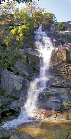
Davies creek NP Very near Cairns, Very nice place! |
||
| Date | |||
| Source | Flickr: Davies creek NP | ||
| Author | NeilsPhotography | ||
| Permission (Reusing this file) |
This file is licensed under the Creative Commons Attribution 2.0 Generic license.
|
| Camera location | | View this and other nearby images on: OpenStreetMap |
|---|
File history
Click on a date/time to view the file as it appeared at that time.
| Date/Time | Thumbnail | Dimensions | User | Comment | |
|---|---|---|---|---|---|
| current | 21:55, 3 November 2012 | | 1,427 × 2,777 (653 KB) | Flickr upload bot (talk | contribs) | Uploaded from http://flickr.com/photo/21976354@N07/2348933241 using Flickr upload bot |
You cannot overwrite this file.
File usage on Commons
The following page uses this file:
File usage on other wikis
The following other wikis use this file:
- Usage on ar.wikipedia.org
- Usage on arz.wikipedia.org
- Usage on ca.wikipedia.org
- Usage on ceb.wikipedia.org
- Usage on de.wikipedia.org
- Usage on en.wikipedia.org
- Usage on es.wikipedia.org
- Usage on he.wikipedia.org
- Usage on ml.wikipedia.org
- Usage on no.wikipedia.org
- Usage on pl.wikipedia.org
- Usage on sv.wikipedia.org
- Usage on vi.wikipedia.org
- Usage on www.wikidata.org