File:Dakar map plan 1863.jpg
Jump to navigation
Jump to search
No higher resolution available.
Dakar_map_plan_1863.jpg (450 × 333 pixels, file size: 34 KB, MIME type: image/jpeg)
Captions
Captions
Add a one-line explanation of what this file represents
Summary
[edit]
| Description |
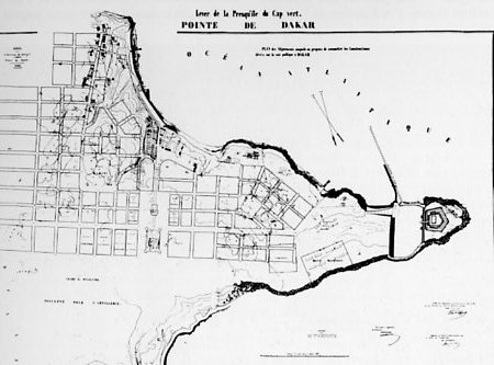
Français : Plan de la pointe de Dakar, 1863.
English: Map of Dakar's peninsula, 1863. |
| Date | |
| Source | Ed. Maurice Culot and Jean-Marie Thiveaud, Institut Français d'architecture, Mission des travaux historiques de la Caisse des dépôts et consignations ; Architectures Françaises : Outre-Mer ; Pierre Mardaga éditeur, Collection Villes ; 1992, ISBN 2-87009-475-2 |
| Author | Unknown author |
| Permission (Reusing this file) |
PD-Old (author died more than 70 years ago) |
Licensing
[edit]
|
This work is in the public domain in its country of origin and other countries and areas where the copyright term is the author's life plus 70 years or fewer. | |
| This file has been identified as being free of known restrictions under copyright law, including all related and neighboring rights. | |
File history
Click on a date/time to view the file as it appeared at that time.
| Date/Time | Thumbnail | Dimensions | User | Comment | |
|---|---|---|---|---|---|
| current | 16:17, 5 May 2007 | | 450 × 333 (34 KB) | Arria Belli (talk | contribs) | {{Information |Description= {{fr|Plan de la pointe de Dakar, 1863.}} {{en|Map of Dakar's peninsula, 1863.}} |Source= Ed. Maurice Culot and Jean-Marie Thiveaud, Institut Français d'architecture, Mission des travaux historiques de la Caisse des dépôts et |
You cannot overwrite this file.
File usage on Commons
The following page uses this file:
File usage on other wikis
The following other wikis use this file:
- Usage on an.wikipedia.org
- Usage on es.wikipedia.org
- Usage on fr.wikipedia.org
- Usage on gl.wikipedia.org