File:DE 802 Köln-Kalk Nord 2015-12-30-03.JPG
From Wikimedia Commons, the free media repository
Jump to navigation
Jump to search
Size of this preview: 800 × 502 pixels. Other resolutions: 320 × 201 pixels | 640 × 402 pixels | 1,024 × 643 pixels | 1,280 × 803 pixels | 2,560 × 1,607 pixels | 5,549 × 3,483 pixels.
Original file (5,549 × 3,483 pixels, file size: 14.13 MB, MIME type: image/jpeg)
File information
Structured data
Captions
DescriptionDE 802 Köln-Kalk Nord 2015-12-30-03.JPG |
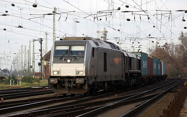
Deutsch: HGK/RheinCargo DE 802 in der Nähe des Rangierbahnhofs Köln-Kalk Nord. English: HGK/RheinCargo DE 802 in the near of the marshalling yard Köln-Kalk Nord |
||
Date | |||
Source | Own work | ||
Author | Rolf Heinrich, Köln | ||
Permission (Reusing this file) |
Rolf Heinrich, Köln, the copyright holder of this work, hereby publishes it under the following licenses:
This file is licensed under the Creative Commons Attribution-Share Alike 4.0 International license. Attribution: Rolf Heinrich, Köln
You may select the license of your choice. |
Camera location | 50° 55′ 49.19″ N, 7° 00′ 58.31″ E | View this and other nearby images on: OpenStreetMap | 50.930331; 7.016196 |
---|
File history
Click on a date/time to view the file as it appeared at that time.
Date/Time | Thumbnail | Dimensions | User | Comment | |
---|---|---|---|---|---|
current | 14:02, 2 January 2016 | 5,549 × 3,483 (14.13 MB) | Rolf H. (talk | contribs) | {{Information |Description ={{de|1=HGK/RheinCargo DE 602 in der Nähe des Rangierbahnhofs Köln-Kalk Nord.}} {{en|HGK/RheinCargo DE 602 in the near of the marshalling yard Köln-Kalk Nord}} |Source ={{own}} |Author =[[User:Rolf H.|Ro... |
You cannot overwrite this file.
File usage on Commons
The following page uses this file:
Metadata
This file contains additional information such as Exif metadata which may have been added by the digital camera, scanner, or software program used to create or digitize it. If the file has been modified from its original state, some details such as the timestamp may not fully reflect those of the original file. The timestamp is only as accurate as the clock in the camera, and it may be completely wrong.
Camera manufacturer | SONY |
---|---|
Camera model | SLT-A65V |
Exposure time | 1/160 sec (0.00625) |
F-number | f/4.5 |
ISO speed rating | 100 |
Date and time of data generation | 15:47, 30 December 2015 |
Lens focal length | 90 mm |
Latitude | 50° 55′ 49.19″ N |
Longitude | 7° 0′ 58.3″ E |
Altitude | 44.328 meters above sea level |
Author | CC-BY-SA Rolf Heinrich, Köln |
Width | 5,549 px |
Height | 3,483 px |
Bits per component |
|
Pixel composition | RGB |
Orientation | Normal |
Number of components | 3 |
Horizontal resolution | 350 dpi |
Vertical resolution | 350 dpi |
Software used | Adobe Photoshop CC 2015 (Windows) |
File change date and time | 08:27, 1 January 2016 |
Y and C positioning | Co-sited |
Exposure Program | Normal program |
Exif version | 2.3 |
Date and time of digitizing | 15:47, 30 December 2015 |
Meaning of each component |
|
Image compression mode | 2 |
APEX shutter speed | 7.321928 |
APEX aperture | 4.33985 |
APEX brightness | 6.98203125 |
APEX exposure bias | 0 |
Maximum land aperture | 4.3359375 APEX (f/4.49) |
Metering mode | Pattern |
Light source | Unknown |
Flash | Flash did not fire, auto mode |
Supported Flashpix version | 1 |
Color space | sRGB |
File source | Digital still camera |
Scene type | A directly photographed image |
Custom image processing | Normal process |
Exposure mode | Auto exposure |
White balance | Auto white balance |
Focal length in 35 mm film | 135 mm |
Scene capture type | Standard |
Contrast | Normal |
Saturation | Normal |
Sharpness | Normal |
GPS time (atomic clock) | 13:47 |
Receiver status | Measurement in progress |
Measurement mode | 3-dimensional measurement |
Measurement precision | Poor (1.4134) |
Speed unit | Kilometers per hour |
Speed of GPS receiver | 3.331 |
Reference for direction of movement | True direction |
Direction of movement | 284.83 |
Geodetic survey data used | WGS-84 |
GPS date | 30 December 2015 |
GPS differential correction | 0 |
GPS tag version | 2.3.0.0 |
Lens used | 70-300mm F4-5.6 SSM |
Unique ID of original document | BAC5B4D8A4BAB381A14C35EDBE50ADA6 |
Date metadata was last modified | 09:27, 1 January 2016 |
Structured data
Items portrayed in this file
depicts
some value
30 December 2015
50°55'49.192"N, 7°0'58.306"E
image/jpeg
1b19c3d63644289215fc77220a2f1db1fb831d19
14,820,712 byte
3,483 pixel
5,549 pixel
100
0.00625 second
4.5
90 millimetre
Hidden categories:
- License migration not eligible
- GFDL
- CC-BY-SA-4.0
- Self-published work
- Files with coordinates missing SDC location of creation (50° N, 7° E)
- Cologne photographs taken on 2015-12-30
- Railway photographs taken on 2015-12-30
- Taken with Sony SLT-A65V
- Taken with Tamron SP 70-300 mm F4-5.6 Di VC USD
- Photographs by Rolf H. taken in 2015