File:D'Anville Afrique 1749 UTA.jpg
Jump to navigation
Jump to search

Size of this preview: 596 × 599 pixels. Other resolutions: 239 × 240 pixels | 477 × 480 pixels | 764 × 768 pixels | 1,018 × 1,024 pixels | 2,037 × 2,048 pixels | 9,966 × 10,021 pixels.
Original file (9,966 × 10,021 pixels, file size: 9.19 MB, MIME type: image/jpeg)
Captions
Captions
Add a one-line explanation of what this file represents
Summary
[edit]| Warning | The original file is very high-resolution. It might not load properly or could cause your browser to freeze when opened at full size. |
|---|
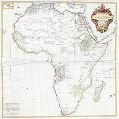
| Title |
Français : Afrique publiée sous les auspices de Monseigneur le duc d'Orléans, prémier Prince du Sang... |
||||||||||||||||||||||||||
| Description |
English: Engraved by Guillaume Delahaye. |
||||||||||||||||||||||||||
| Date | |||||||||||||||||||||||||||
| Source | UTA Libraries Cartographic Connections: map / text | ||||||||||||||||||||||||||
| Creator |
|
||||||||||||||||||||||||||
| Credit line |
English: UTA Libraries Special Collections, Gift of Dr. Jack Franke |
||||||||||||||||||||||||||
| Geotemporal data | |||||||||||||||||||||||||||
| Map location | Africa | ||||||||||||||||||||||||||
| Georeferencing | If inappropriate please set warp_status = skip to hide. | ||||||||||||||||||||||||||
| Bibliographic data | |||||||||||||||||||||||||||
| Place of publication | Paris | ||||||||||||||||||||||||||
| Printed by |
|
||||||||||||||||||||||||||
| Archival data | |||||||||||||||||||||||||||
| Collection |
|
||||||||||||||||||||||||||
| Dimensions | height: 99 cm (39 in); width: 98 cm (38.5 in) | ||||||||||||||||||||||||||
| Medium | colored engraving on paper | ||||||||||||||||||||||||||
| Other versions | |||||||||||||||||||||||||||

.jpg)
Licensing
[edit]

|
This file was provided to Wikimedia Commons by the University of Texas at Arlington Libraries as part of a cooperation project. The University of Texas at Arlington Libraries is part of the University of Texas at Arlington, a public research university located in Arlington, Texas.
|
|
The author died in 1782, so this work is in the public domain in its country of origin and other countries and areas where the copyright term is the author's life plus 100 years or fewer. This work is in the public domain in the United States because it was published (or registered with the U.S. Copyright Office) before January 1, 1929. | |
| This file has been identified as being free of known restrictions under copyright law, including all related and neighboring rights. | |
File history
Click on a date/time to view the file as it appeared at that time.
| Date/Time | Thumbnail | Dimensions | User | Comment | |
|---|---|---|---|---|---|
| current | 20:02, 12 January 2022 | | 9,966 × 10,021 (9.19 MB) | Michael Barera (talk | contribs) | == {{int:filedesc}} == {{Map |title = ''Afrique publiée sous les auspices de Monseigneur le duc d'Orléans, prémier Prince du Sang...'' |description = {{en|Engraved by Guillaume Delahaye.}} |legend = |author = {{Creator:Jean Baptiste Bourguignon d'Anville}} |date = 1749 |source = UTA Libraries ''Cartographic Connections'': [https://libguides.uta.edu/ld.php?content_id=47581045 {{I18n/map}}] / [https://libguides.uta.edu/africa... |
You cannot overwrite this file.
File usage on Commons
The following 2 pages use this file:
File usage on other wikis
The following other wikis use this file:
- Usage on en.wikipedia.org
- Usage on fi.wikipedia.org
- Usage on pt.wikipedia.org