File:CtyMapUtah.png
Jump to navigation
Jump to search

Size of this preview: 800 × 589 pixels. Other resolutions: 320 × 236 pixels | 640 × 471 pixels | 936 × 689 pixels.
Original file (936 × 689 pixels, file size: 52 KB, MIME type: image/png)
Captions
Captions
Add a one-line explanation of what this file represents
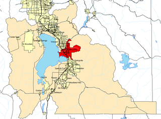
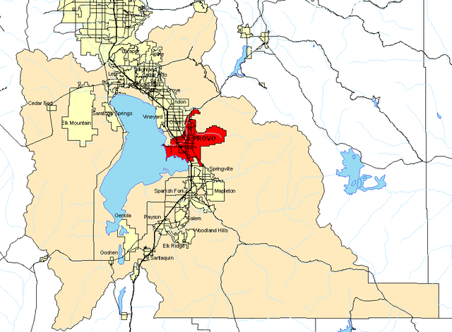
County Map for Utah County, Utah

|
Permission is granted to copy, distribute and/or modify this document under the terms of the GNU Free Documentation License, Version 1.2 or any later version published by the Free Software Foundation; with no Invariant Sections, no Front-Cover Texts, and no Back-Cover Texts. A copy of the license is included in the section entitled GNU Free Documentation License. |
| This file is licensed under the Creative Commons Attribution-Share Alike 3.0 Unported license. | ||
| ||
| This licensing tag was added to this file as part of the GFDL licensing update. |
File history
Click on a date/time to view the file as it appeared at that time.
| Date/Time | Thumbnail | Dimensions | User | Comment | |
|---|---|---|---|---|---|
| current | 23:11, 18 February 2005 | | 936 × 689 (52 KB) | BigBen212 (talk | contribs) | {{GFDL}} County Map for Utah county Utah |
You cannot overwrite this file.
File usage on Commons
There are no pages that use this file.
File usage on other wikis
The following other wikis use this file:
- Usage on en.wikipedia.org
Categories:
- Maps of Utah County, Utah
- Maps of Provo, Utah
- Maps of Draper, Utah
- Maps of Alpine, Utah
- Maps of Highland, Utah
- Maps of Eagle Mountain, Utah
- Maps of Saratoga Springs, Utah
- Maps of Cedar Fort, Utah
- Maps of Lehi, Utah
- Maps of Cedar Hills, Utah
- Maps of American Fork, Utah
- Maps of Pleasant Grove, Utah
- Maps of Orem, Utah
- Maps of Vineyard, Utah
- Maps of Springville, Utah
- Maps of Mapleton, Utah
- Maps of Spanish Fork, Utah
- Maps of Salem, Utah
- Maps of Woodland Hills, Utah
- Maps of Elk Ridge, Utah
- Maps of Payson, Utah
- Maps of Genola, Utah
- Maps of Goshen, Utah
- Maps of Santaquin, Utah