File:Cebolla Wilderness (9503365307).jpg

Original file (5,616 × 3,744 pixels, file size: 15.08 MB, MIME type: image/jpeg)
Captions
Captions
Summary
[edit].jpg&action=edit§ion=1)
| Description |
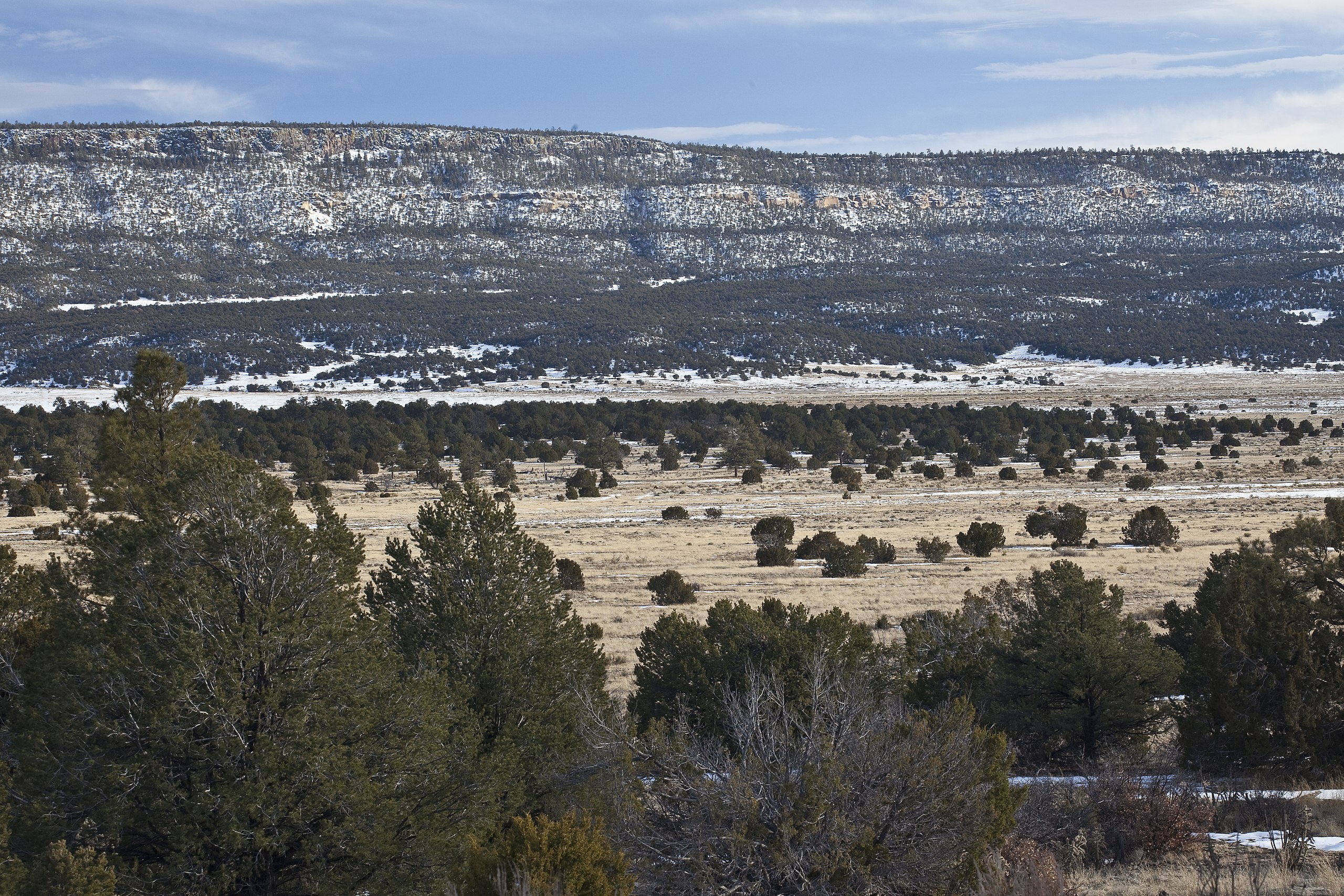
BLM's Cebolla Wilderness, located within the El Malpais National Conservation Area, includes 61,600 acres of rimrock country east of NM 117. Sanstone mesas, canyons and grassy valleys characterize the area. The Mesas and canyons are clad with juniper, piñon, and ponderosa pine. Vertical escarpments provide excellent nesting habitat for golden eagles, prairie falcons, red-tail hawks, and great horned owls. The Cebolla Wilderness is rich in prehistoric archaeological sites, petroglyphs and historic homesteads. One such archaeological site is the Dittert Site (Download Brochure). Sometime between A.D. 1000 and1300, the Dittert Site was built and occupied by the Anasazi people, who were the ancestors of modern Pueblo Indian people. Cebolla Wilderness also contains La Ventana Natural Arch, a dramatic arch sculpted through wind and water erosion in the sandstone cliffs located about ¼ mile inside the wilderness. Recreation activities include primitive types, such as hiking, backpacking, camping, wildlife viewing and horseback riding. Learn more: on.doi.gov/1eYnhHW Photo: Bob Wick, BLM California |
| Date | |
| Source | Cebolla Wilderness |
| Author | Bureau of Land Management |
Licensing
[edit].jpg&action=edit§ion=2)
- You are free:
- to share – to copy, distribute and transmit the work
- to remix – to adapt the work
- Under the following conditions:
- attribution – You must give appropriate credit, provide a link to the license, and indicate if changes were made. You may do so in any reasonable manner, but not in any way that suggests the licensor endorses you or your use.
| This image was originally posted to Flickr by mypubliclands at https://flickr.com/photos/91981596@N06/9503365307. It was reviewed on 4 August 2015 by FlickreviewR and was confirmed to be licensed under the terms of the cc-by-2.0. |
| This image is a work of a Bureau of Land Management* employee, taken or made as part of that person's official duties. As a work of the U.S. federal government, the image is in the public domain in the United States. *or predecessor organization |
File history
Click on a date/time to view the file as it appeared at that time.
| Date/Time | Thumbnail | Dimensions | User | Comment | |
|---|---|---|---|---|---|
| current | 19:57, 4 August 2015 | | 5,616 × 3,744 (15.08 MB) | Wilfredor (talk | contribs) | Transferred from Flickr via Flickr2Commons |
You cannot overwrite this file.
File usage on Commons
There are no pages that use this file.
.jpg&oldid=875127876)