File:Caerau station site geograph-3295458-by-Ben-Brooksbank.jpg
Jump to navigation
Jump to search
Size of this preview: 800 × 514 pixels. Other resolutions: 320 × 206 pixels | 640 × 411 pixels | 1,024 × 658 pixels | 1,280 × 823 pixels | 2,256 × 1,450 pixels.
Original file (2,256 × 1,450 pixels, file size: 2.99 MB, MIME type: image/jpeg)
Captions
Captions
Add a one-line explanation of what this file represents
Summary
[edit]
| Description |
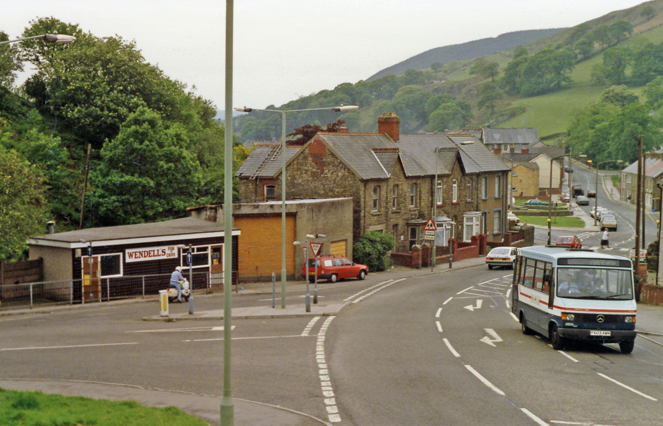
English: Site of Caerau station. View southward, on A4063 towards Measteg, Tondu and Bridgend: ex-GWR (Llynfi & Ogmore) line: Bridgend - Tondu - Maesteg - Cymmer - Abergwynfi, which was closed beyond Cymmer in 6/60 and entirely by 15/7/70, when Caerau station - which was on the left - was closed. (Maesteg - Bridgend was reopened 28/9/92). |
| Date | |
| Source | From geograph.org.uk |
| Author | Ben Brooksbank |
| Permission (Reusing this file) |
Creative Commons Attribution Share-alike license 2.0 |
| Camera location | | View this and other nearby images on: OpenStreetMap |
|---|
Licensing
[edit]

|
This image was taken from the Geograph project collection. See this photograph's page on the Geograph website for the photographer's contact details. The copyright on this image is owned by Ben Brooksbank and is licensed for reuse under the Creative Commons Attribution-ShareAlike 2.0 license.
|
This file is licensed under the Creative Commons Attribution-Share Alike 2.0 Generic license.
Attribution: Ben Brooksbank
- You are free:
- to share – to copy, distribute and transmit the work
- to remix – to adapt the work
- Under the following conditions:
- attribution – You must give appropriate credit, provide a link to the license, and indicate if changes were made. You may do so in any reasonable manner, but not in any way that suggests the licensor endorses you or your use.
- share alike – If you remix, transform, or build upon the material, you must distribute your contributions under the same or compatible license as the original.
File history
Click on a date/time to view the file as it appeared at that time.
| Date/Time | Thumbnail | Dimensions | User | Comment | |
|---|---|---|---|---|---|
| current | 14:40, 12 February 2013 | | 2,256 × 1,450 (2.99 MB) | Chevin (talk | contribs) | == {{int:filedesc}} == {{Information |Description={{en|1='''Site of Caerau station.'''<br/> View southward, on A4063 towards Measteg, Tondu and Bridgend: ex-GWR (Llynfi & Ogmore) line: Bridgend - Tondu - Maesteg - Cymmer - Abergwynfi, which was closed ... |
You cannot overwrite this file.
File usage on Commons
The following page uses this file:
File usage on other wikis
The following other wikis use this file:
- Usage on en.wikipedia.org