File:Cadastral map of Brno.svg
Jump to navigation
Jump to search

Size of this PNG preview of this SVG file: 590 × 551 pixels. Other resolutions: 257 × 240 pixels | 514 × 480 pixels | 822 × 768 pixels | 1,097 × 1,024 pixels | 2,193 × 2,048 pixels.
Original file (SVG file, nominally 590 × 551 pixels, file size: 73 KB)
Captions
Captions
Add a one-line explanation of what this file represents
Summary
[edit]
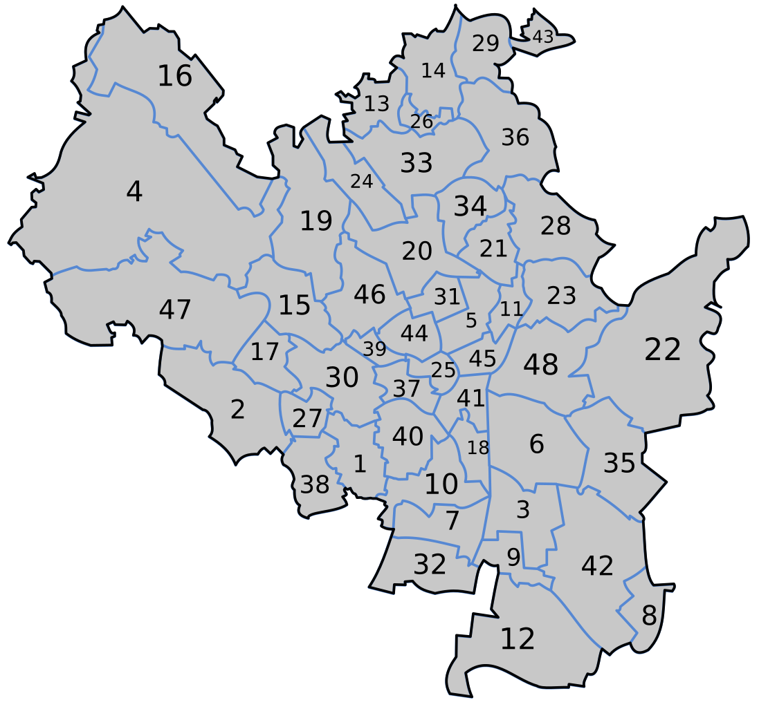
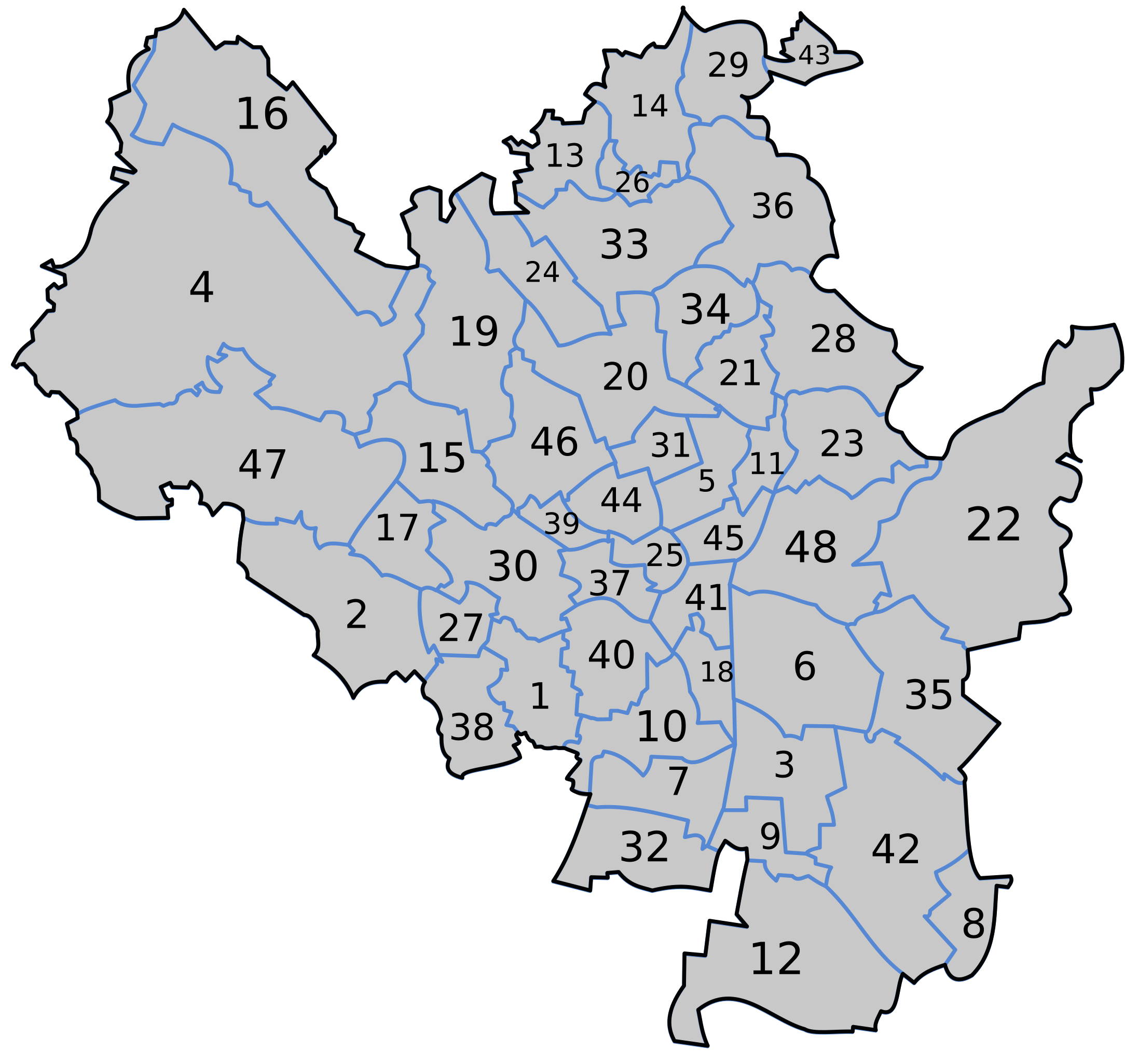
- Bohunice
- Bosonohy
- Brněnské Ivanovice
- Bystrc
- Černá Pole
- Černovice
- Dolní Heršpice
- Dvorska
- Holásky
- Horní Heršpice
- Husovice
- Chrlice
- Ivanovice
- Jehnice
- Jundrov
- Kníničky
- Kohoutovice
- Komárov
- Komín
- Královo Pole
- Lesná
- Líšeň
- Maloměřice
- Medlánky
- Město Brno
- Mokrá Hora
- Nový Lískovec
- Obřany
- Ořešín
- Pisárky
- Ponava
- Přízřenice
- Řečkovice
- Sadová
- Slatina
- Soběšice
- Staré Brno
- Starý Lískovec
- Stránice
- Štýřice
- Trnitá
- Tuřany
- Útěchov u Brna
- Veveří
- Zábrdovice
- Žabovřesky
- Žebětín
- Židenice
| Description |
|
| Date | 2007 |
| Source | Based on GIS maps |
| Author | Frettie |
| Permission (Reusing this file) |
Public domain |
| Other versions | Derivative works of this file: Poloha katastrálneho územia Pisárky.svg |
Licensing
[edit]
| I, the copyright holder of this work, release this work into the public domain. This applies worldwide. In some countries this may not be legally possible; if so: I grant anyone the right to use this work for any purpose, without any conditions, unless such conditions are required by law. |
File history
Click on a date/time to view the file as it appeared at that time.
| Date/Time | Thumbnail | Dimensions | User | Comment | |
|---|---|---|---|---|---|
| current | 21:45, 27 February 2009 | | 590 × 551 (73 KB) | Kirk979 (talk | contribs) | corrections |
| 13:33, 13 February 2007 |  | 590 × 551 (70 KB) | Frettie (talk | contribs) | == Summary == {{Information |Description=*{{en|Cadastral map of Brno's cadastral areas in the en:Czech Republic.}} *{{cs|Katastrální mapa brněnských katastrálních území.}} |Source= Based on GIS maps |Date= 2007 | | |
| 00:15, 12 February 2007 |  | 590 × 551 (143 KB) | Frettie (talk | contribs) | {{Information |Description=*{{en|Cadastral map of Brno's cadastral areas in the en:Czech Republic.}} *{{cs|Katastrální mapa brněnských katastrálních území.}} |Source= Based on GIS maps |Date= 2007 |Author= [[:cs: |
You cannot overwrite this file.
File usage on Commons
The following 3 pages use this file:
File usage on other wikis
The following other wikis use this file:
- Usage on cs.wikipedia.org
- Usage on eo.wikipedia.org
- Usage on sk.wikipedia.org