File:Bridge in West Wheatfield Township.jpg
Jump to navigation
Jump to search

Size of this preview: 800 × 565 pixels. Other resolutions: 320 × 226 pixels | 640 × 452 pixels | 802 × 566 pixels.
Original file (802 × 566 pixels, file size: 65 KB, MIME type: image/jpeg)
Captions
Captions
Add a one-line explanation of what this file represents
|
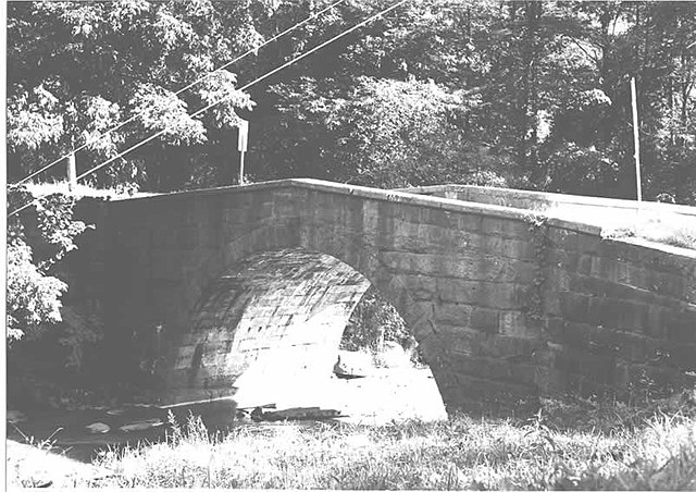
This is an image of a place or building that is listed on the National Register of Historic Places in the United States of America. Its reference number is 88000774. |
| Camera location | | View this and other nearby images on: OpenStreetMap |
|---|
| Description |
English: Side of the Bridge in West Wheatfield Township, which carries Legislative Route 32008 over Richards Run near Robinson in West Wheatfield Township, Indiana County, Pennsylvania, United States. Built in 1911, the bridge is listed on the National Register of Historic Places. |
|||
| Date | ||||
| Source | "Bridge in West Wheatfield Township" (National Register of Historic Places form). National Park Service (June 22, 1988). Photo from http://www.arch.state.pa.us, searchable database, at http://www.arch.state.pa.us/images/hires/H000097_01B.jpg | |||
| Author | PennDOT | |||
| Permission (Reusing this file) |
|

File history
Click on a date/time to view the file as it appeared at that time.
| Date/Time | Thumbnail | Dimensions | User | Comment | |
|---|---|---|---|---|---|
| current | 15:11, 8 December 2009 | | 802 × 566 (65 KB) | Nyttend (talk | contribs) | {{Location|40|24|11|N|79|7|45|W}} {{Information |Description={{en|Side of the {{w|Bridge in West Wheatfield Township}}, which carries Legislative Route 32008 over Richards Run near {{w|Robinson, Pennsylvania|Robinson}} in {{w|West Wheatfield Township, Ind |
You cannot overwrite this file.
File usage on Commons
The following page uses this file:
File usage on other wikis
The following other wikis use this file:
- Usage on cy.wikipedia.org
- Usage on en.wikipedia.org
- Usage on es.wikipedia.org
- Usage on fr.wikipedia.org
- Usage on tl.wikipedia.org
- Usage on uk.wikipedia.org
- Usage on ur.wikipedia.org
- Usage on vi.wikipedia.org
- Usage on www.wikidata.org
Metadata
Categories:
- Photographs by Pennsylvania Department of Transportation
- Built in Pennsylvania in 1911
- Bridges in the United States completed in 1911
- 1910s bridges in Pennsylvania
- Bridges on the National Register of Historic Places in Pennsylvania
- National Register of Historic Places in Indiana County, Pennsylvania
- Bridges in Indiana County, Pennsylvania
- Stone arch bridges in Pennsylvania
- West Wheatfield Township, Indiana County, Pennsylvania