File:Braniewo location map.svg
Jump to navigation
Jump to search

Size of this PNG preview of this SVG file: 419 × 599 pixels. Other resolutions: 168 × 240 pixels | 336 × 480 pixels | 537 × 768 pixels | 716 × 1,024 pixels | 1,432 × 2,048 pixels | 768 × 1,098 pixels.
Original file (SVG file, nominally 768 × 1,098 pixels, file size: 1.46 MB)
Captions
Captions
Add a one-line explanation of what this file represents
| Description |
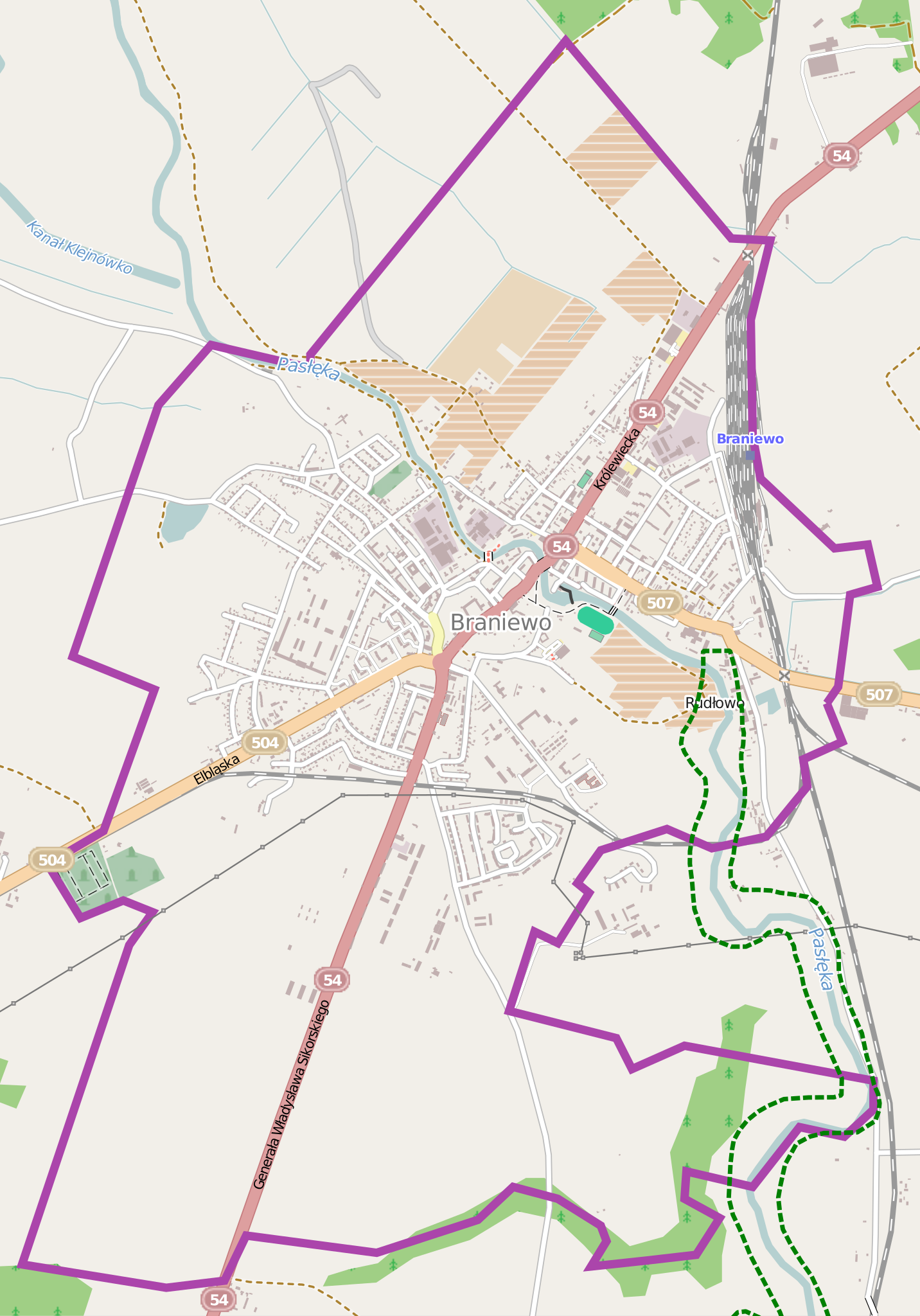
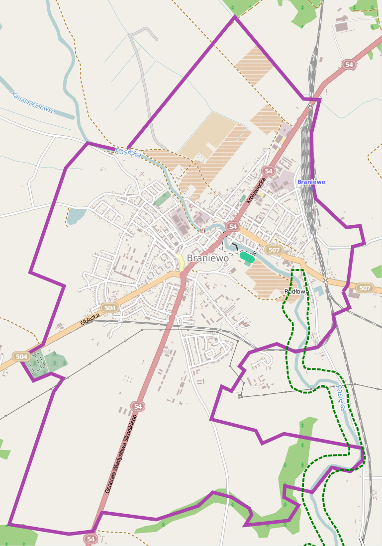
Polski: Mapa Braniewa, Polska
English: Map of Braniewo, Poland |
|||||||||
| Date | ||||||||||
| Source | You may find a page on the OpenStreetMap wiki page for Braniewo | |||||||||
| Creator |
OpenStreetMap contributors OpenStreetMap contributors |
|||||||||
| Permission (Reusing this file) |
OpenStreetMap data is available under the Open Database License (details). Map tiles are licensed under the Creative Commons Attribution-ShareAlike 2.0 license (CC-BY-SA 2.0).
This file is licensed under the Creative Commons Attribution-Share Alike 2.0 Generic license.
|
|||||||||
| Geotemporal data | ||||||||||
| Bounding box |
|
|||||||||
| Georeferencing | If inappropriate please set warp_status = skip to hide. | |||||||||
File history
Click on a date/time to view the file as it appeared at that time.
| Date/Time | Thumbnail | Dimensions | User | Comment | |
|---|---|---|---|---|---|
| current | 05:04, 4 June 2014 | | 768 × 1,098 (1.46 MB) | ArkadiuszZ (talk | contribs) | {{OpenStreetMap | name = Braniewo | location = Braniewo | description = {{pl|Mapa Braniewa, Polska}} {{en|Map of Braniewo, Poland}} | top = 54.4057 | left = 19.7900 | right = 19.8521 | bo... |
You cannot overwrite this file.
File usage on Commons
There are no pages that use this file.
File usage on other wikis
The following other wikis use this file:
- Usage on pl.wikipedia.org
- Zakład Karny Braniewo
- Browar Braniewo
- Braniewo (stacja kolejowa)
- Bazylika św. Katarzyny Aleksandryjskiej w Braniewie
- Zamek w Braniewie
- Braniewo Brama
- Cerkiew Przemienienia Pańskiego w Braniewie
- Cerkiew Świętej Trójcy w Braniewie
- Parafia Przemienienia Pańskiego w Braniewie
- Przejście graniczne Braniewo-Mamonowo
- Cmentarz żydowski w Braniewie
- Parafia św. Katarzyny w Braniewie
- Parafia św. Antoniego w Braniewie
- Parafia Świętego Krzyża w Braniewie
- Parafia Świętej Trójcy w Braniewie
- Parafia cywilno-wojskowa św. Wojciecha w Braniewie
- Ogród Zoologiczno-Botaniczny w Braniewie
- Cmentarz Żołnierzy Armii Radzieckiej w Braniewie
- Placówka Straży Granicznej w Braniewie
- Kościół św. Antoniego w Braniewie
- Kościół św. Krzyża w Braniewie
- Dom Konwertytów w Braniewie
- Moduł:Mapa/dane/Braniewo
- Muzeum Ziemi Braniewskiej
- Zgromadzenie Zakonne Sióstr św. Katarzyny. Dom prowincjalny „Regina Coeli” w Braniewie
- Cmentarz przy ul. Morskiej w Braniewie
- Towarzystwo Miłośników Braniewa
- Budynek Urzędu Miasta w Braniewie
- Spichlerz Mariacki w Braniewie
- Ratusz w Braniewie
- Port w Braniewie
- Klasztor franciszkanów w Braniewie
- Kościół gimnazjalny w Braniewie
- Kaplica św. Rocha w Braniewie
- Cmentarz przy ul. Olsztyńskiej w Braniewie
- Kamienny Dom w Braniewie
- Wikipedysta:Olekd/brudnopis
- Budynek Sądu Rejonowego w Braniewie
- Nowe Miasto Braniewo
- Braniewskie Centrum Kultury
- Cmentarz św. Jana w Braniewie
- Cmentarz przy ul. Elbląskiej w Braniewie
- Wieża Młyna Kieratowego w Braniewie
- Stadnina koni w Braniewie
- Seminarium Nauczycielskie w Braniewie
- Ulica Tadeusza Kościuszki w Braniewie
- Ulica Gdańska w Braniewie
- Budynek przy ul. Botanicznej 5 w Braniewie
- Alumnat Papieski w Braniewie
- Budynek zgromadzenia sióstr katarzynek przy ul. Reginy Protmann 4 w Braniewie
View more global usage of this file.