File:Boshell's Mill before fires.jpg

Original file (1,881 × 1,369 pixels, file size: 383 KB, MIME type: image/jpeg)
Captions
Captions
|
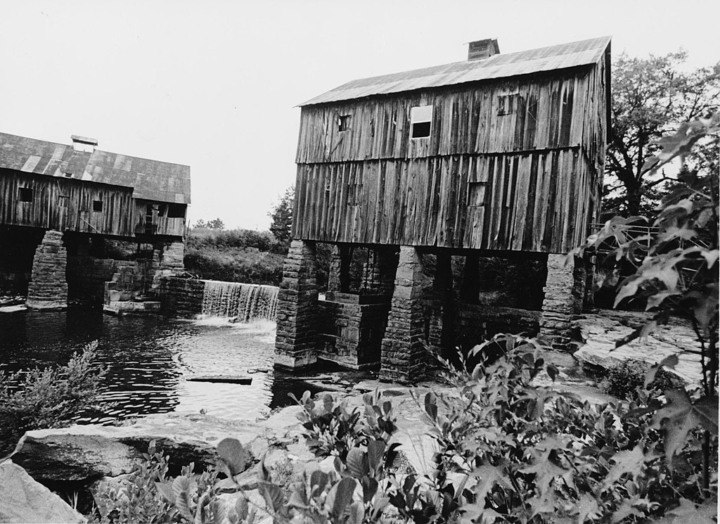
This is an image of a place or building that is listed on the National Register of Historic Places in the United States of America. Its reference number is 75000329. |
| Description |
Boshell's Mill — Lost Creek at Alabama Route 124, 1.7 miles South of Route 78, Townley, Walker County, AL.
|
|||||
| Date | ||||||
| Source |
|
|||||
| Author | David Deising, Photographer | |||||
| Permission (Reusing this file) |
|


| Object location | | View this and other nearby images on: OpenStreetMap |
|---|
File history
Click on a date/time to view the file as it appeared at that time.
| Date/Time | Thumbnail | Dimensions | User | Comment | |
|---|---|---|---|---|---|
| current | 17:49, 2 August 2012 | | 1,881 × 1,369 (383 KB) | Altairisfar (talk | contribs) | {{Information |Description=Boshell's Mill, Lost Creek at Alabama Route 124, 1.7 miles South of Route 78, Townley, Walker County, AL. {{NRHP|75000329}} |Source={{LOC-image|id=hhh.al0915}} |Author=David Deising, Photographer |Date=1973 |Permission={{HABS... |
You cannot overwrite this file.
File usage on Commons
The following page uses this file:
File usage on other wikis
The following other wikis use this file:
- Usage on en.wikipedia.org
- Usage on www.wikidata.org