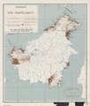
File:Borneo soil trafficability LOC 2014585447.jpg
From Wikimedia Commons, the free media repository
Jump to navigation
Jump to search

Size of this preview: 508 × 599 pixels. Other resolutions: 203 × 240 pixels | 407 × 480 pixels | 651 × 768 pixels | 868 × 1,024 pixels | 1,736 × 2,048 pixels | 3,328 × 3,926 pixels.
Original file (3,328 × 3,926 pixels, file size: 1.79 MB, MIME type: image/jpeg)
File information
Structured data
Captions
Captions
Add a one-line explanation of what this file represents
Summary
[edit]| DescriptionBorneo soil trafficability LOC 2014585447.jpg |
English: Identifies upland and lowland soil types in soil-survey areas. Covers entire island (including Sarawak and Sabah) LC copy imperfect: Fold-lined, rubber-stamped, annotated in black marker ink/lead-pencil, possibly prepared for inclusion in textual publication. Includes descriptive text in legend. Available also through the Library of Congress Web site as a raster image. |
||
| Title InfoField | Borneo soil trafficability | ||
| Shelf ID InfoField | G8101.J3 1945 .J3 | ||
| Date | |||
| Source | https://www.loc.gov/item/2014585447/ | ||
| Author | Janis (Organization) | ||
| Permission (Reusing this file) |
|
||
| Other versions |
|
||
| Location InfoField | Borneo. · Borneo | ||
| Part of InfoField | American Memory · Catalog · Geography And Map Division · Additional Conservation And Environment Cartographic Items | ||
| Subject InfoField | Soil Surveys · Soils · Maps · Physical Maps · Borneo |
Licensing
[edit]| Public domainPublic domainfalsefalse |
| This work is from the Library of Congress. According to the library, there are no known copyright restrictions on the use of this work. |  |
File history
Click on a date/time to view the file as it appeared at that time.
| Date/Time | Thumbnail | Dimensions | User | Comment | |
|---|---|---|---|---|---|
| current | 09:53, 23 July 2018 |  | 3,328 × 3,926 (1.79 MB) | Fæ (talk | contribs) | LOC Maps https://www.loc.gov/item/2014585447/ #9404 |
You cannot overwrite this file.
File usage on Commons
The following page uses this file:

