File:Bonneville salt flats pilot peak.jpg
Jump to navigation
Jump to search
Size of this preview: 800 × 533 pixels. Other resolutions: 320 × 213 pixels | 640 × 427 pixels | 1,024 × 683 pixels | 1,280 × 853 pixels | 2,560 × 1,707 pixels | 3,888 × 2,592 pixels.
Original file (3,888 × 2,592 pixels, file size: 2.9 MB, MIME type: image/jpeg)
Captions
Captions
Add a one-line explanation of what this file represents
Summary
[edit]
| Description |
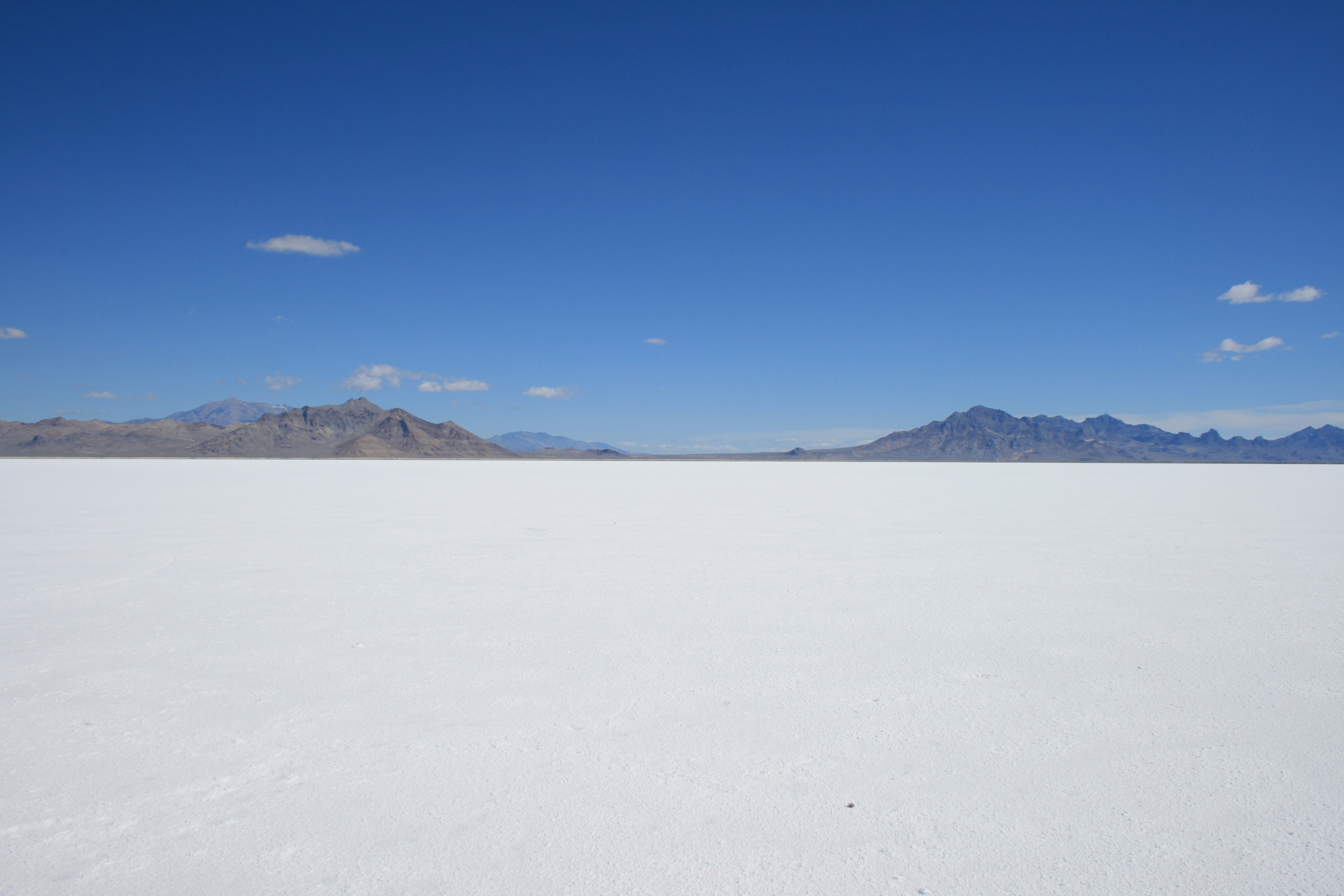
English: Bonneville Salt Flats at Interstate 80, rear left at the horizon Pilot Peak; USA Utah; 2008-06-12. Foreground peaks are 6000+ ft, (2000 ft above Bonneville), peaks in the linear Silver Island Mountains. Pilot Peak is the massif of the Pilot Range. |
| Date | Taken on 12 June 2008 |
| Source | Own work |
| Author | Michael |
| Attribution (required by the license) | © Michael Pätzold / |
| Camera location | | View this and other nearby images on: OpenStreetMap |
|---|
Licensing
[edit]

In printed material: "Photo: Michael Paetzold, Lizenz: https://creativecommons.org/licenses/by-sa/4.0/legalcode.de"
1. Provide my name as given above: Michael Paetzold,
2. a copy of, or the URI for, the applicable license: https://creativecommons.org/licenses/by-sa/4.0/legalcode.de,
3. in the case of an adaptation, a credit identifying the use of the work in the adaptation.
This license and the rights granted hereunder will terminate automatically upon any breach by you of the terms of this license. Any of the above conditions can be waived if you get permission from the copyright holder. If you have questions or wish differing conditions or a higher resolution, please contact me through
mail michael-paetzold.de
 or my discussion page
This file is licensed under the Creative Commons Attribution-Share Alike 4.0 International license.
Attribution: Foto: Michael Paetzold, Lizenz: Creative Commons by-sa-4.0
- You are free:
- to share – to copy, distribute and transmit the work
- to remix – to adapt the work
- Under the following conditions:
- attribution – You must give appropriate credit, provide a link to the license, and indicate if changes were made. You may do so in any reasonable manner, but not in any way that suggests the licensor endorses you or your use.
- share alike – If you remix, transform, or build upon the material, you must distribute your contributions under the same or compatible license as the original.
File history
Click on a date/time to view the file as it appeared at that time.
| Date/Time | Thumbnail | Dimensions | User | Comment | |
|---|---|---|---|---|---|
| current | 10:57, 6 July 2008 | | 3,888 × 2,592 (2.9 MB) | Michael32710 (talk | contribs) | {{Information |Description= Bonneville Salt Flats at Interstate 80, rear left at the horizon Pilot Peak; USA Utah; 2008-06-12 |Source=eigene Arbeit |Date=2008-06-12 |Author= Michael |Permission=GDFL / Crea |
You cannot overwrite this file.
File usage on Commons
The following page uses this file:
File usage on other wikis
The following other wikis use this file:
- Usage on az.wikipedia.org
- Usage on de.wikipedia.org
- Usage on eo.wikipedia.org
- Usage on ka.wikipedia.org
- Usage on ro.wikipedia.org
- Usage on ru.wikipedia.org
- Usage on sv.wikipedia.org
- Usage on uk.wikipedia.org