File:Bankstown and goods lines in Marrickville (wide).jpg
Jump to navigation
Jump to search

Size of this preview: 800 × 379 pixels. Other resolutions: 320 × 152 pixels | 640 × 303 pixels | 1,024 × 485 pixels | 1,280 × 606 pixels | 4,160 × 1,970 pixels.
Original file (4,160 × 1,970 pixels, file size: 1.78 MB, MIME type: image/jpeg)
Captions
Captions
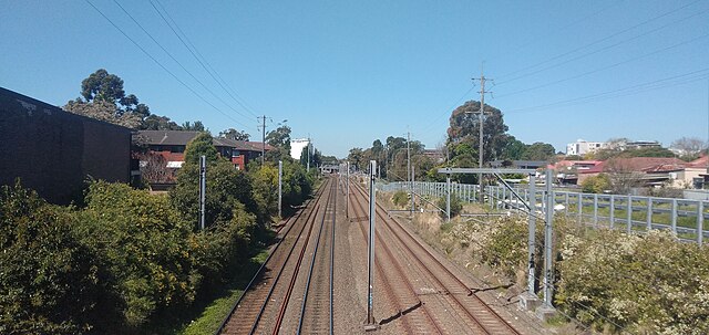
The Botany Goods Line (left) and Bankstown line (right) passing through Marrickville
Summary
[edit].jpg&action=edit§ion=1)
| Description |
English: The Botany Goods Line (left) and Bankstown line (right) viewed from Livingstone Rd as they pass through Marrickville. Marrickville station can be seen in the distance just after the lines curve to the left. Most of the Bankstown line is due to incorporated into Sydney Metro City & Southwest, projected to open in 2024. |
| Date | |
| Source | Own work |
| Author | William Thorpe |
| Camera location | | View this and other nearby images on: OpenStreetMap |
|---|
.jpg¶ms=-33.911736_N_0151.148300_E_globe:Earth_type:camera__&language=en)
Licensing
[edit].jpg&action=edit§ion=2)
I, the copyright holder of this work, hereby publish it under the following license:
This file is licensed under the Creative Commons Attribution-Share Alike 4.0 International license.
- You are free:
- to share – to copy, distribute and transmit the work
- to remix – to adapt the work
- Under the following conditions:
- attribution – You must give appropriate credit, provide a link to the license, and indicate if changes were made. You may do so in any reasonable manner, but not in any way that suggests the licensor endorses you or your use.
- share alike – If you remix, transform, or build upon the material, you must distribute your contributions under the same or compatible license as the original.
File history
Click on a date/time to view the file as it appeared at that time.
| Date/Time | Thumbnail | Dimensions | User | Comment | |
|---|---|---|---|---|---|
| current | 06:06, 23 September 2021 | | 4,160 × 1,970 (1.78 MB) | Willthorpe (talk | contribs) | Uploaded own work with UploadWizard |
You cannot overwrite this file.
File usage on Commons
There are no pages that use this file.
.jpg&oldid=816607709)